
| Cwmllynfell | |
|---|---|
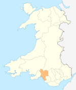
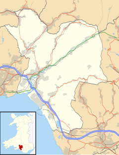 Cwmllynfell Location within Neath Port Talbot | |
| Population | 1,172 (2011 census)[1] |
| OS grid reference | SN747127 |
| Principal area | |
| Preserved county | |
| Country | Wales |
| Sovereign state | United Kingdom |
| Post town | SWANSEA |
| Postcode district | SA9 |
| Dialling code | 01639 |
| Police | South Wales |
| Fire | Mid and West Wales |
| Ambulance | Welsh |
| UK Parliament | |
| Senedd Cymru – Welsh Parliament | |
| Councillors |
|
Cwmllynfell (ⓘ) is the name of a village, community and electoral ward in Neath Port Talbot county borough, Wales.
YouTube Encyclopedic
-
1/1Views:603
-
East Pit, Cwmllynfell Lake
Transcription
Amenities
Cwmllynfell has its own local rugby union team - Cwmllynfell RFC. Also, a bilingual primary school, supermarket, post office, village hall, church and chapels.[citation needed] Nearby there is the Black Mountain which supplies views to the village.
Electoral ward
The electoral ward consists of some or all of the following areas: Blaen-nant, Bryn-Melyn, Celliwarog, Cwmllynfell, Rhiw-fawr in the parliamentary constituency of Neath. Cwmllynfell is bounded by the wards of Quarter Bach of Carmarthenshire to the northeast; Cwmtwrch of Powys to the east; Ystalyfera to the southeast; Pontardawe to the southwest; Gwaun-Cae-Gurwen to the west and Lower Brynamman to the northwest.[2]
In the 2017 local council elections the results were:[3]
| Candidate | Party | Votes | Status |
|---|---|---|---|
| Hugh Jones | Plaid Cymru | 283 | Plaid Cymru gain |
| Kris Lloyd | Labour | 194 |
In the 2012 local council elections the turn out was 49.78%. The results were:
| Candidate | Party | Votes | Status |
|---|---|---|---|
| Clifford Richards | Labour | 348 | Labour hold |
| David James | Plaid Cymru | 110 |
Earthquake
At 14:31 on 17 February 2018 the village was the epicentre of a 4.6 magnitude earthquake, the largest in the British Isles since 2008. The quake was felt as far away as Blackpool.[4][5]
References
- ^ "Ward population 2011". Archived from the original on 12 April 2015. Retrieved 12 April 2015.
- ^ "Election Maps". Ordnance Survey.
- ^ "Election results for Cwmllynfell: County Borough Council - Ordinary Elections - Thursday, 4th May, 2017". Neath Port Talbot County Borough Council. Retrieved 17 August 2018.
- ^ "Earthquake felt across parts of UK". BBC News. 17 February 2018.
- ^ "CWMLLYNFELL,SOUTH WALE". British Geological Survey. 17 February 2018.
6. https://www.garethjones.org/rural_wales/mining_town.htm
External links
| Communities |
|  |
|---|---|---|
| Towns and villages |
| |
| Castles | ||
| Rivers | ||
| Natural sites and parks | ||
| Topics | ||
This Neath Port Talbot location article is a stub. You can help Wikipedia by expanding it. |