
| Dawson Queensland | |||||||||||||||
|---|---|---|---|---|---|---|---|---|---|---|---|---|---|---|---|
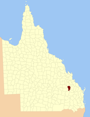 Location within Queensland | |||||||||||||||
| |||||||||||||||
The County of Dawson is a county (a cadastral division) in Queensland, Australia, located in the Shire of Banana in Central Queensland. [1] The county is divided into civil parishes. The county was officially named and bounded by the Governor in Council on 7 March 1901 under the Land Act 1897.[2][3]
YouTube Encyclopedic
-
1/1Views:2 162
-
2017 Forsyth Central Football vs. Dawson County
Transcription
Parishes
Dawson is divided into parishes, as listed below:
| Parish | LGA | Coordinates | Towns |
|---|---|---|---|
| Belmont | Banana | 24°47′S 150°21′E / 24.783°S 150.350°E | |
| Blackman | Banana | 25°21′S 150°12′E / 25.350°S 150.200°E | |
| Camboon | Banana | 25°05′S 150°30′E / 25.083°S 150.500°E | Camboon |
| Colombo | Banana | 24°51′S 150°30′E / 24.850°S 150.500°E | |
| Coteeda | Banana | 25°09′S 150°12′E / 25.150°S 150.200°E | |
| Cracow | Banana | 25°24′S 150°19′E / 25.400°S 150.317°E | Cracow |
| Dresden | Banana | 25°16′S 150°22′E / 25.267°S 150.367°E | |
| Kianga | Banana | 24°43′S 150°07′E / 24.717°S 150.117°E | |
| Mungungal | Banana | 25°08′S 150°21′E / 25.133°S 150.350°E | |
| Okangal | Banana | 25°01′S 150°19′E / 25.017°S 150.317°E | |
| Tarramba | Banana | 24°39′S 150°14′E / 24.650°S 150.233°E | |
| Walloon | Banana | 24°57′S 150°08′E / 24.950°S 150.133°E | Theodore |
| Woolthorpe | Banana | 24°51′S 150°05′E / 24.850°S 150.083°E | |
| Woolton | Banana | 24°54′S 150°20′E / 24.900°S 150.333°E |
References
- ^ Queensland showing counties / compiled and published at the Survey Department, Brisbane, Brisbane : Survey Dept., 1900.
- ^ "Dawson (entry 9450)". Queensland Place Names. Queensland Government. Retrieved 8 September 2015.
- ^ Leichhardt District, County of Dawson Maps - G8 Series at Queensland Archives.