
C. David Campbell Field Corsicana Municipal Airport | |||||||||||||||
|---|---|---|---|---|---|---|---|---|---|---|---|---|---|---|---|
 USGS image 2006 | |||||||||||||||
| Summary | |||||||||||||||
| Airport type | Public | ||||||||||||||
| Owner | City of Corsicana | ||||||||||||||
| Serves | Corsicana, Texas | ||||||||||||||
| Elevation AMSL | 449 ft / 137 m | ||||||||||||||
| Coordinates | 32°01′41″N 96°24′02″W / 32.02806°N 96.40056°W | ||||||||||||||
| Map | |||||||||||||||
 KCRS | |||||||||||||||
| Runways | |||||||||||||||
| |||||||||||||||
| Statistics (2022) | |||||||||||||||
| |||||||||||||||
C. David Campbell Field (Corsicana Municipal Airport) (IATA: CRS, ICAO: KCRS, FAA LID: CRS) is six miles southeast of downtown Corsicana, in Navarro County, Texas[1] It provides general aviation service.
YouTube Encyclopedic
-
1/3Views:811 5941 485 7001 792 812
-
China, tens of millions infected
-
More vaccinated deaths than unvaccinated deaths from covid (US)
-
Dr John Campbell - You Need To Know This Now
Transcription
History
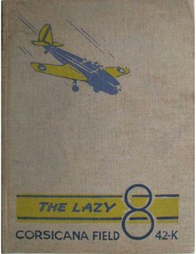
Opened on 1 April 1941 with 2,000' all-way turf runway. Known as Corsicana Field. Assigned to United States Army Air Forces Gulf Coast Training Center (later Central Flying Training Command) as a primary (level 1) pilot training airfield. had six local axillary airfields for emergency and overflow landings.
Began training United States Army Air Corps flying cadets under contract to Air Activities of Texas under 301st Flying Training Detachment. Flying training was performed with Fairchild PT-19s as the primary trainer. Also had several PT-17 Stearmans and a few old A-3 Curtiss Falcons assigned.
Inactivated on 16 October 1944 with the drawdown of AAFTC's pilot training program. Declared surplus and turned over to the Army Corps of Engineers on 30 September 1945. Eventually discharged to the War Assets Administration (WAA) and became a civil airport. [3][4][5]
Facilities
The airport covers 166 acres (67 ha) at an elevation of 449 feet (137 m). It has two runways: 14/32 is 5,004 by 75 feet (1,525 x 23 m) asphalt; 2/20 is 3,200 by 75 feet (975 x 23 m) turf.[1]
In the year ending September 30, 2022, the airport had 25,200 general aviation aircraft operations, average 69 per day. 61 aircraft were then based at the airport: 56 single-engine, 4 multi-engine, and 1 helicopter.[1]
The Cumbie Aviation Museum is located in two rooms in the terminal.[6][7]
See also
- Texas World War II Army Airfields
- 31st Flying Training Wing (World War II)
- List of airports in Texas
References
- ^ a b c d FAA Airport Form 5010 for CRS PDF. Federal Aviation Administration. Effective 5 October 2023.
- ^ Corsicana Municipal Airport. City of Corsica. Accessed 17 August 2010.
- ^
 This article incorporates public domain material from the Air Force Historical Research Agency
- ^ Shaw, Frederick J. (2004), Locating Air Force Base Sites, History’s Legacy, Air Force History and Museums Program, United States Air Force, Washington DC. OCLC 57007862, 1050653629
- ^ Manning, Thomas A. (2005), History of Air Education and Training Command, 1942–2002. Office of History and Research, Headquarters, AETC, Randolph AFB, Texas OCLC 71006954, 29991467
- ^ "Cumbie Aviation Museum". City of Corsicana. Archived from the original on 8 November 2014. Retrieved 3 January 2024.
- ^ Bigham, Randy (29 June 2011). "The Sky is the Limit". Now Magazines. Retrieved 3 January 2024.
External links
- FAA Terminal Procedures for CRS, effective March 21, 2024
- Resources for this airport:
- FAA airport information for CRS
- AirNav airport information for KCRS
- ASN accident history for CRS
- FlightAware airport information and live flight tracker
- NOAA/NWS weather observations: current, past three days
- SkyVector aeronautical chart, Terminal Procedures
| Flying training |
|  | ||||
|---|---|---|---|---|---|---|
| Technical training |
| |||||