
Chrea
الشريعة | |
|---|---|
Commune and town | |
 | |
 Map of Blida province highlighting the Chréa commune | |
 Chrea | |
| Coordinates: 36°25′37″N 2°52′35″E / 36.42694°N 2.87639°E | |
| Country | |
| Province | Blida Province |
| Population (2008)[1] | |
| • Total | 783 |
| Time zone | UTC+1 (CET) |
Chrea is a town in Algeria, located in Blida Province, Ouled Yaïch District, in a mountainous area named Tell Atlas, near Blida. It had a population of 783 in 2008.[1]
In its municipality is situated the Chréa National Park, one of the largest national parks of the country, and a ski resort.[2]
Within the national park is one of the few relict populations of the endangered primate, the Barbary macaque, Macaca sylvanus; this species of primate originally had a much wider range in Northern Algeria and Morocco.[3]
YouTube Encyclopedic
-
1/3Views:35 9093 31224 167
-
Blida-Chréa (Algérie), pays d'une beauté à couper le souffle !
-
Algeria Blida Chréa
-
Algeria Blida Chréa
Transcription
Geography
Climate
Located in the Atlas Mountains, at 1,458 metres (4,783 ft) above sea level, Chréa has a cool Mediterranean climate, with an average annual precipitation of 916 millimetres (36.1 in). Summers are warm and dry and winters are chilly and wetter, with snowfalls. This climate is described by the Köppen climate classification as Csb. This is one of the coldest places in Algeria.
| Climate data for Chréa | |||||||||||||
|---|---|---|---|---|---|---|---|---|---|---|---|---|---|
| Month | Jan | Feb | Mar | Apr | May | Jun | Jul | Aug | Sep | Oct | Nov | Dec | Year |
| Mean daily maximum °C (°F) | 6.7 (44.1) |
7.9 (46.2) |
9.9 (49.8) |
12.8 (55.0) |
17.4 (63.3) |
22.7 (72.9) |
28.5 (83.3) |
28.5 (83.3) |
23.2 (73.8) |
17.0 (62.6) |
10.8 (51.4) |
7.5 (45.5) |
16.1 (60.9) |
| Mean daily minimum °C (°F) | −0.9 (30.4) |
−0.4 (31.3) |
1.1 (34.0) |
3.2 (37.8) |
6.9 (44.4) |
11.2 (52.2) |
15.7 (60.3) |
15.9 (60.6) |
12.3 (54.1) |
7.7 (45.9) |
2.7 (36.9) |
0.3 (32.5) |
6.3 (43.4) |
| Average precipitation mm (inches) | 133 (5.2) |
92 (3.6) |
105 (4.1) |
79 (3.1) |
70 (2.8) |
30 (1.2) |
6 (0.2) |
10 (0.4) |
39 (1.5) |
76 (3.0) |
136 (5.4) |
140 (5.5) |
916 (36) |
| Source: Climate-data.org[4] | |||||||||||||
References
- ^ a b "Recensement 2008 de la population algérienne, wilaya de Blida, sur le site de l'ONS" (PDF). Archived (PDF) from the original on 2020-11-16.
- ^ Algerians forget fighting to go skiing, BBC News, accessed on December 19, 2008.
- ^ C. Michael Hogan, (2008) Barbary Macaque: Macaca sylvanus, Globaltwitcher.com, ed. Nicklas Stromberg Archived April 19, 2012, at the Wayback Machine
- ^ "Climate: Chréa". Retrieved 2 September 2013.
External links
| Blida District | 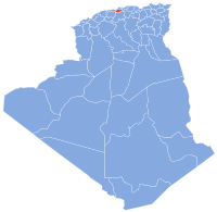 | |
|---|---|---|
| Boufarik District | ||
| El Affroun District | ||
| Larbaâ District | ||
| Ouled Yaïch District | ||
| Bouinan District | ||
| Bougara District | ||
| Oued El Alleug District | ||
| Mouzaïa District | ||
| Meftah District | ||
This article about a location in Blida Province is a stub. You can help Wikipedia by expanding it. |