
Blida
البليدة (in Arabic) | |
|---|---|
     Overview of Blida | |
 Seal | |
| Nicknames: City of roses, مدينة الورود | |
 Location of Blida, Algeria within Blida Province | |
 Blida | |
| Coordinates: 36°28′07″N 02°49′55″E / 36.46861°N 2.83194°E | |
| Country | |
| Province | Blida Province |
| District | Blida District |
| Area | |
| • City | 72.1 km2 (27.8 sq mi) |
| Elevation | 260 m (850 ft) |
| Population (2012) | |
| • City | 182,447 |
| • Density | 2,500/km2 (6,600/sq mi) |
| • Metro | 1,167,882 |
| Time zone | UTC+1 (CET) |
| Postal code | 09000 |
| Area code | 901 |
| Climate | Csa |
Blida (Arabic: البليدة, romanized: al-bulaydah) is a city in Algeria. It is the capital of Blida Province, and it is located about 45 km south-west of Algiers, the national capital.[1] The name Blida, i.e. bulaydah, is a diminutive of the Arabic word belda, city.
YouTube Encyclopedic
-
1/1Views:5 046
-
😍👍4K SCENIC DRIVE IN BLIDA😍👍
Transcription
Geography
Blida is known as the city of roses because of the large number of roses in its gardens.
Blida lies surrounded with orchards and gardens, 190 metres (620 ft) above the sea, at the base of the Tell Atlas, on the southern edge of the fertile Mitidja Plain, and the right bank of the Oued el kebir outflow from the Chiffa gorge. The abundant water of this stream provides power for large corn mills and several factories, and also supplies the town with its numerous fountains and irrigated gardens. Within Blida is Chréa National Park, one of the largest national parks in the country and part of the Atlas Mountains. Blida is surrounded by a wall of considerable extent, pierced by six gates, and is further defended by Port Mimieh, crowning a steep hill on the left bank of the river.[2]
The nearby Chiffa gorge is a habitat of the endangered Barbary macaque, Macaca sylvanus; the habitat is one of only a few locations where populations of the primate are found.[3]

Climate
In Blida, there is a Mediterranean climate. The Köppen-Geiger climate classification is Csa. The average annual temperature in Blida is 17.9 °C (64.2 °F). About 791 mm (31.14 in) of precipitation falls annually.
| Climate data for Blida | |||||||||||||
|---|---|---|---|---|---|---|---|---|---|---|---|---|---|
| Month | Jan | Feb | Mar | Apr | May | Jun | Jul | Aug | Sep | Oct | Nov | Dec | Year |
| Mean daily maximum °C (°F) | 14.2 (57.6) |
15.5 (59.9) |
17.3 (63.1) |
19.9 (67.8) |
23.3 (73.9) |
26.8 (80.2) |
30.9 (87.6) |
31.7 (89.1) |
28.2 (82.8) |
23.3 (73.9) |
18.5 (65.3) |
15.3 (59.5) |
22.1 (71.7) |
| Mean daily minimum °C (°F) | 7.0 (44.6) |
7.6 (45.7) |
9.3 (48.7) |
11.4 (52.5) |
14.3 (57.7) |
17.7 (63.9) |
21.4 (70.5) |
22.1 (71.8) |
20.0 (68.0) |
15.2 (59.4) |
10.9 (51.6) |
8.2 (46.8) |
13.8 (56.8) |
| Average precipitation mm (inches) | 116 (4.6) |
85 (3.3) |
92 (3.6) |
64 (2.5) |
58 (2.3) |
26 (1.0) |
2 (0.1) |
4 (0.2) |
34 (1.3) |
66 (2.6) |
114 (4.5) |
130 (5.1) |
791 (31.1) |
| Source: climate-data | |||||||||||||
History

No ancient center preceded the city. It was identified with the town of Mitidja in the Middle Ages which was ruined during the Beni Ghania campaigns. The present town was founded by Moors in the 16th century.[4]
The town was rebuilt according to a grid plan following an earthquake in 1825 on a site about a mile distant from the ruins.[4][5] It numbers among its buildings several mosques and churches, extensive barracks and a large military hospital. The principal square, the place d'Armes, is surrounded by arcaded houses and shaded by trees. The center of a fertile district, and a post on one of the main routes in the country, Blida has a flourishing trade, chiefly in oranges and flour. The orange groves contain over 50,000 trees, and in April the air for miles round is laden with the scent of the orange blossoms. In the public gardens is a group of magnificent olive trees. The products of the neighboring cork trees and cedar groves are a source of revenue to the town.[4][2] Sidi-Ahmed El-Kebir, Blida's founder, is buried in Sidi El-Kebir (an area named after him). He founded Blida in the 16th century.
A mosque was built by order of Khair-ed-din Barbarossa, and under the Turks the town was of some importance.[2] It was intricately rebuilt of interconnecting alleyways and streets, and was made accessible through the existing six major gates. The gates were as follows:
- Bab Er-Rahba
- Bab Ed-Zair
- Bab El-Khouikha
- Bab Es-Sebt
- Bab Ez-Zaouia
- Bab El-Kbour
- Bab El-Kseb
Today those gates no longer exist, but their names are still in use by people in Blida as reference points to locate streets, places, schools and businesses.
In 1867, another earthquake damaged Blida.[4]
Blida Province is home to a number of Berber-speaking tribes &towns. The Berbers of Blida are known as Djebailia and have been in the plains of Blida/Matija for thousands of years according to historians such as Ibn khaldoun. The tribes are Beni Salah(Ith salah)Beni Misrah(Ith Misra), Ghalia and many more. They speak Taqbaylit the language of the Kabyle which is the Berber language of blida close to the Kabyle varieties spoken east of Algiers Province, It is 95% identical and has traditionally been seen as an intermediate between Kabyle and the Chenoua language native to the north-eastern part of the country.
Notable locations

- Stade Mustapha Tchaker in Blida is the current exclusive home stadium for the Algeria national football team. This has been the case since it was opened in 2002, Algeria have however also played many of their home games away from Tchaker throughout their history, both in friendly matches and for competitive tournaments.
- Al-Kawthar Mosque is located in the center of the city at the Bin Merah Square, known as the famous square of the Toot in Blida. The mosque is distinguished by its space as it attracts more than 12 thousand worshipers on religious occasions.
- Place Toute is located in the center of Blida located near Bab Es-Sebt, Al-Kawthar Mosque, and the old market. Tourists and locals can enjoy the many cafes, pastry shops, ice cream shops, and other restaurants while their children play in the plaza.
Notable people
- Sidi-Ahmed El-Kebir (15th-16th century), Religious man, City Founder
- Mhamed Yazid (1923-2003), Politician
- Mahfoud Nahnah (1942-2003), Politician
- Mohamed Baba Ameur (1893-1976), Theologian
- Mohamed Bouslimani (1941-1993), Politician
- Elissa Rhaïs, Novelist
- Edouard Nieuport (1875-1911), Aviation pioneer and manufacturer
- Mohammed Mazouni, Singer
- Mohamed El Touri, Comedian
- Mustapha Sellami, Football player
- Salah Aougrout, Comedian
- Bachir Selami, Filmographer
- Mustapha Benguergoura, Singer
- Farid Khodja, singer
- Rabah Driassa, Singer & Painter
- Baya, Artist
- Souhila Bel Bahar, Painter
- Mohamed Bourouissa, Artist
- Frantz Fanon, psychiatrist and writer
- Dahmane Ben Achour, Singer
- Rachid Nouni, Singer
- Abdelkader Guessoum, Singer
- Mohamed Tobal, Singer
- Mohamed Sidi el Kebir, Singer
- Kamel Choumane, Singer
Notes
- ^ Alice Cherki and Nadia Benabid, 2006
- ^ a b c One or more of the preceding sentences incorporates text from a publication now in the public domain: Chisholm, Hugh, ed. (1911). "Blida". Encyclopædia Britannica. Vol. 4 (11th ed.). Cambridge University Press. pp. 58–59.
- ^ C. Michael Hogan, 2008
- ^ a b c d "Arab Market, Blida, Algeria". World Digital Library. 1899. Retrieved 25 September 2013.
- ^ Babo, Daniel (2010). Algérie. Des hommes et des lieux. Méolans-Revel: le Sureau. ISBN 978-2-911328-25-1.
References
- Alice Cherki and Nadia Benabid (2006) Frantz Fanon: A Portrait, Cornell University Press, 255 pages ISBN 0-8014-7308-X
- C. Michael Hogan, (2008) Barbary Macaque: Macaca sylvanus, Globaltwitcher.com, ed. Nicklas Stromberg
| Blida District | 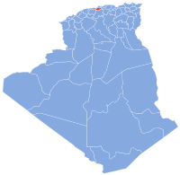 | |
|---|---|---|
| Boufarik District | ||
| El Affroun District | ||
| Larbaâ District | ||
| Ouled Yaïch District | ||
| Bouinan District | ||
| Bougara District | ||
| Oued El Alleug District | ||
| Mouzaïa District | ||
| Meftah District | ||

| International | |
|---|---|
| National | |
| Other | |