
Center Grove Township | |
|---|---|
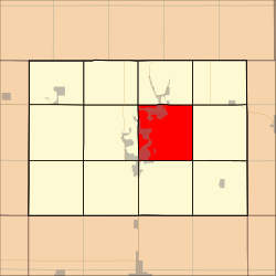 Location in Dickinson County | |
| Coordinates: 43°23′29″N 95°05′16″W / 43.39139°N 95.08778°W | |
| Country | |
| State | |
| County | Dickinson |
| Area | |
| • Total | 93.63 km2 (36.15 sq mi) |
| • Land | 81.28 km2 (31.38 sq mi) |
| • Water | 12.35 km2 (4.77 sq mi) 13.19% |
| Elevation | 426 m (1,398 ft) |
| Population (2000) | |
| • Total | 7,478 |
| • Density | 92/km2 (238.3/sq mi) |
| Time zone | UTC-6 (CST) |
| • Summer (DST) | UTC-5 (CDT) |
| ZIP codes | 51331, 51351, 51355, 51360 |
| GNIS feature ID | 0467588 |
Center Grove Township is one of twelve townships in Dickinson County, Iowa, USA. As of the 2000 census, its population was 7,478.[1]
YouTube Encyclopedic
-
1/3Views:58020 8642 800
-
"IRS Letter Format" Need Assistance With Tax Letter Format Of IRS?
-
Medical Assistant Program Video *
-
Recovery Options: Treatment for Drug Addiction and Alcoholism
Transcription
History
Center Grove Township was formed in 1866.[2]
Geography
According to the United States Census Bureau, Center Grove Township covers an area of 36.15 square miles (93.63 square kilometers); of this, 31.38 square miles (81.28 square kilometers, 86.81 percent) is land and 4.77 square miles (12.35 square kilometers, 13.19 percent) is water.
Cities, towns, villages
- Arnolds Park
- Milford (partial)
- Okoboji (southeast three-quarters)
- Spirit Lake (vast majority)
- West Okoboji (partial)
Adjacent townships
- Spirit Lake Township (north)
- Superior Township (northeast)
- Richland Township (east)
- Lloyd Township (southeast)
- Milford Township (south)
- Okoboji Township (southwest)
- Lakeville Township (west)
- Diamond Lake Township (northwest)
Cemeteries
The township contains these three cemeteries: Lake View, Lakeland Memory Gardens and Rose Hill.
Major highways
Airports and landing strips
- Airport Okoboji
- Dickinson County Memorial Hospital Heliport
- Lake Okoboji Seaplane Base
- Spirit Lake Municipal Airport
Lakes
- Center Lake
- Lower Gar Lake
- Minnewashta Lake
- Prairie Lake
- Upper Gar Lake
Landmarks
- Pillsbury Point State Park
- Summer Circle Park
School districts
- Okoboji Community School District
- Spirit Lake Community School District
Political districts
- Iowa's 5th congressional district
- State House District 06
- State Senate District 03
References
- United States Census Bureau 2007 TIGER/Line Shapefiles
- United States Board on Geographic Names (GNIS)
- United States National Atlas
- ^ "U.S. Census website". Retrieved May 6, 2009.
- ^ History of Emmet County and Dickinson County, Iowa. Pioneer Publishing Company. 1917. pp. 282.
External links
Wikimedia Commons has media related to Center Grove Township, Dickinson County, Iowa.
Municipalities and communities of Dickinson County, Iowa, United States | ||
|---|---|---|
| Cities |  | |
| Townships | ||
| Unincorporated community | ||