
Cedar Fort, Utah | |
|---|---|
 Cedar Valley Post Office, June 2009 | |
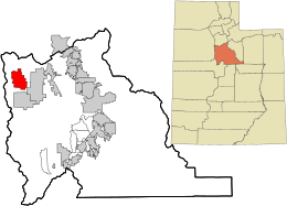 Location in Utah County and the state of Utah | |
| Coordinates: 40°19′35″N 112°6′20″W / 40.32639°N 112.10556°W | |
| Country | United States |
| State | Utah |
| County | Utah |
| Settled | 1852 |
| Incorporated | May 17, 1965 |
| Named for | Juniper ("cedar") trees |
| Area | |
| • Total | 21.38 sq mi (55.37 km2) |
| • Land | 21.38 sq mi (55.37 km2) |
| • Water | 0.00 sq mi (0.00 km2) |
| Elevation | 5,085 ft (1,550 m) |
| Population (2010) | |
| • Total | 368 |
| • Estimate (2019)[2] | 395 |
| • Density | 18.48/sq mi (7.13/km2) |
| Time zone | UTC-7 (Mountain (MST)) |
| • Summer (DST) | UTC-6 (MDT) |
| ZIP code | 84013 |
| Area code(s) | 385, 801 |
| FIPS code | 49-11430[3] |
| GNIS feature ID | 1455091[4] |
| Website | www |
Cedar Fort is a town in Utah County, Utah, United States. It is part of the Provo–Orem Metropolitan Statistical Area. The population was 368 at the 2010 census.[5]
YouTube Encyclopedic
-
1/3Views:43434012 070
-
Cove Fort Utah point of interestate I 70 I15
-
Cedar Breaks- Brian Head Utah Camping Search Late June 2016
-
Leaving Cedar City, Exploring Utah VanLife On the Road
Transcription
Geography
According to the United States Census Bureau, the town has a total area of 21.2 square miles (55.0 km2), all land.[6]
| Census | Pop. | Note | %± |
|---|---|---|---|
| 1870 | 272 | — | |
| 1880 | 250 | −8.1% | |
| 1890 | 176 | −29.6% | |
| 1900 | 218 | 23.9% | |
| 1910 | 236 | 8.3% | |
| 1920 | 178 | −24.6% | |
| 1930 | 177 | −0.6% | |
| 1940 | 208 | 17.5% | |
| 1950 | 213 | 2.4% | |
| 1970 | 188 | — | |
| 1980 | 269 | 43.1% | |
| 1990 | 284 | 5.6% | |
| 2000 | 341 | 20.1% | |
| 2010 | 368 | 7.9% | |
| 2019 (est.) | 395 | [2] | 7.3% |
| U.S. Decennial Census[7] | |||
Demographics
At the 2000 census, there were 341 people, 101 households, and 83 families in the town. The population density was 16.1 people per square mile (6.2/km2). There were 110 housing units at an average density of 5.2 per square mile (2/km2). The racial makeup of the town was 95.89% White, 0.59% Native American, 0.29% Asian, 0.29% Pacific Islander, 0.29% from other races, and 2.64% from two or more races. Hispanic or Latino of any race were 0.88%.[3]
Of the 101 households, 43.6% had children under 18, 76.2% were married couples living together, 4.0% had a female householder with no husband present, and 17.8% were non-families. 16.8% of households were one person, and 10.9% were one person aged 65 or older. The average household size was 3.38, and the average family size was 3.87.
The age distribution was 36.1% under the age of 18, 8.8% from 18 to 24, 24.0% from 25 to 44, 19.6% from 45 to 64, and 11.4% 65 or older. The median age was 29 years. For every 100 females, there were 101.8 males. For every 100 females aged 18 and over, there were 101.9 males.
The median household income was $44,773, and the median family income was $45,833. Males had a median income of $40,000 versus $25,500 for females. The per capita income for the town was $14,266. About 5.4% of families and 11.3% of the population were below the poverty line, including 18.5% of those under age 18 and 7.5% of those aged 65 or over.

Education
Cedar Fort is part of the Alpine School District. The only school in town is Cedar Valley Elementary. Older students attend schools in Eagle Mountain and Saratoga Springs.
See also

References
- ^ "2019 U.S. Gazetteer Files". United States Census Bureau. Retrieved August 7, 2020.
- ^ a b "Population and Housing Unit Estimates". United States Census Bureau. May 24, 2020. Retrieved May 27, 2020.
- ^ a b "U.S. Census website". United States Census Bureau. Retrieved January 31, 2008.
- ^ U.S. Geological Survey Geographic Names Information System: Cedar Fort
- ^ "Profile of General Population and Housing Characteristics: 2010 Demographic Profile Data (DP-1): Cedar Fort town, Utah". United States Census Bureau. Retrieved March 8, 2012.
- ^ "Geographic Identifiers: 2010 Demographic Profile Data (G001): Cedar Fort town, Utah". United States Census Bureau. Retrieved March 8, 2012.
- ^ "Census of Population and Housing". Census.gov. Retrieved June 4, 2015.
External links
Places adjacent to Cedar Fort, Utah | |
|---|---|
Municipalities and communities of Utah County, Utah, United States | ||
|---|---|---|
| Cities |  | |
| Towns | ||
| CDPs | ||
| Other communities | ||
| Indian reservation | ||
| Ghost towns | ||
| Footnotes | ‡This populated place also has portions in an adjacent county or counties | |
| International | |
|---|---|
| National | |