
| Buena Vista Battery | |
|---|---|
| Part of Fortifications of Gibraltar | |
| Buena Vista in Gibraltar | |
 Buena Vista Battery | |
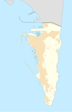 Buena Vista Battery Location within Gibraltar | |
| Coordinates | 36°07′05″N 5°21′00″W / 36.117986°N 5.349997°W |
| Type | Coastal artillery battery |
| Site information | |
| Owner | Government of Gibraltar |
| Open to the public | Yes |
| Condition | Abandoned |
| Site history | |
| Built by | UK Ministry of Defence |
| Garrison information | |
| Garrison | Royal Gibraltar Regiment |
Buena Vista Battery was an artillery battery near the Buena Vista Barracks at the southern end of the British Overseas Territory of Gibraltar. It is located on a slight ridge in front of the nearby Buena Vista Barracks, which was once the base of the Royal Gibraltar Regiment.[1]
YouTube Encyclopedic
-
1/2Views:17 184281 084
-
Visit to Angel Island in the San Francisco Bay (includes tramlapse tour)
-
TEDxBlue - Angela Lee Duckworth, Ph.D - 10/18/09
Transcription
[Cheerful upbeat ukulele music] [Male narrator] Hello, thanks for coming along Today we’re going to visit Angel Island The largest island in San Francisco Bay, at about 1.2 square miles Angel Island has been used for a variety of purposes over the years It’s been military bases, it’s been a quarantine station It’s been an immigration inspection and detention facility And during World War II it even housed prisoners of war However, today, with the exception of a very small piece which is an active U.S. Coast Guard Station the entire rest of the island is a California State Park The only access to the island is by ferry or by private boat although I suppose if you were really hardy you could swim here We’re arriving on an unusually warm December day on a ferry from San Francisco Because December is the off season, the ferry arrives from San Francisco twice a day Once in the morning about 10:00, and then it will come back in the afternoon about 4:00 to pick us back up So we’ll have the entire day to spend on the island Well, we’ve disembarked and there goes the ferry leaving us behind to spend the day on Angel Island Don’t worry, it’ll be back about 4:00 to pick us up If you’re interested in seeing the ferry rides to and from the island those are separate videos on my channel, so you can look for those [Music ends, wave sounds are heard] [Mellow, jazzy music starts] You can see here at Ayala Cove, there are a number of facilities including a nice, large picnic area There are also a couple of restaurants here We’re here in the off season, so only one of the restaurants was open and its only open for limited hours Both restaurants are open in the summer for longer hours The food is good — I wouldn’t say its “gourmet”, but its not bad Angel Island is a big island, with roads and a network of trails Lots of hiking available, including all the way to the highest point on the island which is Mt. Caroline Livermore at 788 feet, if you’re up for that This is a view of Mt. Livermore taken from the video of the ferry ride on the way to the island so be sure to check out that, if you haven’t already There are no private motorized vehicles allowed on the island however, you can bring your bike, and also rent bikes There are group tours by Segway, and some sort of electric bikes If its your first time on the island, I highly recommend taking one of these open-air tram tours They go around the outer perimeter of the island and they take about an hour and they’re a good way to get a sense of the island and what sort of things you might want to come back and visit If you want to, you can also get off anywhere along the tour and explore, and then walk back So that’s the first thing we’re going to do here We’re going to take one of these tram tours around the island But, before we can get going, we’ve got to make kind of a tight U-turn here with the tire just inches from the edge of this ledge We get a little bit of “spotting” help from one of the passengers And with that help, we make it by without going over the edge and we’re on our way Okay, we’re taking a tram ride here, and if you know me, then you know — if there’s a tram ride, then we’ve got to have a “tramlapse”! And further, the “tramlapse” has got to be instrumented So, let’s begin by first adding some instrumentation and switching to some suitable “tramlapse” music [Jazz music ends, fast-paced rock music starts slowly and builds] Don’t worry, though — during this “tramlapse” we’ll be stopping or slowing down at about 13 different points of interest Alright, it’s time to speed it up and do a little bit of “lapsing” until our first point of interest [Music becomes more fast-paced with strong beat] We’re now arriving at our first stop, which is Point Ione Off to the left in the distance you can see a little bit of the Golden Gate Bridge The point directly in front of us is Point Ione And across the bay you can see the houses of Sausalito To the right is the town of Belvedere on the island of Belvedere known for it’s views As you might guess, its a rather expensive area It only has a population of around 2,000 and there are no businesses in Belvedere — its entirely residential The narrow channel that separates us from the mainland here is known as Raccoon Strait And across Raccoon Strait you can see the docks where the ferries land A little bit behind the docks is the narrow spit of land that connects Belvedere with Tiburon And just behind that you can see a little bit of Richardson Bay And then beyond Richardson Bay is Mt. Tamalpais known to everybody in the Bay Area as “Mount Tam” Further to the right is the town of Tiburon, on the Tiburon Peninsula The city of Tiburon has a population of around 9,000 And unlike it’s neighbor Belvedere, Tiburon does have businesses It has two hotels, it has a weekly newspaper, has quite a few restaurants, boutiques and small shops [music] We’re approaching Camp Reynolds also known as the “West Garrison” because its on the west side of the island This red building here was a hospital It was used for training Army surgeons, and it was completed in 1904 Here’s a first overview of our next stop, which is Camp Reynolds [music] Here we are at Camp Reynolds Interesting thing about Camp Reynolds — it contains the largest collection of wood-framed Civil War buildings left in the United States That’s right — you would think that would be in the South somewhere but no, its right here in the San Francisco Bay The largest collection of wood-framed Civil War buildings thats still left The yellow building with red trim is the officers’ quarters Three families shared that house Everybody got their own rooms at the top and they shared the lower level The buildings going down towards the water were for soldiers and their families And it went according to rank, with the higher ranks getting the houses higher up So, if someone came onto the island with a higher rank they’d all have to shift down And the lowest ranks would have to pitch their tents down by the water All these buildings were built in the 1860’s Some of them were built over on Yerba Buena island and hauled over here and then hauled up the hill by mules Others were brought over in pieces on a barge, and then assembled over here Nobody lives here now Park personnel do live elsewhere on the island, but nobody lives here However, some Bay Area schools do come once in a while and spend the night The large, grassy area with the flagpole is the parade ground The building down by the water, I’ve heard conflicting stories about Some places seem to indicate that it was a hospital Others that it was a place for storing ammunition and explosives So its not clear to me actually which that was — a hospital or an ammunition dump And, by the way, the white restrooms off to the left were added as part of the park they were not there during the Civil War era, obviously [music] Our next stop is a place called Battery Ledyard It has some really great views of the Bay — sweeping views from the Bay Bridge, city of San Francisco over to the Golden Gate Bridge, and all the way over to Marin Battery Ledyard was the site of one of the three artillery batteries that were built on the island after the Spanish-American War I’ve seen various accounts of when it was started and when it was completed — different dates According to the tour guide on this trip, it was completed in 1904 and it was declared obsolete in 1909 so it only lasted for five years as an active military installation By the way, no military installation on Angel Island has ever actively been involved in any battles No military installation on Angel Island has ever “fired a shot in anger”, as they say [music] There are some really great views of the Golden Gate Bridge from over here You’ll notice the two rectangular things hanging on the side of the bridge Those are platforms used by the painters and maintenance people to work on the bridge Painting of the bridge is a continuous process, ongoing all year, it never ends Hey — you know what? Why don’t we take a minute and teleport over to the Golden Gate Bridge! and see what it looks like from over there And, here’s one of those platforms that the painters and maintenance people use That would be an interesting job, I guess Obviously it might be kind of a problem if you had a fear of heights And if you look out beyond the platform. you can see Angel Island And I think where we’ve stopped, at Battery Ledyard, is right about here So, here we are looking at ourselves from the bridge, and looking at ourselves from Angel Island — looking both directions Alright, well, that’s enough of ourselves looking back at ourselves, so let’s teleport back over to Angel Island and continue our tour [music] There you can see the western span of the Bay Bridge officially known as the “San Francisco - Oakland Bay Bridge” Upper deck being westbound or inbound traffic and the lower deck being for outbound or eastbound traffic The eastern end of the western span is anchored at Yerba Buena Island, right there And then this is the eastern span of the Bay Bridge And you can see the new eastern span in front, with the single suspension tower, the tall, white tower And then behind it, the metal-work is the old eastern span which is in the process of being torn down and will be gone eventually Okay, time to leave Battery Ledyard and continue our journey [music] As we head away from Battery Ledyard, down below you can see a sandy beach Thats Perles Beach, named after James Perle who was a dairy farmer and a handyman a civilian who lived on the island during the 1860’s and worked for the Army His son, Fred Perle, then worked for the Army for about 40 years and was the last land owner on Angel Island [music] Ahead of us, up above on the hill you can see an outcropping of rock with a greenish color That is serpentine rock, and that’s the official state rock of California It became the official state rock of California in 1965 and California was the first state to designate a state rock! How about that! However, there was a movement a few years ago to change that because apparently serpentine has asbestos in it and there was some senator that was worried about that But I don’t think it went anywhere, because serpentine is still the official state rock Serpentine was quarried here and this large structure that you see here is a rock crusher that was built in 1931 and it was used to crush the rock and sort gravel for the island’s roads Wildlife on the island includes snakes, salamanders, raccoons, and field voles including a sub-species of mole found only this island I’m sure you’ll be disappointed that we didn’t see any moles on this tour However, we did see some of the estimated 200 deer that reside on the island [music] Well, ho hum, here’s some more fantastic views of the Golden Gate Bridge, San Francisco, the Bay Bridge… You know, you almost get jaded on this island there are so many fantastic views from every direction [music] This narrow point is Point Blunt it contains an active U.S. Coast Guard Station Its the only part of the island that is not accessible to the general public And beyond you can see the East Bay, the East Bay hills, Berkeley and Oakland And also a very good view of the eastern span of the Bay Bridge with the new section in the foreground with the white suspension tower and in the background the metal-work of the old bridge which is in the process of being torn down [music only for next 2 minutes, no narration] We’re now entering Fort McDowell, also known as the “East Garrison” It was named after General Irvin McDowell who led the Union Army in the First Battle of Bull Run in the Civil War The big building on the right is the barracks When it was originally built, it was known as “the 600-man barracks” And then later on it became known as “the thousand-man barracks” as they squeezed in even more men during World War II The grassy area in front of the barracks is where the parade ground was The row of buildings on the left was the officers’ quarters, known as “officers’ row” Park personnel and their families now live in some of these buildings Most of the buildings here date between 1910 and 1912 and they were built using military prisoners from the Army prison over on Alcatraz as labor Although heavily used in World War I the most heavy use of Fort McDowell was in World War II It was an important point of debarkation and embarkation and also quarantine But the busiest period was when World War II ended For example, in just the month of December, 1945 23,632 men returned through Fort McDowell And during that month, the main mess hall served 310,000 meals During World War II, more than 300,000 soldiers shipped to the Pacific Theater through Fort McDowell Ahead, at the end of officers’ row, is the Administration Building Past the Administration Building is a newer, yellow building on the left, which is the chapel This is open to the public and has become a romantic spot for weddings Past the chapel is the hospital Soldiers were examined here before they shipped out or when they returned It was last used as the headquarters for the Nike Missile Command in the early 1960’s Yes, there were actually 12 Nike missiles here on Angel Island up until 1962, when they became obsolete and were removed And that was the last time that Angel Island was ever used for military purposes [music] We’ve arrived at the former U.S. Immigration Station nicknamed “The Guardian of the Western Gate” also known as “The Ellis Island of the West” Between 1910 and 1940 nearly one million immigrants from more than 80 countries passed through here During World War II it was a P.O.W. processing center for captured German and Japanese soldiers Not a lot you can see from the road up here, so we’ll just pause here for a minute Really need to get down in there and explore to see it all So, we’ll leave that for some other tour, some other time [music] As we head up the hill here, you can see just a little bit more of the former Immigration Station, off to the right, through the fence [music] We’re now approaching Point Campbell, which is the northernmost tip of Angel Island In the distance is the Richmond - San Rafael Bridge, which is Interstate 580 The little island that you see there is actually in front of the bridge It looks like the bridge might go to the island but actually that island is in front of the bridge from our perspective That’s Red Rock Island And the most interesting thing about that is that’s the only privately-owned island in San Francisco Bay Not only that, but it’s currently for sale at the time of this video It was for sale for $10 million, the price has been lowered to $5 million So, you could buy your own island, about a 6 acre island, in San Francisco Bay, for only $5 million And yet another interesting thing about this island is that the boundaries of 3 counties converge on this island San Francisco, Marin, and Contra Costa Counties Two of the counties, San Francisco and Contra Costa, actually share part of the island The city of Richmond and the city of San Francisco each have about half of the island If you asked anyone on the street if San Francisco shares a common border with the city of Richmond over in the East Bay, they’d probably say you’re crazy But, yes, they actually do share a common border on Red Rock Island Part of the city of San Francisco is over on that island A part of San Francisco that I’ve never been to [music] And, here we are, right back where we started, at Ayala Cove And this concludes our “tramlapse” tour of the island My first ever “tramlapse” video [Mellow jazz music] If we were feeling frisky and ambitious we might go on a hike on one of the many trails around the island But today I’m actually feeling kind of laid-back, kind of lazy so I think I’ll just hang out here at Ayala Cove and relax for a bit Its kinda nice that there’s this idyllic, quiet place here to kind of relax and hang out only a ferry-ride away from the hustle and bustle of the city of San Francisco Since the only access to the island is by ferry or by private boat there’s no traffic on the island, its nice and quiet that way There aren’t a lot of huge crowds coming and going Especially in the December off-season that we’re in now So, we’ll just relax here a while until our ferry comes to take us back This building is the Visitor Center — it houses a small museum on the ground floor The museum is mostly photographs and posters about the history of the island There isn’t a lot in the way of artifacts in that sense of a museum But its still worth a visit, its interesting to read about the history of the island and to contemplate what things were like years ago There are other ferries that arrive and leave at various times during the day that go to other places, aside from the San Francisco ferry I believe that this ferry here is coming from Tiburon This is the docks and the waiting area here, where people wait to board the ferries and off to the right are the public restrooms — important to point those out You may be wondering about the workers who work on the island the Park Rangers, the people who work in the restaurants and so on A handful of them do live on the island, as we saw during the “tramlapse” tour we saw some of the places they live in A lot of them commute by boat Some of them take a private boat that brings them over a little bit before opening time A lot of them come over on the same ferries that we do The ferries from San Francisco tend to be the earliest and the latest So, after this ferry leaves, it actually gets quite quiet around here at Ayala Cove A little more peaceful, fewer people around Not that there were many in this December off-season But, still, it gets even quieter after the majority of the people leave The only people left are those waiting to go back to San Francisco I really do appreciate places like this I can hop on Muni, take a bus over to the Embarcadero Take a ferry over to this island and hang out here in this nice quiet peaceful place There was no driving involved And then when I’m ready to leave, hop on the ferry, same thing Back on Muni, and I’m home And it was a pleasant journey both ways, not involving any freeways or driving or traffic, or any of that So, maybe we’ll come back again some other time and look around some more But right now, it’s time to head back to San Francisco [Cheerful upbeat ukulele music] This is the ferry that will take us back to San Francisco, right on time If you’re interested in seeing the ferry ride back to San Francisco That’s a separate video elsewhere on my channel, and you can check that out if you like Thanks for joining me on this trip to Angel Island, hope you enjoyed it And I’ll see you on the next trip, wherever that may be [Closed captions by Party of the Third Part] [Let me know if you found them useful, or have comments or suggestions]
Description
The area of the battery and barracks was originally used as a lookout post with an attached guardroom, which had to be rebuilt in the 1760s after falling into ruin. At the time the shoreline below was considered to be unassailable, as it was swept by strong currents. The lookout was subsequently converted into an artillery battery intended to protect Camp Bay from surprise attacks.[2]
By 1834 it had two 18-inch (460 mm) howitzers and two 32-pdrs (14.5 kg), but these were removed by 1859. A 9-inch (230 mm) rifled muzzle loader (RML) in an open iron shielded emplacement was installed in 1872, and in 1896 two additional emplacements were added to house two QF 12-pdr (5.4 kg) 12 cwt (610 kg) Mark I guns. Two 12-pdr QF guns on cone mountings were installed in 1902. In October 1940, during the Second World War, a 4-inch (100 mm) naval gun was installed on the battery.[2]
The adjoining barracks was constructed in the 1840s to the designs of Major General Sir John Thomas Jones; it was one of several that were built in the territory following a report that he produced on Gibraltar's defences (see also Defensible Barracks and Retrenched Barracks). Also known as the "Stone Block", its simple design consisted of a single rectangular block with windows on each side, divided into two sections on each floor with three wide intercommunicating rooms in each section. It was used for many years by the Royal Gibraltar Regiment but was subsequently converted for commercial use as factory and storage units.[3]
Battery and barracks today
The Government of Gibraltar has designated Buena Vista Battery as a Class A listed building under the Gibraltar Heritage Trust Act of 1989.[4] The ownership of buildings associated with Buena Vista passed from the UK Ministry of Defence ownership to the Government of Gibraltar in 2011. The agreement swapped over 300 MOD houses and flats with the Government of Gibraltar and in exchange they agreed to build 90 new houses on remaining MOD land.[5]
The site is now being re-developed for residential use but the developers intend to retain, restore and preserve the barracks and the gun emplacements. The fifteen residences were said to sell for between one and two million pounds.[6]
References
- ^ Fa & Finlayson (2006). The Fortifications of Gibraltar 1068–1945. Osprey Publishing. p. 58. ISBN 978-1-84603-016-1. Retrieved 30 March 2013.
- ^ a b Hughes, Quentin; Migos, Athanassios (1995). Strong as the Rock of Gibraltar. Exchange Publications. pp. 196–8.
- ^ Hughes, Quentin; Migos, Athanassios (1995). Strong as the Rock of Gibraltar. Exchange Publications. pp. 194–6.
- ^ "Gibraltar Heritage Trust Act 1989" (PDF). Government of Gibraltar. Archived from the original (PDF) on 27 August 2012. Retrieved 30 March 2013.
- ^ "Government announces details of the recent Lands Agreement with MOD". 29 July 2011. Government of Gibraltar. Archived from the original on 13 November 2012. Retrieved 1 May 2013.
- ^ Buena Vista Park Villas launched Archived March 15, 2013, at the Wayback Machine, GBC, September 2012, accessed 1 April 2013