To install click the Add extension button. That's it.

The source code for the WIKI 2 extension is being checked by specialists of the Mozilla Foundation, Google, and Apple. You could also do it yourself at any point in time.

4,5
Kelly Slayton
Congratulations on this excellent venture… what a great idea!
Alexander Grigorievskiy
I use WIKI 2 every day and almost forgot how the original Wikipedia looks like.
Live Statistics
English Articles
Improved in 24 Hours
Added in 24 Hours
Languages
Recent
Show all languages
What we do. Every page goes through several hundred of perfecting techniques; in live mode. Quite the same Wikipedia. Just better.
.
Leo
Newton
Brights
Milds

Bowstring, Minnesota

From Wikipedia, the free encyclopedia

Bowstring
Bowstring is located in Minnesota
Bowstring
Bowstring
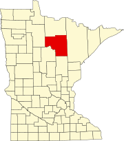
Location of the community of Bowstring
within Itasca County
Bowstring is located in the United States
Bowstring
Bowstring
Bowstring (the United States)
Coordinates: 47°32′35″N 93°47′48″W / 47.54306°N 93.79667°W / 47.54306; -93.79667
CountryUnited States
StateMinnesota
CountyItasca
TownshipBowstring Township
Elevation
1,345 ft (410 m)
Time zoneUTC-6 (Central (CST))
 • Summer (DST)UTC-5 (CDT)
ZIP code
56636
Area code218
GNIS feature ID655495[1]

Bowstring is an unincorporated community in Bowstring Township, Itasca County, Minnesota, United States.

The community is located 15 miles north of Deer River on Minnesota State Highway 6.

The unincorporated community of Bowstring also extends into Bowstring Lake Unorganized Territory of Itasca County.

Geography

The center of Bowstring is generally considered at the intersection of State Highway 6 (MN 6) and Itasca County Road 133 (CR 133). Nearby places include Talmoon, Marcell, Spring Lake, and Inger. Bowstring is located within the Bowstring State Forest of Itasca County. Lake Jessie Township and Leech Lake Indian Reservation are both in the vicinity.

The Bowstring River flows through the area.

Community

The U.S. Postal Service accepts mail addressed to Bowstring, which is held for pickup at a contract post office located at the Bowstring Store.

The community is named after nearby Bowstring Lake. Its population is about 121 people. Buildings include a church, the Bowstring Store, the USDA fire warden's office, a community center, and several houses. It also features a telephone booth, which was an important feature up until the arrival of cellular phone service in the area in the 1980s.

The community has served travelers, tourists, and the area's few permanent residents since being settled in the 1920s.

References

  1. ^ "Bowstring, Minnesota". Geographic Names Information System. United States Geological Survey, United States Department of the Interior.
  • Rand McNally Road Atlas – 2007 edition – Minnesota entry
  • Official State of Minnesota Highway Map – 2011/2012 edition
  • Mn/DOT map of Itasca County – Sheet 2 – 2011 edition
This page was last edited on 22 July 2023, at 20:22
Basis of this page is in Wikipedia. Text is available under the CC BY-SA 3.0 Unported License. Non-text media are available under their specified licenses. Wikipedia® is a registered trademark of the Wikimedia Foundation, Inc. WIKI 2 is an independent company and has no affiliation with Wikimedia Foundation.