
Blahodatne
Благодатне | |
|---|---|
 Flag  Coat of arms | |
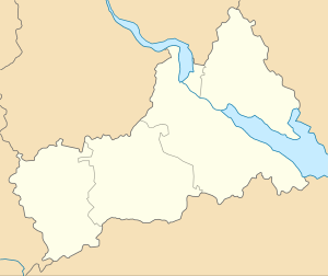 Blahodatne Location in Cherkasy Oblast | |
| Coordinates: 49°33′N 32°05′E / 49.550°N 32.083°E | |
| Country | |
| Oblast | Cherkasy Oblast |
| Raion | Zolotonosha Raion |
| Village founded | 1923 (Chapaievka) 1619 (Bohushkova Slobidka) |
| Elevation | 82 m (269 ft) |
| Population (2007) | |
| • Total | 3,331 |
| Time zone | UTC+2 (EET) |
| • Summer (DST) | UTC+3 (EEST) |
| Postal code | 19774 |
| Area code | +380 4737 |
Blahodatne (Ukrainian: Благодатне) is a selo in Zolotonosha Raion, Cherkasy Oblast, Ukraine. It belongs to Zolotonosha urban hromada, one of the hromadas of Ukraine.[1] Blahodatne has a population of 3,331.
History
The first mention of the village which was called Bogushkovo settlement refers to 1619. In the XVII century the village was the center of Cossack infantry of Kropivnitskogo and subsequently Pereyaslav regiments. The Cossacks of Bogushkova Slobodka participated in the national liberation war of the middle of the 17th century, and in 1666 the village became the center of the uprising of the Pereyaslavsky regiment.[2]
At the end of the XVIII century, the village had 285 yards with a population of 850 inhabitants, and already 737 yards with 3907 inhabitants at the beginning of the XX century. There were 3 blacksmiths, 34 mills, 4 creameries, and several shops.
In 1920, during the Civil War while returning from the Polish front the regiments of the 25th Chapayev division stopped in the village for a short rest. This became the basis for renaming the village to Chapayevka (Ukrainian: Чапаєвка) in 1923.
In 1929, the kolkhoz was formed named after Chapayev. In the 1930s, a typical high school building was built, a 400-seat House of Culture and a House of Pioneers were opened.
On June 7, 1936, the first rural stadium in the republic for 5 thousand spectators was inaugurated where all-Ukrainian sports competitions among rural athletes took place.[3]
On 21 May 2016, Verkhovna Rada adopted decision to rename Chapaievka to Blahodatne according to the law prohibiting names of Communist origin.[4]
Population
Language
Distribution of the population by native language according to the 2001 census:[5]
| Language | Number | Percentage |
|---|---|---|
| Ukrainian | 2 931 | 92.52% |
| Russian | 211 | 6.66% |
| Other[a] | 26 | 0.82% |
| Total | 3 168 | 100.00% |
Notes
- ^ Those who did not indicate their native language or indicated a language that was native to less than 1% of the local population.
References
- ^ "Золотоношская городская громада" (in Russian). Портал об'єднаних громад України.
- ^ "Карта РККА M-36 (В) • 1 км. Кировоградская, Черкасская и Киевская области". www.etomesto.ru. Retrieved 2021-01-06.
- ^ "Український видавничий портал - who-is-who.ua". who-is-who.ua. Retrieved 2021-01-06.
- ^ "Про перейменування деяких населених пунктів" (in Ukrainian). Holos Ukrainy. 21 May 2016. Retrieved 23 December 2020.
- ^ "Рідні мови в об'єднаних територіальних громадах України" (in Ukrainian).
External links
| Raions | ||
|---|---|---|
| Hromadas |
| |
| Cities | ||
| Rural settlements | ||