
Black Diamond | |
|---|---|
 The entrance to Black Diamond | |
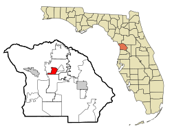 Location in Citrus County and the state of Florida | |
| Coordinates: 28°54′41″N 82°29′33″W / 28.91139°N 82.49250°W | |
| Country | |
| State | |
| County | Citrus |
| Area | |
| • Total | 3.94 sq mi (10.21 km2) |
| • Land | 3.94 sq mi (10.21 km2) |
| • Water | 0.00 sq mi (0.00 km2) |
| Elevation | 56 ft (17 m) |
| Population (2020) | |
| • Total | 1,255 |
| • Density | 318.29/sq mi (122.89/km2) |
| Time zone | UTC-5 (Eastern (EST)) |
| • Summer (DST) | UTC-4 (EDT) |
| FIPS code | 12-06667[2] |
| GNIS feature ID | 1853236[3] |
Black Diamond is a census-designated place (CDP) in Citrus County, Florida, United States. The population was 1,101 at the 2010 census,[4] up from 694 in 2000.
YouTube Encyclopedic
-
1/3Views:1 3663 967627
-
Black Diamond Ranch Quarry "Best 5 consecutive holes of golf in the world"
-
Black Diamond by Marine Technology MTI
-
Black Diamond Wellington Florida Bank Foreclosure
Transcription
Geography
Black Diamond is located north of the geographic center of Citrus County at 28°54′40″N 82°29′33″W / 28.91111°N 82.49250°W (28.911262, -82.492608).[5] It is bordered to the north by Pine Ridge, to the east by Beverly Hills and Pine Ridge, and to the south by Lecanto. County Road 491 (North Lecanto Highway) forms the eastern edge of the CDP, leading northeast 5 miles (8 km) to U.S. Route 41 and south 4 miles (6 km) to State Road 44 in Lecanto.
According to the United States Census Bureau, the CDP has a total area of 3.9 square miles (10.2 km2), all land.[4]
Demographics
| Census | Pop. | Note | %± |
|---|---|---|---|
| 2020 | 1,255 | — | |
| U.S. Decennial Census[6] | |||
Census
As of the census[2] of 2000, there were 694 people, 248 households, and 212 families residing in the CDP. The population density was 183.6 inhabitants per square mile (70.9/km2). There were 374 housing units at an average density of 98.9 per square mile (38.2/km2). The racial makeup of the CDP was 94.09% White, 0.72% African American, 4.61% Asian, and 0.58% from two or more races. Hispanic or Latino of any race were 1.01% of the population.
Households
There were 248 households, out of which 15.3% had children under the age of 18 living with them, 84.7% were married couples living together, 0.8% had a female householder with no husband present, and 14.5% were non-families. 11.7% of all households were made up of individuals, and 4.0% had someone living alone who was 65 years of age or older. The average household size was 2.23 and the average family size was 2.39.
Age averages
In the CDP the population was spread out, with 9.7% under the age of 18, 1.4% from 18 to 24, 10.7% from 25 to 44, 39.0% from 45 to 64, and 39.2% who were 65 years of age or older. The median age was 62 years. For every 100 females, there were 81.2 males. For every 100 females age 18 and over, there were 81.7 males.
Incomes
The median income for a household in the CDP was $107,771, and the median income for a family was $105,987. Males had a median income of $0 versus $32,500 for females. The per capita income for the CDP was $53,621. About 5.7% of families and 3.7% of the population were below the poverty line, including none of those under the age of eighteen or sixty-five or over.
Education
The CDP is served by Citrus County Schools.[7] Residents are zoned to Central Ridge Elementary School.[8] Residents are divided between Citrus Springs Middle and Crystal River Middle.[9] Portions of the CDP are zoned to Crystal River High School and Lecanto High School.[10]
References
- ^ "2020 U.S. Gazetteer Files". United States Census Bureau. Retrieved October 31, 2021.
- ^ a b "U.S. Census website". United States Census Bureau. Retrieved January 31, 2008.
- ^ "US Board on Geographic Names". United States Geological Survey. October 25, 2007. Retrieved January 31, 2008.
- ^ a b "Geographic Identifiers: 2010 Demographic Profile Data (G001): Black Diamond CDP, Florida". U.S. Census Bureau, American Factfinder. Archived from the original on February 12, 2020. Retrieved June 25, 2014.
- ^ "US Gazetteer files: 2010, 2000, and 1990". United States Census Bureau. February 12, 2011. Retrieved April 23, 2011.
- ^ "Census of Population and Housing". Census.gov. Retrieved June 4, 2016.
- ^ "2010 CENSUS - CENSUS BLOCK MAP (INDEX): Black Diamond CDP, FL." U.S. Census Bureau. Retrieved on February 3, 2017. See map pages. Compare this map to the attendance boundary maps of the school district.
- ^ "Citrus County Elementary School Attendance Boundaries Archived 2015-02-26 at the Wayback Machine." Citrus County Schools. Retrieved on February 2, 2017.
- ^ "Citrus County Middle School Attendance Boundaries Archived 2015-02-26 at the Wayback Machine." Citrus County Schools. Retrieved on February 2, 2017.
- ^ "Citrus County High School Attendance Boundaries Archived 2015-02-26 at the Wayback Machine." Citrus County Schools. Retrieved on February 2, 2017.
External links
Municipalities and communities of Citrus County, Florida, United States | ||
|---|---|---|
| Cities |  | |
| CDPs | ||
| Unincorporated communities | ||
| Ghost towns | ||