
| Bernal Heights Summit | |
|---|---|
 Bernal Heights hill viewed from the north | |
| Highest point | |
| Elevation | 475+ feet (145+ m) NGVD 29[1] |
| Coordinates | 37°44′35″N 122°24′57″W / 37.7429861°N 122.4158042°W[2] |
| Geography | |
 Bernal Heights | |
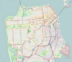
| Location | San Francisco California, U.S. |
| Topo map | USGS San Francisco South |
Bernal Heights Summit (/ˈbɜːrnəl/ BUR-nəl) or Bernal Heights Hill is a hill in the San Francisco, California neighborhood of Bernal Heights. Upper elevations are part of Bernal Heights Park, which the San Francisco Recreation & Parks Department manages. At its highest elevation (466 ft.) is a privately owned equipment building and 50-foot tall telecommunications tower.[3] The tower does not have an official name, but some residents call it "Sutrito", as it resembles a shorter version of Sutro Tower.[4] The park and summit are largely surrounded by Bernal Heights Boulevard.

YouTube Encyclopedic
-
1/3Views:3243841 411
-
2018 North America Consumer Product Safety Summit - Part 1
-
UC Davis Professor Soars with Blue Angels
-
#SFSW16 Panel - Loyalty 2.0: Rethinking Engagement
Transcription
Ecology
Unusual flora and fauna can be found on Bernal Hill. Wildflowers include the footsteps of spring, blue-eyed grass, checkerbloom, shooting star[5] and yellow mariposa lily.[6] Bernal Hill was one of the earliest hills in San Francisco to be re-colonized by wild coyotes.[7]
Geology
Bernal Hill, along with the other hills in the San Francisco area, is a folded hill; it was created by the "wrinkling up" effect of the Pacific plate subducting under the North American plate, when the North American and Pacific plates were converging around 150 million years ago. Near the summit are folded layers of very hard rock called radiolarian chert.[8] It is a sedimentary silicate rock which gets its silica content from the shells of microscopic creatures called radiolaria. The red color comes from iron oxide. Between the chert layers are thin layers of shale in many different colors from the same red as the surrounding rock to white, green, and purple. Other types of rocks and minerals on the hill include serpentinite, jasper, and clay.
See also
References
- ^ San Francisco South quadrangle, California (Map). 1:24000. 7.5 Minute Topographic. USGS.
- ^ "Bernal Heights". Geographic Names Information System. United States Geological Survey, United States Department of the Interior. Retrieved 2009-06-12.
- ^ "Conditional Use Authorization" (PDF). San Francisco Planning Department. Archived from the original (PDF) on 2011-08-27. Retrieved 2011-08-21.
- ^ "Nomenclature Update: Introducing 'Sutrito Tower'". Bernalwood. 22 September 2011.
- ^ "Bernal Heights Park | San Francisco Recreation and Park".
- ^ Hogan, C. Michael (2009). N. Stromberg (ed.). "Calochortus luteus". GlobalTwitcher.com. Archived from the original on 2011-10-04. Retrieved 2009-12-13.
- ^ "Sightings Continue as Coyote Takes Up Residence Around Bernal Hill". Bernalwood. 27 January 2016.
- ^ "Chert FAQ - Golden Gate National Recreation Area (U.S. National Park Service)".
This San Francisco-related article is a stub. You can help Wikipedia by expanding it. |