
Belén de Andaquies | |
|---|---|
Municipality and town | |
 | |
 Flag  Seal | |
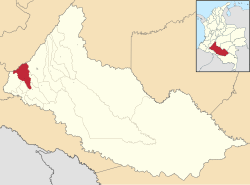 Location of the municipality and town of Belén de Andaquies in the Caquetá Department of Colombia. | |
| Country | |
| Department | Caquetá Department |
| Area | |
| • Total | 1,095 km2 (423 sq mi) |
| Population (Census 2018[2]) | |
| • Total | 9,075 |
| • Density | 8.3/km2 (21/sq mi) |
| Time zone | UTC-5 (Colombia Standard Time) |
Belén de los Andaquíes is a town and municipality in Caquetá Department, Colombia.
Climate
Belén de los Andaquíes has a very wet tropical rainforest climate (Af).
| Climate data for Belén de Andaquies (Mono La), elevation 300 m (980 ft), (1981–2010) | |||||||||||||
|---|---|---|---|---|---|---|---|---|---|---|---|---|---|
| Month | Jan | Feb | Mar | Apr | May | Jun | Jul | Aug | Sep | Oct | Nov | Dec | Year |
| Mean daily maximum °C (°F) | 31.9 (89.4) |
31.3 (88.3) |
30.6 (87.1) |
29.9 (85.8) |
29.6 (85.3) |
28.9 (84.0) |
28.8 (83.8) |
29.8 (85.6) |
30.9 (87.6) |
31.0 (87.8) |
31.0 (87.8) |
31.3 (88.3) |
30.4 (86.7) |
| Daily mean °C (°F) | 26.2 (79.2) |
25.8 (78.4) |
25.5 (77.9) |
25.1 (77.2) |
25.0 (77.0) |
24.5 (76.1) |
24.2 (75.6) |
24.8 (76.6) |
25.4 (77.7) |
25.6 (78.1) |
25.7 (78.3) |
25.9 (78.6) |
25.3 (77.5) |
| Mean daily minimum °C (°F) | 20.9 (69.6) |
20.7 (69.3) |
20.8 (69.4) |
20.7 (69.3) |
20.7 (69.3) |
20.5 (68.9) |
20.1 (68.2) |
20.4 (68.7) |
20.6 (69.1) |
20.8 (69.4) |
21.0 (69.8) |
20.8 (69.4) |
20.7 (69.3) |
| Average precipitation mm (inches) | 144.8 (5.70) |
219.6 (8.65) |
311.4 (12.26) |
409.2 (16.11) |
441.0 (17.36) |
399.1 (15.71) |
338.8 (13.34) |
269.4 (10.61) |
252.8 (9.95) |
310.9 (12.24) |
271.4 (10.69) |
160.9 (6.33) |
3,529.3 (138.95) |
| Average precipitation days | 12 | 15 | 20 | 23 | 24 | 23 | 22 | 19 | 19 | 19 | 19 | 14 | 228 |
| Average relative humidity (%) | 82 | 84 | 85 | 87 | 87 | 87 | 87 | 85 | 84 | 84 | 84 | 83 | 85 |
| Mean monthly sunshine hours | 167.4 | 118.6 | 105.4 | 99.0 | 105.4 | 96.0 | 102.3 | 124.0 | 144.0 | 148.8 | 141.0 | 158.1 | 1,510 |
| Mean daily sunshine hours | 5.4 | 4.2 | 3.4 | 3.3 | 3.4 | 3.2 | 3.3 | 4.0 | 4.8 | 4.8 | 4.7 | 5.1 | 4.1 |
| Source: Instituto de Hidrologia Meteorologia y Estudios Ambientales[3] | |||||||||||||
References
- ^ "Municipalities of Colombia". statoids. Retrieved 30 April 2020.
- ^ "Censo Nacional de Población y Vivienda 2018" (in Spanish). DANE. Retrieved 30 April 2020.
- ^ "Promedios Climatológicos 1981–2010" (in Spanish). Instituto de Hidrologia Meteorologia y Estudios Ambientales. Archived from the original on 15 August 2016. Retrieved 17 June 2024.
Municipalities in the Caquetá Department | ||
|---|---|---|
1°24′58″N 75°52′21″W / 1.41611°N 75.8725°W
This Caquetá Department location article is a stub. You can help Wikipedia by expanding it. |