


Bekopaka is a rural municipality in western Madagascar. It belongs to the district of Antsalova, which is a part of Melaky Region. The population of the commune was estimated to be approximately 9,000 in 2001 commune census.[2]
Bekopaka is served by a local airport, and primary and junior level secondary education are available in town. The most important crop is rice, while other important products are bananas, maize and cassava.[2]

YouTube Encyclopedic
-
1/3Views:9 5481 9882 966
-
MADAGASCAR - De Bekopaka à Morondava (Allée des Baobabs)
-
Tsingys 4x4.MP4
-
Circuit Ouest Madagascar Tana-Miandrivazo-descente Tsiribihina-Belo sur Tsiribihina-Bekopaka
Transcription
Rivers
Bekopaka is situated on the Manambolo River.
Nature
The Tsingy de Bemaraha Strict Nature Reserve is situated north from Bekopaka (17 km).
Roads
The unpaved National road 8 from Morondava (195 km)/
References
- ^ Estimated based on DEM data from Shuttle Radar Topography Mission
- ^ a b c "ILO census data". Cornell University. 2002. Retrieved 2008-03-04.
Capital: Maintirano | ||
| Antsalova (6) - 406 | 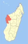 | |
| Ambatomainty (5) - 404 | ||
| Besalampy (9) - 410 |
| |
| Maintirano (16) - 413 | ||
| Morafenobe (4) - 416 | ||
5 districts; 40 communes | ||
19°1′S 44°51′E / 19.017°S 44.850°E
This Melaky location article is a stub. You can help Wikipedia by expanding it. |