
Tambohorano | |
|---|---|
 Mandrozo lake | |
 Tambohorano Location in Madagascar | |
| Coordinates: 17°30′24″S 43°57′8″E / 17.50667°S 43.95222°E | |
| Country | |
| Region | Melaky |
| District | Maintirano |
| Elevation | 14 m (46 ft) |
| Population (2001)[2] | |
| • Total | 8,000 |
| Time zone | UTC3 (EAT) |
| Postal code | 413 |
Tambohorano is a rural municipality on the west coast of Madagascar approximately 290 kilometres north-west of the capital Antananarivo. It belongs to the district of Maintirano, which is a part of Melaky Region. The population of the commune was estimated to be approximately 8,000 in 2001.[2]
Tambohorano is on the West coast of Madagascar, 60 km North of Maintirano. It has a local airport and a maritime harbour. Primary and junior level secondary education are available in town. The majority 65% of the population of the commune are farmers, while an additional 20% receives their livelihood from raising livestock. The most important crop is rice, while other important products are wheat, coconuts, cassava and barley. Services provide employment for 5% of the population. Additionally fishing employs 10% of the population.[2]
Bodies of water
- the Mandrozo Lake, the fifth largest lake in Madagascar with a surface of 15,145 ha.[3]
References
- ^ Estimated based on DEM data from Shuttle Radar Topography Mission
- ^ a b c "ILO census data". Cornell University. 2002. Retrieved 2008-03-04.
- ^ Mandrozo
Capital: Maintirano | ||
| Antsalova (6) - 406 | 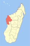 | |
| Ambatomainty (5) - 404 | ||
| Besalampy (9) - 410 |
| |
| Maintirano (16) - 413 | ||
| Morafenobe (4) - 416 | ||
5 districts; 40 communes | ||
17°30′24″S 43°57′8″E / 17.50667°S 43.95222°E
This Melaky location article is a stub. You can help Wikipedia by expanding it. |