
Behabad County
Persian: شهرستان بهاباد | |
|---|---|
 Location of Behabad County in Yazd province (right, green) | |
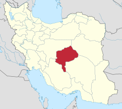 Location of Yazd province in Iran | |
| Coordinates: 32°00′N 56°05′E / 32.000°N 56.083°E[1] | |
| Country | |
| Province | Yazd |
| Capital | Behabad |
| Districts | Central, Asfyj |
| Population (2016)[2] | |
| • Total | 17,221 |
| Time zone | UTC+3:30 (IRST) |
Behabad County (Persian: شهرستان بهاباد) is in Yazd province, Iran. Its capital is the city of Behabad.[3]
History
After the National Census of 2006, Behabad District was separated from Bafq County in the establishment of Behabad County, which was divided into two districts and three rural districts, with the city of Behabad as its capital and only city.[3]
Demographics
Population
The census in 2011 counted 15,331 people in 4,523 households.[4] At the 2016 census, the county's population was 17,221 in 5,380 households.[2]
Administrative divisions
Behabad County's population history and administrative structure over two consecutive censuses are shown in the following table.
| Administrative Divisions | 2011[4] | 2016[2] |
|---|---|---|
| Central District | 11,074 | 13,392 |
| Jolgeh RD | 3,422 | 4,160 |
| Behabad (city) | 7,652 | 9,232 |
| Asfyj District | 4,257 | 3,829 |
| Asfyj RD | 2,127 | 2,064 |
| Banestan RD | 2,130 | 1,765 |
| Total | 15,331 | 17,221 |
| RD = Rural District | ||
See also
![]() Media related to Behabad County at Wikimedia Commons
Media related to Behabad County at Wikimedia Commons
References
- ^ OpenStreetMap contributors (6 April 2023). "Behabad County" (Map). OpenStreetMap. Retrieved 6 April 2023.
- ^ a b c "Census of the Islamic Republic of Iran, 1395 (2016)". AMAR (in Persian). The Statistical Center of Iran. p. 21. Archived from the original (Excel) on 18 November 2020. Retrieved 19 December 2022.
- ^ a b Ahmadinejad, Mahmoud. "Approval of the letter regarding reforms and divisional changes in Yazd province". Lamtakam (in Persian). Ministry of Interior, Council of Ministers. Archived from the original on 20 December 2023. Retrieved 20 December 2023.
- ^ a b "Census of the Islamic Republic of Iran, 1390 (2011)". Syracuse University (in Persian). The Statistical Center of Iran. p. 21. Archived from the original (Excel) on 20 January 2023. Retrieved 19 December 2022.
Yazd Province, Iran | |||||||||||||||||||||
|---|---|---|---|---|---|---|---|---|---|---|---|---|---|---|---|---|---|---|---|---|---|
| Capital |  | ||||||||||||||||||||
| Counties and cities |
| ||||||||||||||||||||
| Landmarks |
| ||||||||||||||||||||
| populated places | |||||||||||||||||||||
| Capital | |||||||||||||||||||
|---|---|---|---|---|---|---|---|---|---|---|---|---|---|---|---|---|---|---|---|
| Districts |
| ||||||||||||||||||
This Yazd province location article is a stub. You can help Wikipedia by expanding it. |