
Beaver, Arkansas | |
|---|---|
 The "Little Golden Gate Bridge" | |
 Location of Beaver in Carroll County, Arkansas. | |
| Coordinates: 36°28′31″N 93°46′22″W / 36.47528°N 93.77278°W | |
| Country | United States |
| State | Arkansas |
| County | Carroll |
| Area | |
| • Total | 0.50 sq mi (1.29 km2) |
| • Land | 0.32 sq mi (0.82 km2) |
| • Water | 0.18 sq mi (0.48 km2) |
| Elevation | 1,004 ft (306 m) |
| Population (2020) | |
| • Total | 67 |
| • Density | 212.70/sq mi (82.14/km2) |
| Time zone | UTC-6 (Central (CST)) |
| • Summer (DST) | UTC-5 (CDT) |
| ZIP code | 72613 |
| Area code | 479 |
| FIPS code | 05-04540 |
| GNIS feature ID | 2405224[2] |
| Website | www |
Beaver is a town in Carroll County, Arkansas, United States. As of the 2020 census it had a population of 67.[3] The community is located on the White River at the western limits of Table Rock Lake deep in the Ozark Mountains. Located north of Eureka Springs, the small town has been featured in movies for its picturesque scenery. The town is known for the Beaver Bridge, a two-panel suspension bridge over the White River listed on the National Register of Historic Places.
YouTube Encyclopedic
-
1/5Views:1 114 84230 69221 956152 65983 593
-
American Graffiti (10/10) Movie CLIP - Drag Race at Paradise Road (1973) HD
-
Raining Jacks - Phil Robertson the Duck Commander
-
Ben Stiller at Walmart in Rogers, AR
-
"The Bigfoot Stories You've Never Heard" #WeirdDarkness
-
Beaver Lake Dam with Floodgates Open
Transcription
Laurie, what in the hell are you doing in there? - Is she gonna ride with you? - Mind your own business,John. Yeah, she's going with me. You take care of yourself, man. You guys ready? You son of a bitch! Come on, she's gonna blow. I don't know. Please, don't come near me. I'm gonna be sick. Oh, Steven. Oh, Steven! Please don't leave me. - Don't leave me, please. - I won't. I couldn't bear it. Please. I'm not gonna leave you. - I'm not gonna leave you. - Promise me. - I promise. - Do you? I'm not gonna leave you. That was beautiful, John. Just beautiful. - I was losin', man. - What? He was pulling away from me just before he crashed. You're crazy! You creamed him from right off the line. Shit, Toad! The man had me. He was beatin' me. John, I don't know what you're talking about. It was the most beautiful thing I've ever seen.
Geography

Beaver is located in northwestern Carroll County.
According to the United States Census Bureau, the town has a total area of 0.54 square miles (1.4 km2), of which 0.35 square miles (0.9 km2) is land and 0.19 square miles (0.5 km2), or 33.16%, is water.[4]
Highway 187 is the only member of the Arkansas Highway System that serves Beaver. The route leads west 5 miles (8 km) to US Highway 62, which provides access to Eureka Springs to the southeast and Rogers to the west. The Arkansas Highway 23, the Pig Trail Scenic Byway, runs near the town as well, a popular route with tourists and motorcyclists.[5]
Demographics
| Census | Pop. | Note | %± |
|---|---|---|---|
| 1960 | 24 | — | |
| 1990 | 57 | — | |
| 2000 | 95 | 66.7% | |
| 2010 | 100 | 5.3% | |
| 2020 | 67 | −33.0% | |
| U.S. Decennial Census[6] | |||
As of the census[7] of 2000, there were 95 people, 37 households, and 27 families residing in the town. The population density was 271.0 inhabitants per square mile (104.6/km2). There were 43 housing units at an average density of 122.7 per square mile (47.4/km2). The racial makeup of the town was 96.84% White, 2.11% from other races, and 1.05% from two or more races. 2.11% of the population were Hispanic or Latino of any race.
There were 37 households, of which 29.7% had children under the age of 18 living with them, 62.2% were married couples living together, 5.4% had a female householder with no husband present, and 27.0% were non-families. 21.6% of all households were made up of individuals, and 8.1% had someone living alone who was 65 years of age or older. The average household size was 2.57 and the average family size was 2.81.
In the town, the population was spread out, with 27.4% under the age of 18, 5.3% from 18 to 24, 23.2% from 25 to 44, 29.5% from 45 to 64, and 14.7% who were 65 years of age or older. The median age was 42 years. For every 100 females, there were 97.9 males. For every 100 females age 18 and over, there were 97.1 males.
The median income for a household in the town was $23,438, and the median income for a family was $25,417. Males had a median income of $25,417 versus $26,250 for females. The per capita income for the town was $11,665. There were 13.0% of families and 16.2% of the population living below the poverty line, including no one under the age of eighteen and none of those over 64.
In popular culture

The Beaver Bridge was depicted in the 2005 film Elizabethtown, and a nearby train trestle was featured in The Blue and the Gray.
Climate
The climate is characterized by relatively high temperatures and evenly distributed precipitation throughout the year. The Köppen Climate Classification subtype for this climate is "Cfa" (Humid Subtropical Climate).[8]
| Climate data for Beaver, Arkansas | |||||||||||||
|---|---|---|---|---|---|---|---|---|---|---|---|---|---|
| Month | Jan | Feb | Mar | Apr | May | Jun | Jul | Aug | Sep | Oct | Nov | Dec | Year |
| Mean daily maximum °C (°F) | 8 (46) |
11 (51) |
16 (61) |
22 (72) |
26 (78) |
29 (85) |
33 (91) |
32 (90) |
27 (81) |
22 (72) |
15 (59) |
9 (49) |
21 (70) |
| Mean daily minimum °C (°F) | −4 (25) |
−2 (29) |
3 (38) |
9 (48) |
13 (55) |
17 (63) |
19 (67) |
18 (65) |
15 (59) |
9 (49) |
4 (39) |
−2 (29) |
8 (47) |
| Average precipitation cm (inches) | 5.1 (2) |
7.1 (2.8) |
10 (4.1) |
11 (4.2) |
12 (4.9) |
11 (4.4) |
8.4 (3.3) |
9.7 (3.8) |
10 (4.1) |
9.4 (3.7) |
9.7 (3.8) |
8.6 (3.4) |
113 (44.4) |
| Source: Weatherbase [9] | |||||||||||||
See also
References
- ^ "2020 U.S. Gazetteer Files". United States Census Bureau. Retrieved October 29, 2021.
- ^ a b U.S. Geological Survey Geographic Names Information System: Beaver, Arkansas
- ^ "Explore Census Data". data.census.gov. Retrieved December 21, 2021.
- ^ "Geographic Identifiers: 2010 Demographic Profile Data (G001): Beaver town, Arkansas". U.S. Census Bureau, American Factfinder. Archived from the original on February 12, 2020. Retrieved June 13, 2014.
- ^ General Highway Map, Carroll County, Arkansas (PDF) (Map). 1:62500. Cartography by Planning and Research Division. Arkansas State Highway and Transportation Department. April 9, 2010. Archived from the original (PDF) on January 15, 2018. Retrieved June 29, 2013.
- ^ "Census of Population and Housing". Census.gov. Retrieved June 4, 2015.
- ^ "U.S. Census website". United States Census Bureau. Retrieved January 31, 2008.
- ^ Climate Summary for Beaver, Arkansas
- ^ "Weatherbase.com". Weatherbase. 2013. Retrieved on August 16, 2013.
External links
Municipalities and communities of Carroll County, Arkansas, United States | ||
|---|---|---|
| Cities | 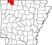 | |
| Towns | ||
| Townships | ||
| Unincorporated communities | ||
| Ghost towns | ||
| Footnotes | ‡This populated place also has portions in an adjacent county or counties | |