
Bascom, Ohio | |
|---|---|
 Running concurrently with Ohio State Route 18, Tiffin Street bisects Bascom. | |
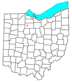 Location of Bascom | |
| Coordinates: 41°07′35″N 83°17′08″W / 41.12639°N 83.28556°W | |
| Country | United States |
| State | Ohio |
| County | Seneca |
| Area | |
| • Total | 1.51 sq mi (3.92 km2) |
| • Land | 1.51 sq mi (3.92 km2) |
| • Water | 0.00 sq mi (0.00 km2) |
| Elevation | 768 ft (234 m) |
| Population (2020) | |
| • Total | 397 |
| • Density | 262.22/sq mi (101.21/km2) |
| Time zone | UTC-5 (Eastern (EST)) |
| • Summer (DST) | UTC-4 (EDT) |
| ZIP code | 44809 |
| Area code | 419 |
| GNIS feature ID | 2628862[2] |
Bascom (/ˈbæskəm/ BAS-kəm[3]) is a census-designated place in western Hopewell Township, Seneca County, Ohio.[2] It has a post office with the ZIP code 44809 and hosts Hopewell-Loudon High School.[4] The community is located at the intersection of State Routes 18 and 635 east of Fostoria. The population was 397 at the 2020 census.
History
Bascom was laid out in 1837.[5] The community derives its name from Scott & Bascom, publishers of The Ohio State Journal.[6][7] A post office called Bascom has been in operation since 1850.[8]
Demographics
| Census | Pop. | Note | %± |
|---|---|---|---|
| 2020 | 397 | — | |
| U.S. Decennial Census[9] | |||
References
- ^ "ArcGIS REST Services Directory". United States Census Bureau. Retrieved September 20, 2022.
- ^ a b c U.S. Geological Survey Geographic Names Information System: Bascom, Ohio
- ^ "E.W. Scripps School of Journalism Ohio Pronunciation Guide | Ohio University". www.ohio.edu. Ohio University. 2016. Retrieved October 22, 2022.
- ^ USPS – Cities by ZIP Code Archived June 15, 2011, at the Wayback Machine
- ^ Lang, William (1880). History of Seneca County, from the Close of the Revolutionary War to July, 1880. Transcript Printing Company. pp. 540.
- ^ AC10235922, Anonymus (1853). Register of Officers and Agents, Civil, Military, and Naval, in the Service of the United States. Armstrong.
{{cite book}}: CS1 maint: numeric names: authors list (link) - ^ Baughman, Abraham J. (1911). History of Seneca County, Ohio: A Narrative Account of Its Historical Progress, Its People, and Its Principal Interests. Lewis Publishing Company. p. 437.
- ^ "Seneca County". Jim Forte Postal History. Archived from the original on January 5, 2016. Retrieved December 27, 2015.
- ^ "Census of Population and Housing". Census.gov. Retrieved June 4, 2016.
External links
Municipalities and communities of Seneca County, Ohio, United States | ||
|---|---|---|
| Cities |  | |
| Villages | ||
| Townships | ||
| CDPs | ||
| Unincorporated communities | ||
| Ghost towns | ||
| Footnotes | ‡This populated place also has portions in an adjacent county or counties | |
| International | |
|---|---|
| National | |
This Seneca County, Ohio state location article is a stub. You can help Wikipedia by expanding it. |