
Balışeyh District | |
|---|---|
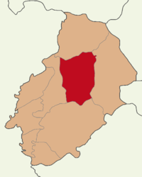 Map showing Balışeyh District in Kırıkkale Province | |
 Balışeyh District Location in Turkey  Balışeyh District Balışeyh District (Turkey Central Anatolia) | |
| Coordinates: 39°55′N 33°43′E / 39.917°N 33.717°E | |
| Country | Turkey |
| Province | Kırıkkale |
| Seat | Balışeyh |
| Government | |
| • Kaymakam | Sançar Batuhan Kurdu |
| Area | 623 km2 (241 sq mi) |
| Population (2022) | 5,857 |
| • Density | 9.4/km2 (24/sq mi) |
| Time zone | TRT (UTC+3) |
| Website | www |
Balışeyh District is a district of the Kırıkkale Province of Turkey. Its seat is the town of Balışeyh.[1] Its area is 623 km2,[2] and its population is 5,857 (2022).[3]
Composition
There is one municipality in Balışeyh District:[1]
There are 28 villages in Balışeyh District:[4]
- Akçakavak
- Aşağıkarakısık
- Aydınşeyh
- Battalobası
- Beşbıçak
- Beyobası
- Bıyıkaydın
- Dikmen
- Eldelek
- Hıdırşeyh
- Hüseyinobası
- Işıklar
- İzzettinköy
- Karalı
- Kargın
- Kenanobası
- Kılevli
- Kırlangıç
- Koçubaba
- Kösedurak
- Kulaksız
- Mehmetbeyobası
- Selamlı
- Ulaklı
- Uzunlar
- Yenice
- Yenili
- Yukarıkarakısık
References
- ^ a b İlçe Belediyesi, Turkey Civil Administration Departments Inventory. Retrieved 1 March 2023.
- ^ "İl ve İlçe Yüz ölçümleri". General Directorate of Mapping. Retrieved 1 March 2023.
- ^ "Address-based population registration system (ADNKS) results dated 31 December 2022, Favorite Reports" (XLS). TÜİK. Retrieved 13 March 2023.
- ^ Köy, Turkey Civil Administration Departments Inventory. Retrieved 1 March 2023.
Balışeyh District in Kırıkkale Province of Turkey | |||||||||||||||||||||||||||
|---|---|---|---|---|---|---|---|---|---|---|---|---|---|---|---|---|---|---|---|---|---|---|---|---|---|---|---|
| Districts |   | ||||||||||||||||||||||||||
|
Metropolitan municipalities are bolded. | |||||||||||||||||||||||||||
This geographical article about a location in Kırıkkale Province, Turkey is a stub. You can help Wikipedia by expanding it. |