
Ambriz | |
|---|---|
  | |
 Flag | |
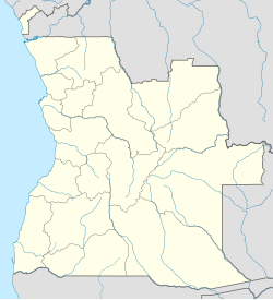 Ambriz Location in Angola | |
| Coordinates: 7°51′S 13°07′E / 7.850°S 13.117°E | |
| Country | |
| Admin. division | Bengo Province |
| Area | |
| • Total | 1,623.0 sq mi (4,203.5 km2) |
| Population (2014 Census)[1] | |
| • Total | 22,712 |
| Time zone | UTC+1 (WAT) |
| Climate | BSh |
| Ambriz Lighthouse | |
| Constructed | ~1930s |
| Foundation | masonry base |
| Construction | masonry tower |
| Height | 14 metres (46 ft)[2] |
| Shape | quadrangular tower with balcony and lantern |
| Markings | white tower |
| Operator | Instituto Marítimo e Portuário de Angola |
| Focal height | 33 metres (108 ft)[2] |
| Range | 16 nautical miles (30 km; 18 mi)[2] |
| Characteristic | Fl (4) W 12s.[2] |
| Angola no. | PT-5180[3] |
Ambriz is a village and municipality in Bengo Province, Angola. It is located 127 km from the town of Caxito. It borders the municipality of N'zeto, Zaire Province, to the north and the municipality of Dande to the south.
Demographics
The population of Ambriz totals 20,000, of whom the majority are Bakongo; there are also Portuguese descendants, and people of mixed Portuguese-African ancestry.[4] The population includes people of the Ovimbundu and Kimbundu ethnic groups.
Economy
Fishing is the traditional activity and low-scale agricultural activity. In the past, Ambriz had an oil and gas platform assembly yard (PETROMAR), which was destroyed during warfare in 1992. The base is being reconstructed. In 2007, an Angolan-Portuguese company announced plans to build a biodiesel plant to be fueled by palm oil.
Transportation
The village has a small port and an airport with an unpaved runway.
See also
References
- ^ "Resultados Definitivos Recenseamento Geral da População e Habitação – 2014 Província do Bengo" (PDF). Instituto Nacional de Estatística, República de Angola. Archived from the original (PDF) on 7 August 2020. Retrieved 3 May 2020.
- ^ a b c d List of Lights, Pub. 113: The West Coasts of Europe and Africa, the Mediterranean Sea, Black Sea and Azovskoye More (Sea of Azov) (PDF). List of Lights. United States National Geospatial-Intelligence Agency. 2015.
- ^ Rowlett, Russ. "Lighthouses of Angola". The Lighthouse Directory. University of North Carolina at Chapel Hill. Retrieved 9 May 2017.
- ^ "Perfil - município do Ambriz". Bengo.gov.ao (in Portuguese). Retrieved 21 Mar 2016.
External links
- "Provinces of Angola - Bengo". 2 August 2008. Archived from the original on 2 August 2008. Retrieved 26 August 2017.
7°51′S 13°07′E / 7.850°S 13.117°E
Capital: Caxito | |
| Ambriz |
|
| Bula Atumba |
|
| Dande | |
| Dembos | |
| Nambuangongo | |
| Pango-Aluquém |
|
| International | |
|---|---|
| National | |
| Ambriz Lighthouse | |
This Angola location article is a stub. You can help Wikipedia by expanding it. |