

Size of this PNG preview of this SVG file: 547 × 600 pixels. Other resolutions: 219 × 240 pixels | 438 × 480 pixels | 700 × 768 pixels | 934 × 1,024 pixels | 1,868 × 2,048 pixels | 1,266 × 1,388 pixels.
Original file (SVG file, nominally 1,266 × 1,388 pixels, file size: 478 KB)
| This is a file from the Wikimedia Commons. Information from its description page there is shown below. Commons is a freely licensed media file repository. You can help. |
Summary
| Description |
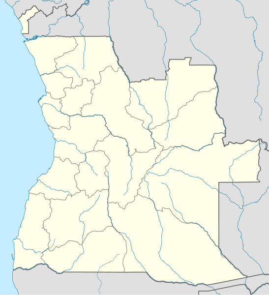
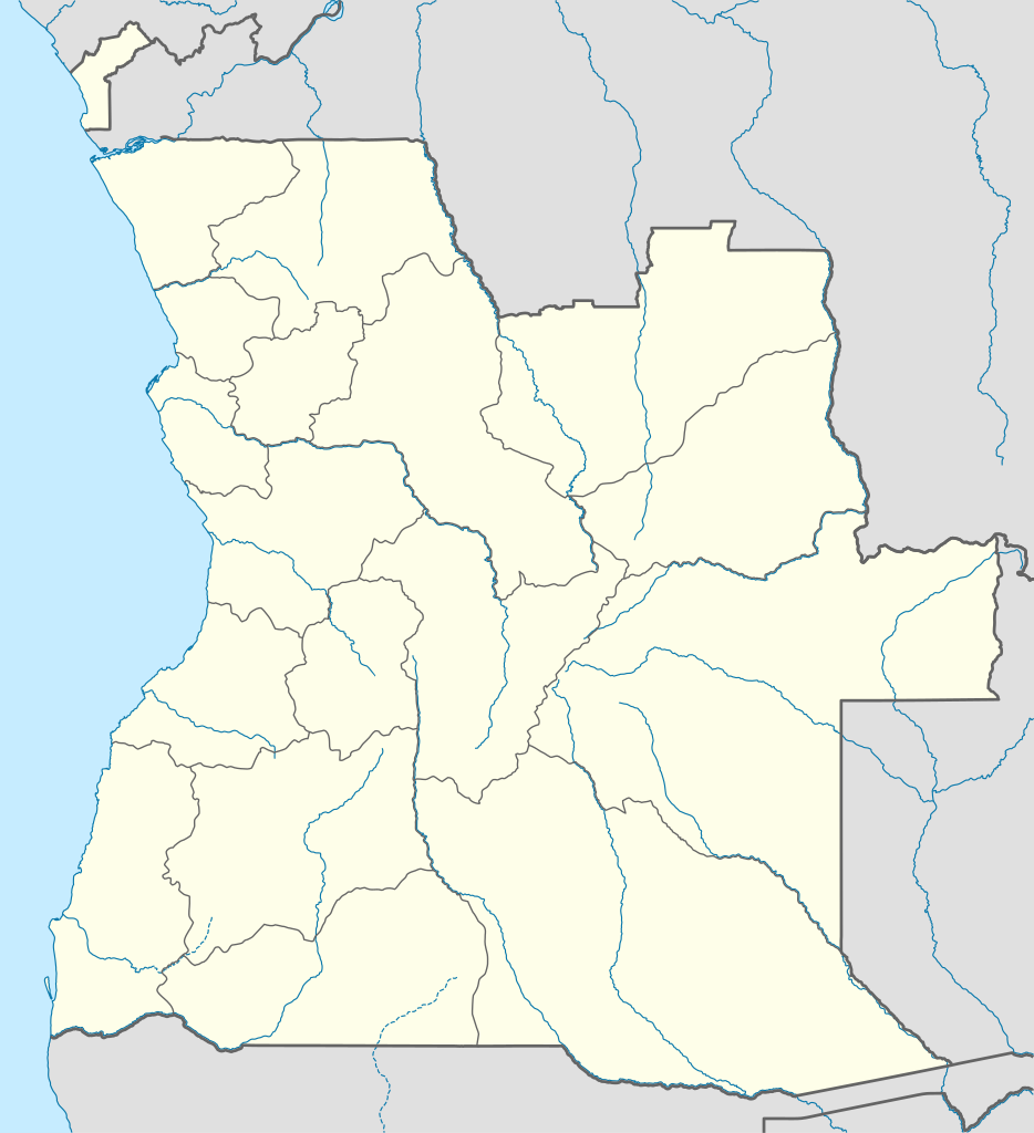
Quadratische Plattkarte, N-S-Streckung 102 %. Geographische Begrenzung der Karte:
Location map of Angola
Equirectangular projection, N/S stretching 102 %. Geographic limits of the map:
|
||
| Date | |||
| Source |
Own work, using
|
||
| Author | NordNordWest | ||
| Permission (Reusing this file) |
I, the copyright holder of this work, hereby publish it under the following license: This file is licensed under the Creative Commons Attribution-Share Alike 3.0 Unported license.
|
||
| SVG development | This map was created with an unknown SVG tool.
|

File history
Click on a date/time to view the file as it appeared at that time.
| Date/Time | Thumbnail | Dimensions | User | Comment | |
|---|---|---|---|---|---|
| current | 18:15, 21 August 2019 | | 1,266 × 1,388 (478 KB) | Hallel | Inclusão de novo mapa com as alterações territoriais das províncias do Bengo e Luanda |
| 17:35, 20 October 2009 |  | 1,266 × 1,388 (478 KB) | NordNordWest | =={{int:filedesc}}== {{Information |Description= {{de|Positionskarte von Angola}} Quadratische Plattkarte, N-S-Streckung 102 %. Geographische Begrenzung der Karte: * N: 4.1° S * S: 18.5° S * W: 11.1° O * O: 24.5° O {{en|Location map of |
File usage
More than 100 pages use this file. The following list shows the first 100 pages that use this file only. A full list is available.
- 2010 Africa Cup of Nations
- Albano Machado Airport
- Alto Zambeze
- Ambriz
- Bailundo
- Battle of Cassinga
- Battle of Cuito Cuanavale
- Benguela
- Benguela Airport
- Bibala
- Bocoio
- Cabinda (city)
- Cabinda Airport
- Caconda
- Cacuaco
- Cafunfo
- Cahama
- Caianda
- Calueque
- Caluquembe
- Camacupa
- Camanongue
- Cassinga
- Catoca diamond mine
- Catumbela
- Catumbela Airport
- Caxito
- Caála
- Chamutete
- Chiange
- Chibabo, Angola
- Chitato
- Cuban intervention in Angola
- Cuchi
- Cuito Cuanavale
- Cuíto
- Didimbo
- Dongo, Huíla
- Dundo
- Dundo Airport
- Gabela, Angola
- Ganda, Angola
- Jamba, Cuando Cubango
- Jamba, Huíla
- Kapanda Airport
- Kunje
- Kwanda Island
- Lobito
- Luau, Cuanza Sul
- Luau, Moxico Province
- Lubango
- Lubango Airport
- Lucapa
- Luchazes
- Luena, Angola
- Malanje
- Malanje Airport
- Matala, Angola
- Mbanza Congo Airport
- Menongue
- Menongue Airport
- Moçâmedes
- N'dalatando
- N'zeto
- Nancova
- Naulila
- Negage Airport
- Ngonguembo
- Ondjiva
- Ondjiva Pereira Airport
- Operation Alpha Centauri
- Operation Argon
- Operation Askari
- Operation Bruilof
- Operation Daisy
- Operation Displace
- Operation Hooper
- Operation Klipklop
- Operation Moduler
- Operation Packer
- Operation Protea
- Operation Reindeer
- Operation Rekstok
- Operation Restore
- Operation Sceptic
- Operation Super
- Operation Wallpaper
- Porto Amboim
- Quatro de Fevereiro Airport
- Sambizanga
- Saurimo
- Soyo
- Soyo Airport
- Sumbe
- Tômbua
- Uaco Cungo
- Uíge
- Viana, Luanda
- Welwitschia Mirabilis Airport
- Xangongo
View more links to this file.
Global file usage
The following other wikis use this file:
- Usage on af.wikipedia.org
- Usage on am.wikipedia.org
- Usage on an.wikipedia.org
- Usage on ar.wikipedia.org
- Usage on ast.wikipedia.org
- Luanda
- Ríu Congu
- Bolongongo
- Londuimbale
- N'Zeto
- Lubalo
- África Central
- Lubango
- Área de caltenimientu Kavango-Zambeze
- Ríu Zambeze
- Morro do Moco
- Benguela
- Módulu:Mapa de llocalización/datos/Angola
- Módulu:Mapa de llocalización/datos/Angola/usu
- Aeropuertu Internacional Quatro de Fevereiro
- Aeropuertu de Benguela
- Aeropuertu de Cabinda
- Aeropuertu de Kuito
- Lobito
- Usage on azb.wikipedia.org
View more global usage of this file.