
Abu Ghoveyr Rural District
Persian: دهستان ابوغوير | |
|---|---|
 Abu Ghoveyr Rural District  Abu Ghoveyr Rural District | |
| Coordinates: 32°13′37″N 47°41′58″E / 32.22694°N 47.69944°E[1] | |
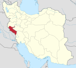
| Country | Iran |
| Province | Ilam |
| County | Dehloran |
| District | Dasht-e Abbas |
| Capital | Abu Ghoveyr |
| Population (2016)[2] | |
| • Total | 1,813 |
| Time zone | UTC+3:30 (IRST) |
Abu Ghoveyr Rural District (Persian: دهستان ابوغوير) is in Dasht-e Abbas District of Dehloran County, Ilam province, Iran.[3] Its capital is the village of Abu Ghoveyr.[4]
Demographics
Population
At the time of the 2006 National Census, the rural district's population was 1,142 in 190 households, when it was in Musian District.[5] There were 1,915 inhabitants in 288 households at the following census of 2011.[6] The 2016 census measured the population of the rural district as 1,813 in 254 households. The most populous of its 22 villages was Abu Ghoveyr, with 320 people.[2]
In March 2017, Abu Ghoveyr and Dasht-e Abbas Rural Districts were separated from from Musian District in the establishment of Dasht-e Abbas District.[3]
See also
References
- ^ OpenStreetMap contributors (5 June 2023). "Abu Ghoveyr Rural District (Dehloran County)" (Map). OpenStreetMap (in Persian). Retrieved 5 June 2023.
- ^ a b "Census of the Islamic Republic of Iran, 1395 (2016)". AMAR (in Persian). The Statistical Center of Iran. p. 16. Archived from the original (Excel) on 1 November 2020. Retrieved 19 December 2022.
- ^ a b Jahangiri, Ishaq (22 March 2017). "Approval letter regarding country divisions in Dehloran County, Ilam province". Islamic Parliament Research Center of the Islamic Republic of Iran (in Persian). Ministry of Interior, Council of Ministers. Archived from the original on 13 March 2019. Retrieved 5 June 2023.
- ^ Mousavi, Mirhossein. "Creation and formation of six rural districts in Mehran County under Ilam province". Lamtakam (in Persian). Ministry of Interior, Council of Ministers. Archived from the original on 8 February 2024. Retrieved 8 February 2024.
- ^ "Census of the Islamic Republic of Iran, 1385 (2006)". AMAR (in Persian). The Statistical Center of Iran. p. 16. Archived from the original (Excel) on 20 September 2011. Retrieved 25 September 2022.
- ^ "Census of the Islamic Republic of Iran, 1390 (2011)". Syracuse University (in Persian). The Statistical Center of Iran. p. 16. Archived from the original (Excel) on 17 January 2023. Retrieved 19 December 2022.
Ilam province, Iran | ||||||||||||||||||||||||
|---|---|---|---|---|---|---|---|---|---|---|---|---|---|---|---|---|---|---|---|---|---|---|---|---|
Capital: Ilam | ||||||||||||||||||||||||
| Counties and cities |
|  | ||||||||||||||||||||||
| Sights |
| |||||||||||||||||||||||
| Populated places | ||||||||||||||||||||||||
This Dehloran County location article is a stub. You can help Wikipedia by expanding it. |