
Ain Beida
ﻋﻴﻦ اﻟﺒﻴﻀﺎء | |
|---|---|
Commune and town | |
 Location of Ain Beida commune within Ouargla Province | |
 Ain Beida Location of Ain Beida within Algeria | |
| Coordinates: 31°56′18″N 5°24′1″E / 31.93833°N 5.40028°E | |
| Country | |
| Province | Ouargla Province |
| District | Sidi Khouïled District |
| Area | |
| • Total | 1,973 km2 (762 sq mi) |
| Elevation | 139 m (456 ft) |
| Population (2008)[2] | |
| • Total | 19,039 |
| • Density | 9.6/km2 (25/sq mi) |
| Time zone | UTC+1 (CET) |
Ain Beida (Arabic: ﻋﻴﻦ اﻟﺒﻴﻀﺎء, lit. white eye) is a town and commune in Sidi Khouïled District, Ouargla Province, Algeria. According to the 2008 census it has a population of 19,039,[2] up from 14,500 in 1998,[3] and an annual population growth rate of 2.8%.[2] Ain Beida is just 6 kilometres (3.7 mi) from central Ouargla and is effectively a suburb of the city. It is also home to the Ain Beida Airport, Ouargla's principal airport.[4]
YouTube Encyclopedic
-
1/1Views:1 487
-
KHELIL NADJET A OUARGLA 20 DEC 2008 (14)
Transcription
Climate
Ain Beida has a hot desert climate (Köppen climate classification BWh), with very hot summers and mild winters. Rainfall is light and sporadic, and summers are particularly dry.
Education
5.4% of the population has a tertiary education, and another 16.2% has completed secondary education.[5] The overall literacy rate is 82.5%, and is 91.1% among males and 73.5% among females.[6]
Localities
The commune is composed of four localities:[7]
References
- ^ "Official website of the province of Ouargla - Ain Beida" (in Arabic). Archived from the original on 24 March 2013. Retrieved 25 February 2013.
- ^ a b c "Population: Béchar Wilaya" (PDF) (in French). Office National des Statistiques Algérie. Retrieved 24 February 2013.
- ^ "Algeria Communes". Statoids. Retrieved 8 March 2013.
- ^ "Ain el Beida Airport". OurAirports. Retrieved 25 February 2013.
- ^ "Structure relative de la population résidente des ménages ordinaires et collectifs âgée de 6 ans et plus selon le niveau d'instruction et la commune de résidence" (PDF) (in French). Office National des Statistiques Algérie. Retrieved 13 February 2013.
- ^ "Taux d'analphabétisme et taux d'alphabétisation de la population âgée de 15 ans et plus, selon le sexe et la commune de résidence " (PDF) (in French). Office National des Statistiques Algérie. Retrieved 13 February 2013.
- ^ "Décret n° 84-365, fixant la composition, la consistance et les limites territoriale des communes. Wilaya d'El Oued" (PDF) (in French). Journal officiel de la République Algérienne. 19 December 1984. p. 1551. Archived (PDF) from the original on 21 October 2013. Retrieved 2 March 2013.
Places adjacent to Aïn Beida, Ouargla | |
|---|---|
Capital: Ouargla | ||
| Ouargla District | 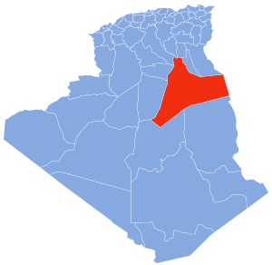 | |
| El Borma District | ||
| El Hadjira District | ||
| Hassi Messaoud District | ||
| Mégarine District | ||
| N'Goussa District | ||
| Sidi Khouïled District | ||
| Taïbet District | ||
| Témacine District | ||
| Touggourt District | ||