
Šarkan
Sárkányfalva | |
|---|---|
Municipality and village | |
 | |
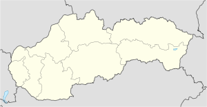 Šarkan Location in Slovakia | |
| Coordinates: 47°52′N 18°34′E / 47.867°N 18.567°E | |
| Country | |
| Region | Nitra Region |
| District | Nové Zámky District |
| Area | |
| • Total | 13.63[2] km2 (5.26[2] sq mi) |
| Elevation | 131[3] m (430[3] ft) |
| Population (2021) | |
| • Total | 369[1] |
| Time zone | UTC+1 (CET) |
| • Summer (DST) | UTC+2 (CEST) |
| Area code | +421 36[3] |
| Website | obecsarkan |
Šarkan (Hungarian: Sárkányfalva) is a village and municipality in the Nové Zámky District in the Nitra Region of south-west Slovakia.
YouTube Encyclopedic
-
1/3Views:21 9921 218360
-
Ultraľahký šarkan
-
TV Šarkan- 1.časť
-
Château Belá, Château Šarkan – skvosty nášho okolia
Transcription
History
In historical records the village was first mentioned in 1247.
Geography

The municipality lies at an elevation of 150 metres (490 ft) and covers an area of 13.638 km2 (5.266 mi2). It has a population of about 353 (2006).
Ethnicity
The population is roughly 88% Hungarian and 12% Slovak.
Facilities
The village has a small public library and a football pitch.
References
- ^ "Počet obyvateľov podľa pohlavia - obce (ročne)". www.statistics.sk (in Slovak). Statistical Office of the Slovak Republic. 2022-03-31. Retrieved 2022-03-31.
- ^ a b "Hustota obyvateľstva - obce [om7014rr_ukaz: Rozloha (Štvorcový meter)]". www.statistics.sk (in Slovak). Statistical Office of the Slovak Republic. 2022-03-31. Retrieved 2022-03-31.
- ^ a b c d "Základná charakteristika". www.statistics.sk (in Slovak). Statistical Office of the Slovak Republic. 2015-04-17. Retrieved 2022-03-31.
- ^ a b "Hustota obyvateľstva - obce". www.statistics.sk (in Slovak). Statistical Office of the Slovak Republic. 2022-03-31. Retrieved 2022-03-31.
External links
Wikimedia Commons has media related to Šarkan.
47°52′N 18°34′E / 47.867°N 18.567°E
This Nitra Region geography article is a stub. You can help Wikipedia by expanding it. |