
Zouk Mosbeh
ذوق مصبح | |
|---|---|
Municipality | |
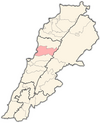
 Zouk Mosbeh Location within Lebanon | |
| Coordinates: 33°57′18″N 35°36′53″E / 33.95500°N 35.61472°E | |
| Country | |
| Governorate | Keserwan-Jbeil |
| District | Keserwan |
| Area | |
| • Total | 4.53 km2 (1.75 sq mi) |
| Elevation | 170 m (560 ft) |
| Time zone | UTC+2 (EET) |
| • Summer (DST) | UTC+3 (EEST) |
| Dialing code | +961 |
Zouk Mosbeh (Arabic: زوق مصبح) is a town and municipality in the Keserwan District of the Keserwan-Jbeil Governorate in Lebanon. It is located 12 kilometers north of Beirut. Zouk Mosbeh's average elevation is 170 meters above sea level and its total land area is 453 hectares.[1] Its inhabitants are predominantly Maronite Catholics and Christians from other denominations.[2] There are three schools in the town, one public and two private, which together enrolled a total of 4,633 students in 2005–2006.[1] There were 167 businesses with over five employees operating in Zouk Mosbeh as of 2006.[1]
Zouk Mosbeh is well known for a cave called the King's Cave and is home to the Notre Dame University – Louaize.[3] The town is home to the Hall of Fame Museum which contains fifty silicone models of famous celebrities, and several of them are animated.[4] It is also home to the Christ the King Convent and the base of the Association for the Protection of the Lebanese Heritage.
History
In 1838, Eli Smith noted Zuk Musbah as a village located in Aklim el-Kesrawan, Northeast of Beirut; the chief seat of the Maronites.[5]
Industrial Zone
The city is known for its industrial zone which contains numerous shops. It has been hit with an explosion in 2007 causing one death and 3 injuries,[6] but was rebuilt and started operating properly since then.[7]
References
- ^ a b c "Zouk Mosbeh". Localiban. Localiban. 2008-01-23. Retrieved 2009-07-24.
- ^ "Elections municipales et ikhtiariah au Mont-Liban" (pdf). Localiban. Localiban. 2010. p. 19. Retrieved 2016-02-12.
- ^ Paul Courbon (June 1989). Atlas of the great caves of the world, p. 131. Cave Books. ISBN 978-0-939748-21-1. Retrieved 17 July 2012.
- ^ Haddad Zeina, Lebanese Ministry of Tourism Museum Brochure, 2006.
- ^ Robinson and Smith, 1841, vol 3, 2nd appendix, p. 193
- ^ "قتيل و3 جرحى بعودة التفجيرات الليلية لبيروت من بوابة "ذوق مصبح"".
- ^ "مدينة زوق مصبح الصناعية مشلولة".
Bibliography
External links
Capital: Jounieh | ||
| Towns and villages |
|  |
| Notable landmarks | ||
| International | |
|---|---|
| National | |
This Lebanon location article is a stub. You can help Wikipedia by expanding it. |