
Okaibe
عقيبة | |
|---|---|
Municipality | |
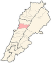
 Okaibe Location in Lebanon | |
| Coordinates: 34°03′22″N 35°38′35″E / 34.056°N 35.643°E | |
| Country | |
| Governorate | Keserwan-Jbeil |
| District | Keserwan |
| Area | |
| • Total | 1.5 km2 (0.6 sq mi) |
| Elevation | 10 m (30 ft) |
| Highest elevation | 300 m (1,000 ft) |
| Lowest elevation | 0 m (0 ft) |
| Population (2021) | |
| • Total | 12,500 |
| • Density | 8,300/km2 (22,000/sq mi) |
| Time zone | UTC+2 (EET) |
| • Summer (DST) | UTC+3 (EEST) |
| Dialing code | +961 |
Okaibe (Arabic: عقيبة) is a coastal village in Keserwan-Jbeil Governorate in Lebanon, well known for its public sandy beach, fishing port and market. It is a mix of a semi urban lively market street, and three distinctive residential areas situated on elevated ground and overlooking the coast. The river of "Nahr Ibrahim" runs through Okaibe and flows into the sea along the famous sandy beach. Historically a fishing community, with exclusively local residents, Okaibe has recently opened up through small scale real-estate investments that boosted the population growth. The overwhelming majority of the population is Christian and particularly Maronite Catholic.
YouTube Encyclopedic
-
1/3Views:1 5915 8872 588
-
A summer date with Lebanon
-
5 Days Around the Greek Islands... Fun Under the Sun and Beautiful Sceneries
-
Mechwar NoGarlicNoOnions Around the Middle East
Transcription
Geography
Okaibe is located around 27 km (17 mi) north of Beirut, in the district of Keserwan. The city has a 2 km (1.2 mi) coastal front consisting of sandy and rocky beaches along with a remarkable crystal blue water. Moreover, it is renowned for the year-long running river known as " Nahr Ibrahim".
The city is bordered by Nahr Ibrahim and Zaytoun to the north, Bouar to the South, and Al-Nammoura to the east.
The five Communal areas in Okaibe are Al-Mina (Arabic translation for "port"), Boukak El Dine, Kfarchiham, Kmayrze and Jazayer Nahr Ibrahim.
Demographics
Okaibe has an estimated population of 11,000 (no official census exists), they are predominantly Maronite Catholics.[citation needed]
Religious sites
Maronite churches are a common site in Okaibe, with 6 churches, 2 monasteries, and 2 chapels. Notably, there is also 1 Hindu temple for the Indian community residing in the area.
References
External links
- Aaqaybeh; localiban
Capital: Jounieh | ||
| Towns and villages |
|  |
| Notable landmarks | ||