
Yıldırım | |
|---|---|
District and municipality | |
 Map showing Yıldırım District in Bursa Province | |
 Yıldırım Location in Turkey  Yıldırım Yıldırım (Marmara) | |
| Coordinates: 40°06′36″N 29°04′56″E / 40.11°N 29.0821°E | |
| Country | Turkey |
| Province | Bursa |
| Government | |
| • Mayor | Oktay Yılmaz (AKP) |
| Area | 110 km2 (40 sq mi) |
| Population (2022)[1] | 655,856 |
| • Density | 6,000/km2 (15,000/sq mi) |
| Time zone | TRT (UTC+3) |
| Area code | 0224 |
| Website | www |

Bursa Uludağ Gondola | ||||||||||||||||||||||||||||||||||||||||||
|---|---|---|---|---|---|---|---|---|---|---|---|---|---|---|---|---|---|---|---|---|---|---|---|---|---|---|---|---|---|---|---|---|---|---|---|---|---|---|---|---|---|---|
| ||||||||||||||||||||||||||||||||||||||||||
Yıldırım is a municipality and district of Bursa Province, Turkey.[2] Its area is 110 km2,[3] and its population is 655,856 (2022).[1] It covers part of the city centre of Bursa. Founded in 1987, it was named after Ottoman Sultan Bayezid I, whose nickname was Yıldırım ("thunderbolt" in Turkish).

It is at the foot of Mt. Uludağ, at 150–155 metres in elevation. Kestel and Gürsu are to its west, and the flat lands of Demirtaş, a subdistrict of Osmangazi, are to its north. The Bursa-Ankara highway passes through it. With Osmangazi and Nilüfer, Yıldırım covers the Bursa agglomeration.
The Bursa Uludağ Aerial Lift (Turkish: Teleferik, pictured to the right) is an aerial lift serving Mt. Uludağ. Built by the Swiss company Von Roll Holding and opened on 29 October 1963, the aerial tramway was replaced in 2013 by a modern and much bigger capacity gondola lift system by Leitner Group of Italy.[4]
Yıldırım is one of Turkey's important textile production centers.[5] With a population of 629,702 at the 2000 census, it is also one of Turkey's most populated areas; 30% of Bursa's population lives in the Yıldırım district.
YouTube Encyclopedic
-
1/5Views:1 66929 3873 9589 4431 740
-
BURSA YILDIRIM TURU 📺 microsoft flight simulator 2020
-
Bursa Yıldırım İlçesi Direksiyon Eğitimi Sınav Güzergahı
-
DAVUTKADI v KURTBASAN CADDESİ Yıldırım Bursa
-
DAVUTKADI YEŞİLYAYLA TEYYARECİ MEHMET ALİ CADDESİ YILDIRIM BURSA
-
Nebevi Mirastan Günümüze Mesajlar | Muhammed Emin Yıldırım (Bursa / Orhangazi)
Transcription
Historical places
- Yeşil Mosque (Green Mosque)
- Yeşil Türbe (Green Tomb)
- Bayezid I Mosque and (külliye) complex (Yıldırım Camii ve külliyesi)
- Emir Sultan Mosque
- Cumalıkızık village, with well-preserved historical Ottoman architecture
Composition
There are 71 neighbourhoods in Yıldırım District:[6]
- 152 Evler
- Akçağlayan
- Anadolu
- Arabayatağı
- Bağlaraltı
- Balaban
- Baruthane
- Beyazıt
- Çelebi Mehmet
- Çınarönü
- Cumalıkızık
- Davutdede
- Davutkadı
- Değirmenlikızık
- Değirmenönü
- Demetevler
- Duaçınarı
- Eğitim
- Emirsultan
- Erikli
- Ertuğrulgazi
- Esenevler
- Fidyekızık
- Güllük
- Hacıseyfettin
- Hacıvat
- Hamamlıkızık
- Hocataşkın
- İsabey
- Kaplıkaya
- Karaağaç
- Karamazak
- Karapınar
- Kazımkarabekir
- Kurtoğlu
- Maltepe
- Mehmet Akif Ersoy
- Mevlana
- Meydancık
- Millet
- Mimarsinan
- Mollaarap
- Musababa
- Namazgah
- Ortabağlar
- Piremir
- Sakarya
- Samanlı
- Selçukbey
- Selimzade
- Sinandede
- Sıracevizler
- Şirinevler
- Siteler
- Şükraniye
- Teferrüç
- Ulus
- Umurbey
- Vakıf
- Vatan
- Yavuzselim
- Yediselviler
- Yenimahalle
- Yeşil
- Yeşilyayla
- Yetmişbeşinciyıl
- Yiğitler
- Yıldırım
- Yunusemre
- Zeyniler
- Zümrütevler
References
- ^ a b "Address-based population registration system (ADNKS) results dated 31 December 2022, Favorite Reports" (XLS). TÜİK. Retrieved 12 July 2023.
- ^ Büyükşehir İlçe Belediyesi, Turkey Civil Administration Departments Inventory. Retrieved 12 July 2023.
- ^ "İl ve İlçe Yüz ölçümleri". General Directorate of Mapping. Retrieved 12 July 2023.
- ^ "Construction of the world's longest monocable gondola lift in Bursa". Leitner Ropeways. Retrieved 2013-11-08.
- ^ Gazete, Banka (17 November 2021). "Yıldırım Belediyesi'nden tekstile 'nitelikli' destek". Gazetebanka.com. Retrieved 17 November 2021.
- ^ Mahalle, Turkey Civil Administration Departments Inventory. Retrieved 12 July 2023.
Yıldırım, Bursa in Bursa Province of Turkey | |||||||||||||||||||||||||||
|---|---|---|---|---|---|---|---|---|---|---|---|---|---|---|---|---|---|---|---|---|---|---|---|---|---|---|---|
| Districts |  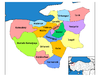 | ||||||||||||||||||||||||||
|
Metropolitan municipalities are bolded. | |||||||||||||||||||||||||||