
Wolong
卧龙区 | |
|---|---|
| Wolong District transcription(s) | |
| 卧龙区 transcription(s) | |
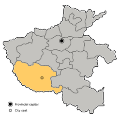
 Wolong in Nanyang. Note the map does not include the sub-prefecture-level city of Dengzhou. | |
 Nanyang in Henan | |
| Coordinates (Nanyang government): 32°59′26″N 112°31′42″E / 32.9906°N 112.5284°E | |
| Country | People's Republic of China |
| Province | Henan |
| Prefecture-level city | Nanyang |
| Area | |
| • District | 1,007 km2 (389 sq mi) |
| • Urban | 27 km2 (10 sq mi) |
| • Rural | 990 km2 (380 sq mi) |
| Highest elevation | 417.6 m (1,370.1 ft) |
| Lowest elevation | 90 m (300 ft) |
| Population (2019)[2] | |
| • District | 963,800 |
| • Density | 960/km2 (2,500/sq mi) |
| • Urban | 330,000 |
| • Urban density | 12,000/km2 (32,000/sq mi) |
| • Rural | 598,900 |
| • Rural density | 600/km2 (1,600/sq mi) |
| Time zone | UTC+8 (China Standard) |
| Postal code | 473000 |
| Area code | 0377 |
| Website | www |
Wolong District (simplified Chinese: 卧龙区; traditional Chinese: 臥龍區; pinyin: Wòlóng Qū) is a District in the center part of Nanyang, in the southwest of Henan province, People's Republic of China. It possesses a total area of 1,017 km2 (393 sq mi), and has a population of 930,000.[3]
Geography
Within this area, the land level is much higher in the north than in the south.
The Wolong District is part of the Yangtze River Basin.
Administrative divisions
As 2012, this district is divided to 9 subdistricts, 7 towns and 4 townships.[4]
- Subdistricts
|
|
- Towns
|
|
- Townships
|
|
Education
Higher education
- Nanyang Institute of Technology[5]
- Nanyang Normal University[6]
- Nanyang Medical College[7]
- Nanyang Vocational College of Agriculture[8](南陽農業職業學院)
Infrastructure
Transport
Railways
Highways and expressways
See also
- Expressways of Henan
- China National Highways
- Expressways of China
- Henan
- Nanyang, Henan
- Wancheng District
References
- ^ 最新人口信息 www.hongheiku.com (in Chinese). hongheiku. Retrieved 2021-01-12.
- ^ 最新人口信息 www.hongheiku.com (in Chinese). hongheiku. Retrieved 2021-01-12.
- ^ "Wolong district". China Daily. Retrieved 7 October 2017.
- ^ 安阳市-行政区划网 www.xzqh.org (in Chinese). XZQH. Retrieved 2012-05-24.
- ^ "English-南阳理工学院".
- ^ "Welcome to Nanyang Normal University".
- ^ http://www.nymc.edu.cn/ (Chinese)
- ^ http://www.nyac.cn/ (Chinese)
External links
This Henan location article is a stub. You can help Wikipedia by expanding it. |