
Sunset, Florida | |
|---|---|
 | |
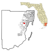 Location in Miami-Dade County and the state of Florida | |
 U.S. Census Bureau map showing CDP boundaries | |
| Coordinates: 25°42′21″N 80°21′23″W / 25.70583°N 80.35639°W | |
| Country | |
| State | |
| County | |
| Area | |
| • Total | 3.56 sq mi (9.22 km2) |
| • Land | 3.51 sq mi (9.09 km2) |
| • Water | 0.05 sq mi (0.12 km2) |
| Elevation | 7 ft (2 m) |
| Population | |
| • Total | 15,912 |
| • Density | 4,533.33/sq mi (1,750.25/km2) |
| Time zone | UTC-5 (Eastern (EST)) |
| • Summer (DST) | UTC-4 (EDT) |
| ZIP codes | 33173, 33183 (Miami) |
| Area code(s) | 305, 786, 645 |
| FIPS code | 12-69812[3] |
| GNIS feature ID | 1867214[4] |
Sunset is a census-designated place (CDP) in Miami-Dade County, Florida, United States. It is part of the Miami metropolitan area of South Florida. The population was 15,912 at the 2020 census.[2] The U.S. Postal Service uses the ZIP Codes of 33173 and 33183 for Sunset.
YouTube Encyclopedic
-
1/5Views:2 3302 7957 7117 477357
-
Naples Florida Sunset.
-
Naples Pier Sunset - Florida Tourist Destination
-
Key West Mallory Square Sunset Celebration
-
Venice Florida Sunset, Jesse Cook & Sunset at The PIer
-
Key West - Florida, Amazing Sunset & Vacation
Transcription
Geography
The community is located 11 miles (18 km) southwest of downtown Miami at 25°42′21″N 80°21′23″W / 25.70583°N 80.35639°W (25.705820, -80.356296).[5] It is bordered by the communities of Kendale Lakes, Westwood Lakes, Olympia Heights, Glenvar Heights, and Kendall.
According to the United States Census Bureau, the Sunset CDP has a total area of 3.6 square miles (9.3 km2), of which 0.05 square miles (0.13 km2), or 1.35%, are water.[1]
Demographics
| Census | Pop. | Note | %± |
|---|---|---|---|
| 1980 | 13,531 | — | |
| 1990 | 15,810 | 16.8% | |
| 2000 | 17,150 | 8.5% | |
| 2010 | 16,389 | −4.4% | |
| 2020 | 15,912 | −2.9% | |
| source:[6] | |||
2020 census
| Race / Ethnicity (NH = Non-Hispanic) | Pop 2010[7] | Pop 2020[8] | % 2010 | % 2020 |
|---|---|---|---|---|
| White (NH) | 2,666 | 2,115 | 16.27% | 13.29% |
| Black or African American (NH) | 109 | 103 | 0.67% | 0.65% |
| Native American or Alaska Native (NH) | 2 | 3 | 0.01% | 0.02% |
| Asian (NH) | 315 | 292 | 1.92% | 1.84% |
| Pacific Islander or Native Hawaiian (NH) | 0 | 5 | 0.00% | 0.03% |
| Some other race (NH) | 36 | 33 | 0.22% | 0.21% |
| Mixed race or Multiracial (NH) | 97 | 185 | 0.59% | 1.16% |
| Hispanic or Latino (any race) | 13,164 | 13,176 | 80.32% | 82.81% |
| Total | 16,389 | 15,912 | 100.00% | 100.00% |
As of the 2020 United States census, there were 15,912 people, 4,964 households, and 3,754 families residing in the CDP.[9]
As of the 2010 United States census, there were 16,389 people, 5,121 households, and 4,023 families residing in the CDP.[10]
2000 census
As of the census[3] of 2000, there were 17,150 people, 5,488 households, and 4,505 families residing in the CDP. The population density was 4,820.6 inhabitants per square mile (1,861.2/km2). There were 5,608 housing units at an average density of 1,576.3 per square mile (608.6/km2). The racial makeup of the CDP was 91.24% White (26.1% Non-Hispanic White),[11] 1.51% African American, 0.11% Native American, 2.45% Asian, 2.49% from other races, and 2.20% from two or more races. Hispanic or Latino of any race were 69.69% of the population.
As of 2000, there were 5,488 households, out of which 36.8% had children under the age of 18 living with them, 63.9% were married couples living together, 14.0% had a female householder with no husband present, and 17.9% were non-families. 12.7% of all households were made up of individuals, and 4.3% had someone living alone who was 65 years of age or older. The average household size was 3.10 and the average family size was 3.38.
In 2000, in the CDP, the population was spread out, with 23.3% under the age of 18, 9.0% from 18 to 24, 29.6% from 25 to 44, 24.6% from 45 to 64, and 13.5% who were 65 years of age or older. The median age was 38 years. For every 100 females, there were 91.4 males. For every 100 females age 18 and over, there were 86.4 males.
In 2000, the median income for a household in the CDP was $58,903, and the median income for a family was $66,422. Males had a median income of $39,893 versus $31,234 for females. The per capita income for the CDP was $23,735. About 5.4% of families and 7.1% of the population were below the poverty line, including 6.9% of those under age 18 and 8.2% of those age 65 or over.
As of 2000, speakers of Spanish as a first language accounted for 73.75% of residents, while English made up 24.03%, and French was the mother tongue of 0.63% of the population.[12]
Transportation
The Don Shula Expressway Toll Road and Snapper Creek Expressway run through the southeast corner of Sunset.
Education

Miami-Dade County Public Schools operates public schools.
Elementary schools
- Snapper Creek Elementary School
- Blue Lakes Elementary School
Middle schools
- Glades Middle School
High Schools
Charter Schools
- True North Classical Academy
References
- ^ a b "2022 U.S. Gazetteer Files: Florida". United States Census Bureau. Retrieved January 13, 2023.
- ^ a b "P1. Race – Sunset CDP, Florida: 2020 DEC Redistricting Data (PL 94-171)". U.S. Census Bureau. Retrieved January 13, 2023.
- ^ a b "U.S. Census website". United States Census Bureau. Retrieved January 31, 2008.
- ^ "US Board on Geographic Names". United States Geological Survey. October 25, 2007. Retrieved January 31, 2008.
- ^ "US Gazetteer files: 2010, 2000, and 1990". United States Census Bureau. February 12, 2011. Retrieved April 23, 2011.
- ^ "CENSUS OF POPULATION AND HOUSING (1790-2000)". U.S. Census Bureau. Retrieved July 17, 2010.
- ^ "P2 HISPANIC OR LATINO, AND NOT HISPANIC OR LATINO BY RACE - 2010: DEC Redistricting Data (PL 94-171) - Sunset CDP, Florida". United States Census Bureau.
- ^ "P2 HISPANIC OR LATINO, AND NOT HISPANIC OR LATINO BY RACE - 2020: DEC Redistricting Data (PL 94-171) - Sunset CDP, Florida". United States Census Bureau.
- ^ "S1101 HOUSEHOLDS AND FAMILIES - 2020: Sunset CDP, Florida". United States Census Bureau.
- ^ "S1101 HOUSEHOLDS AND FAMILIES - 2010: Sunset CDP, Florida". United States Census Bureau.
- ^ "Demographics of Sunset, FL". MuniNetGuide.com. Retrieved November 9, 2007.
- ^ "MLA Data Center Results of Sunset, FL". Modern Language Association. Retrieved November 9, 2007.
Municipalities and communities of Miami-Dade County, Florida, United States | ||
|---|---|---|
| Cities |  | |
| Towns | ||
| Villages | ||
| CDPs |
| |
| Unincorporated communities | ||
| Ghost town | ||
| Indian reservation | ||
| Footnotes | ‡This populated place also has portions in an adjacent county or counties | |