
Volusia-Flagler area | |
|---|---|
| Deltona–Daytona Beach–Ormond Beach, Florida Metropolitan Statistical Area | |
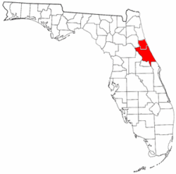 Location in the state of Florida | |
| Coordinates: 29°10′48″N 81°11′23″W / 29.18°N 81.1897°W | |
| Country | United States |
| State(s) | Florida |
| Largest city | Deltona |
| Other cities | – Palm Coast – Daytona Beach – Port Orange – Ormond Beach – DeLand – New Smyrna Beach – Edgewater – Flagler Beach – Bunnell |
| Area | |
| • Total | 2,003.26 sq mi (5,188.4 km2) |
| Highest elevation | 120 ft (36.58 m) |
| Lowest elevation | 0 ft (0 m) |
| Population (2014 est.)[1] | |
| • Total | 609,939 |
| • Rank | 90th in the U.S. |
| • Density | 378.67/sq mi (980.75/km2) |
The Deltona–Daytona Beach–Ormond Beach, Florida Metropolitan Statistical Area is a metropolitan statistical area (MSA) in central and the north portions of Florida consisting of Volusia and Flagler counties in the state of Florida.[2] As of 2013, it is the 88th-largest MSA in the United States, with a census-estimated population of 600,756.
History
The MSA was first defined in 1971 as the Daytona Beach, FL Standard MSA, consisting of Volusia County. Flagler County was added to the MSA in 1992. In 2003 the MSA was renamed Deltona–Daytona Beach–Ormond Beach, and Flagler County was removed from the MSA in and designated the Palm Coast, FL Micropolitan Statistical Area (μSA. The Palm Coast area became an MSA in 2006. The Palm Coast MSA was eliminated in 2013, and Flagler County was placed in the Deltona–Daytona Beach–Ormond Beach MSA again.[3]
Principal cities and towns
Daytona Beach, Deltona, Ormond Beach, and Deland, all located in Volusia County, are designated as principal cities in the MSA.[2]
The city of Palm Coast in Flagler County is the second-largest municipality in the MSA, and the City of Port Orange is larger than Ormond Beach, but neither city qualifies as a principal city.
Commerce
The Volusia/Flagler area is best known for its tourism industry, which attracts millions of visitors each year. Motorsports dominate the area, with several race-track venues as magnets. The best known is Daytona International Speedway, where the headquarters of NASCAR are located. Other racing venues include New Smyrna Speedway and Volusia Speedway Park. Other motorsport events include Daytona Beach Bike Week, a massive biker rally that occurs in March, and several classic-car shows.
The main natural attractions for tourists are the beaches of Volusia and Flagler Counties, with Daytona Beach, Flagler Beach, New Smyrna Beach, and Ormond Beach being the largest draws. Summer is usually the high season for beach tourism in this area.
Transportation
Roads
Limited-access highways in the Volusia/Flagler area include:
 Interstate 95, the main highway through the area, connects with Jacksonville to the north and Miami to the south.
 Interstate 4, which has its eastern terminus at I-95 in Daytona Beach, travels west to connect with Orlando and the Walt Disney World Resort.
Major surface highways include:
Mass transit
Public bus transportation in Volusia County is provided by Volusia County Public Transit System (VOTRAN), which connects all the major cities. Paratransit service is also offered by VOTRAN.
Commuter rail service is provided by SunRail, and the northern terminus is located in DeBary, in Volusia County.
See also
References
- ^ "U.S. Census website". United States Census Bureau. Retrieved 2015-03-13.
- ^ a b "Revised Delineations of Metropolitan Statistical Areas, Micropolitan Statistical Areas, and Guidance on the Uses of the Delineations of These Areas" (PDF). Executive Office of the President. July 21, 2023. p. 47, 129. Retrieved July 21, 2023.
- ^ "Metro Area History 1950–2020". U.S. Census Bureau. March 2020. Rows 1338, 3792. Retrieved July 30, 2023.
| Authority control databases: National |
|---|