
Soma | |
|---|---|
District and municipality | |
 Map showing Soma District in Manisa Province | |
 Soma Location in Turkey  Soma Soma (Turkey Aegean) | |
| Coordinates: 39°11′18″N 27°36′32″E / 39.18833°N 27.60889°E | |
| Country | Turkey |
| Province | Manisa |
| Government | |
| • Mayor | Ali Tulup (AKP) |
| Area | 820 km2 (320 sq mi) |
| Elevation | 161 m (528 ft) |
| Population (2022)[1] | 111,789 |
| • Density | 140/km2 (350/sq mi) |
| Time zone | UTC+3 (TRT) |
| Area code | 0236 |
| Website | www |
Soma is a municipality and district of Manisa Province, Turkey.[2] Its area is 820 km2,[3] and its population is 111,789 (2022).[1] The town lies at an elevation of 161 m (528 ft).
YouTube Encyclopedic
-
1/4Views:545819824801
-
SOMA , tarihin izinde
-
Soma , Manisa , Ottoman house
-
Darkale 4K Drone Görüntüleri - Soma Manisa
-
MANİSA SOMA YAVAŞ TARIM
Transcription
History
From 1867 until 1922, Soma was part of the Aidin Vilayet of the Ottoman Empire.
Composition
There are 71 neighbourhoods in Soma District:[4]
- Adil
- Akçaavlu
- Atatürk
- Avdan
- Bayat
- Beyce
- Boncuklu
- Bozarmut
- Büyük Güney
- Büyük Işıklar
- Çatalçam
- Çavdır
- Cenkyeri
- Çerkez Hamidiye
- Çevircek
- Cuma
- Cumhuriyet
- Darkale
- Deniş
- Dereköy
- Devlethan
- Dualar
- Duğla
- Evciler
- Eynez
- Göktaş
- Hacıyusuf
- Hamidiye
- Hatun
- Heciz
- Hürriyet
- İnönü
- İstasyon
- Kaplan
- Karacahisar
- Karacakaş
- Karaçam
- Karamanlı
- Kayrakaltı
- Kiraz
- Kızılören
- Kobaklar
- Koyundere
- Kozanlı
- Kozluören
- Küçük Güney
- Kum
- Kurtuluş
- Menteşe
- Naldöken
- Namazgah
- Nihat Danışman
- Onüçeylül
- Pirahmet
- Samsacı
- Sarıkaya
- Sevişler
- Söğütçük
- Sultaniye
- Tabanlar
- Tekeli Işıklar
- Turgutalp
- Türkali
- Türkpiyale
- Ularca
- Uruzlar
- Vakıflı
- Yağcılı
- Yayladalı
- Yırca
- Zafer
Economy
Lignite mining and a lignite-fired thermal power plant are the main economic activities in Soma.[5] During World War I the mines were opened up for production. The lignite extracted during that time was described as being of "very bad" quality. That lignite was burned with German coal for trains in the region. A small portion was exported to İzmir.[6] A just transition from coal could be supported by the European Bank for Reconstruction and Development.[7]
The Soma Wind Farm, with 119 wind turbines and an installed total capacity of 140.4 MW, is one of Turkey's largest wind farms.[8]
Olive, walnut and almond cultivation is among the important agricultural activities of Soma.[9]
2014 Soma coal mine disaster
On 13 May 2014, as a result of an explosion caused by a mine fire at the Soma coal mine, 301 workers were killed.[10]
References
- ^ a b "Address-based population registration system (ADNKS) results dated 31 December 2022, Favorite Reports" (XLS). TÜİK. Retrieved 12 July 2023.
- ^ Büyükşehir İlçe Belediyesi, Turkey Civil Administration Departments Inventory. Retrieved 12 July 2023.
- ^ "İl ve İlçe Yüz ölçümleri". General Directorate of Mapping. Retrieved 12 July 2023.
- ^ Mahalle, Turkey Civil Administration Departments Inventory. Retrieved 19 September 2023.
- ^ The Journal of Turkish Weekly. "Soma Manisa Turkey-Thermal Power Plant". Archived from the original on 2010-12-18. Retrieved 2009-04-11.
- ^ Prothero, G.W. (1920). Anatolia. London: H.M. Stationery Office. p. 101.
- ^ "The EBRD's just transition initiative". European Bank for Reconstruction and Development.
- ^ "'Rüzgar'da en büyük olacak". Vatan (in Turkish). 2010-11-02. Retrieved 2012-06-30.
- ^ Gazete, Banka (21 November 2021). "Manisalı üreticilere fidan desteği devam ediyor". Gazete Banka. p. https://gazetebanka.com/. Retrieved 21 November 2021.
- ^ "Faciada son bilanço: 298 ölü". ntvmsnbc. 17 May 2014. Retrieved 17 May 2014.
External links
Soma, Manisa in Manisa Province of Turkey | |||||||||||||||||||||||||||
|---|---|---|---|---|---|---|---|---|---|---|---|---|---|---|---|---|---|---|---|---|---|---|---|---|---|---|---|
| Districts |  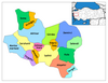 | ||||||||||||||||||||||||||
|
Metropolitan municipalities are bolded. | |||||||||||||||||||||||||||
| Authority control databases: National |
|---|
This article about an Aegean Region of Turkey location is a stub. You can help Wikipedia by expanding it. |