
Shalkar | |
|---|---|
District | |
| Шалқар ауданы | |
 Seal | |
 | |
| Coordinates: 47°0′50″N 59°0′36″E / 47.01389°N 59.01000°E | |
| Country | Kazakhstan |
| Region | Aktobe Region |
| Administrative center | Shalkar |
| Government | |
| • Akim | Zhidekhanov Zhanbolat Otegulovich[1] |
| Population (2013)[2] | |
| • Total | 45,513 |
| Time zone | UTC+5 (West) |
Shalkar (Kazakh: Шалқар ауданы, Şalqar audany) is a district of Aktobe Region in Kazakhstan. The administrative center of the district is the town of Shalkar.[3] Population: 45,513 (2013 estimate);[2] 44,187 (2009 Census results);[4] 46,697 (1999 Census results).[4]
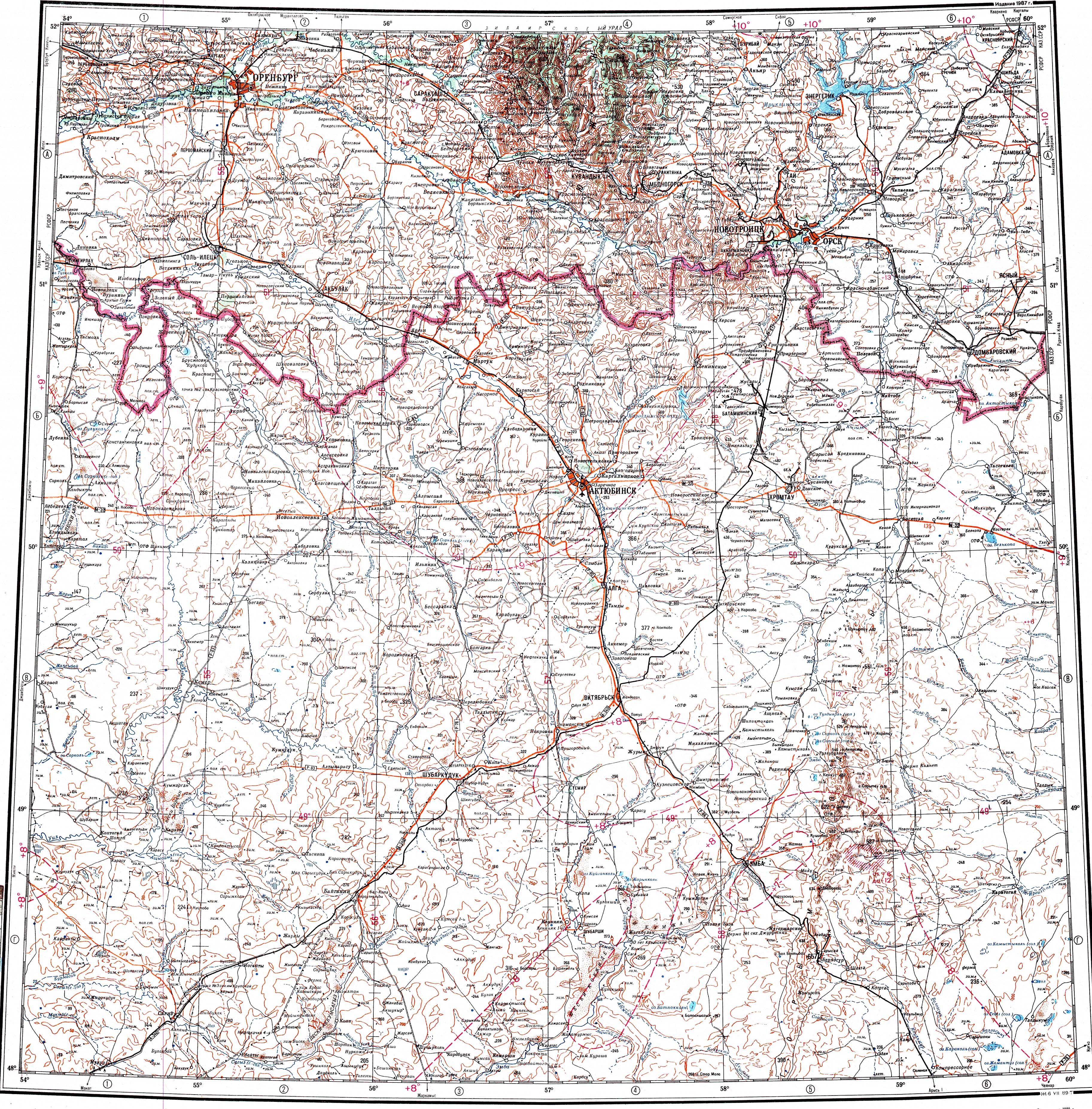
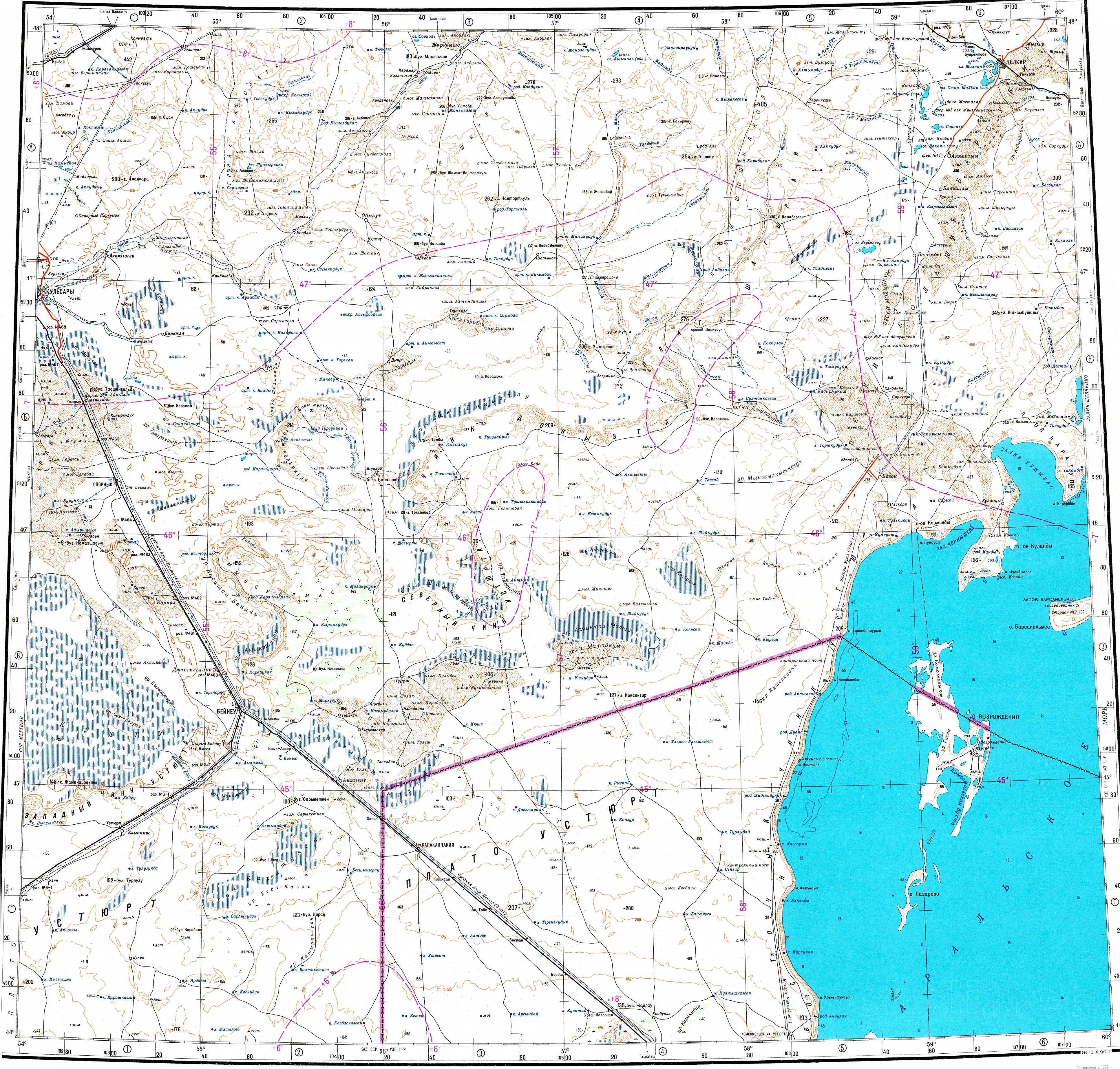
Geography
The Shalkar Basin and a number of lakes in it which are mostly salty, such as Tebez and Zhamantuz, are part of the district. Rivers Zhylandysay, Kauylzhyr and Bolgasyn flow across the territory of the district. The Lesser Barsuki Desert lies in the eastern part.[5][6]
History
The Chelkar district was formed as part of the Aktobe province on October 21, 1921. July 5, 1922 was transformed into Chelkar district. In 1928, the district was recreated as part of the Aktobe District. In 1930, he passed into direct subordination to the Kazakh ASSR. In 1932 he moved to the Aktobe region. On March 10, 2000, by decree of the President of Kazakhstan the transcription of the name of Chelkar district in Russian was changed to Shalkar district.[7]
References
- ^ "Акимат Шалкарского района". www.gov.kz.
- ^ a b "Население Республики Казахстан" (in Russian). Департамент социальной и демографической статистики. Retrieved 27 December 2013.
- ^ www.geonames.de Subdivisions of Kazakhstan in local languages
- ^ a b "Население Республики Казахстан" [Population of the Republic of Kazakhstan] (in Russian). Департамент социальной и демографической статистики. Retrieved 8 December 2013.
- ^ "M-40 Topographic Chart (in Russian)". Retrieved 11 February 2024.
- ^ "L-40 Topographic Chart (in Russian)". Retrieved 11 February 2024.
- ^ "О переименовании и изменении транскрипций названий отдельных административно-территориальных единиц Актюбинской, Алматинской и Западно-Казахстанской областей". adilet.zan.kz. 2000-03-10.
Capital: Aktobe | ||
| Districts |  | |
| Major cities | ||
| Towns and villages |
| |