
Sason District | |
|---|---|
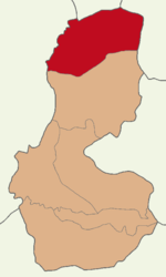 Map showing Sason District in Batman Province | |
 Sason District Location in Turkey | |
| Coordinates: 38°23′N 41°24′E / 38.383°N 41.400°E | |
| Country | Turkey |
| Province | Batman |
| Seat | Sason |
| Government | |
| • Kaymakam | Murat Mete |
| Area | 706 km2 (273 sq mi) |
| Population (2021) | 30,182 |
| • Density | 43/km2 (110/sq mi) |
| Time zone | UTC+3 (TRT) |
| Website | www |
Sason District is a district of the Batman Province of Turkey. Its seat is the town Sason.[1] Its area is 706 km2,[2] and its population is 30,182 (2021).[3] It was formerly part of the sanjak of Siirt, which was in Diyarbakır vilayet until 1880 and in Bitlis Vilayet in 1892. Later it became part of Muş sanjak in Bitlis vilayet, and remained part of Muş until 1927. It was one of the districts of Siirt province until 1993. The boundaries of the district varied considerably in time. The current borders are not the same as in the 19th century, when the district of Sasun was situated more to the north (mostly territory now included in the central district of Muş).[4]
Composition
There are two municipalities in Sason District:[1][5]
There are 54 villages in Sason District:[6]
- Acar
- Altındere
- Balbaşı
- Bayramlar
- Boğazkapı
- Cevizli
- Çağlı
- Çakırpınar
- Çalışırlar
- Çayırlı
- Çınarlı
- Dağçatı
- Dereiçi
- Dereköy
- Derince
- Dikbayır
- Dörtbölük
- Ekinlik
- Ergünü
- Erikli
- Geçitli
- gnçler
- Gürgenli
- Güvercinlik
- Heybeli
- İncesu
- Kaleyolu
- Karameşe
- Karayün
- Kaşyayla
- Kavaklı
- Kayadüzü
- Kelhasan
- Kilimli
- Kilis
- Kınalı
- Köprübaşı
- Kulaksız
- Meşeli
- Örenağıl
- Sarıyayla
- Soğanlı
- Taşyuva
- Topluca
- Turnalı
- Umurlu
- Yakabağ
- Yeniköy
- Yiğitler
- Yolüstü
- Yuvalar
- Yürekli
- Yuvalıçay
- Ziyaret
References
- ^ a b İlçe Belediyesi, Turkey Civil Administration Departments Inventory. Retrieved 30 January 2023.
- ^ "İl ve İlçe Yüz ölçümleri". General Directorate of Mapping. Retrieved 30 January 2023.
- ^ "Address-based population registration system (ADNKS) results dated 31 December 2021" (XLS) (in Turkish). TÜİK. Retrieved 30 January 2023.
- ^ Thierry, J.M., Sasun. Voyages archéologiques, Revue des études arméniennes 23, 1992, p.320; Verheij, Jelle. ’Les frères de terre et d'eau’ : sur le rôle des Kurdes dans les massacres arméniens de 1894-1896", in: Bruinessen, M. van & Blau, Joyce (eds), Islam des Kurdes (special issue of Les Annales de l'Autre islam 5, Paris, 1998) p.239
- ^ Belde Belediyesi, Turkey Civil Administration Departments Inventory. Retrieved 30 January 2023.
- ^ Köy, Turkey Civil Administration Departments Inventory. Retrieved 30 January 2023.
Sason District in Batman Province of Turkey | |||||||||||||||||||||||||||
|---|---|---|---|---|---|---|---|---|---|---|---|---|---|---|---|---|---|---|---|---|---|---|---|---|---|---|---|
| Districts |   | ||||||||||||||||||||||||||
|
Metropolitan municipalities are bolded. | |||||||||||||||||||||||||||
This geographical article about a location in Batman Province, Turkey is a stub. You can help Wikipedia by expanding it. |