
Sariwŏn
사리원시 | |
|---|---|
| Korean transcription(s) | |
| • Chosŏn'gŭl | 사리원시 |
| • Hancha | 沙里院市 |
| • McCune-Reischauer | Sariwŏn-si |
| • Revised Romanization | Sariwon-si |
Clockwise from top: view of Sariwon, street in Sariwon, North Hwanghae Province Art Theatre, Songbul Temple, Sariwon Folk Village | |
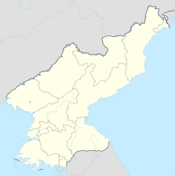
 Map of North Hwanghae showing the location of Sariwon | |
 | |
 Sariwŏn Location within North Korea | |
| Coordinates: 38°30′28″N 125°45′16″E / 38.50778°N 125.75444°E | |
| Country | |
| Province | North Hwanghae Province |
| Population (2008) | |
| • Total | 307,764 |
| • Dialect | Hwanghae |
| Time zone | UTC+9 (Pyongyang Time) |


Sariwŏn (Korean: 사리원; Korean pronunciation: [sa.ɾi.wʌn]) is a city in North Korea. It is the capital and largest city of North Hwanghae Province.
YouTube Encyclopedic
-
1/5Views:20 8176 4963 70811 374963
-
Sariwon | North Korea's Rural Capital | DPRK Cities
-
Sariwon and "makkoli" rice wine (Wanderer's North Korea tour, Part 7)
-
Korean Food | Sariwon | Korean BBQ, Banchan, Gyeran Jjim, 기타
-
North Korea 2013: Driving in Sariwon 北朝鮮旅行 沙里院市内ドライブ
-
DMZ, Sariwon, Panmunjom - North Korea DPRK
Transcription
Population
The city's population as of 2008 is 307,764.
Administrative divisions
Sariwŏn is divided into 31 tong (neighbourhoods) and 9 ri (villages):
|
|
Healthcare
Sariwŏn has the only pediatric hospital (founded by Hungarians in the 1950s) in the entire region; it serves 16 districts and 500,000 children and teens annually.
Industry
Sariwŏn has a Potassic/Potash Fertilizer Complex and a tractor factory.
Education
Several institutions of higher education are based in Sariwŏn, including the Kye Ung-sang University, the Sariwŏn University of Geology, the Sariwŏn University of Medicine, the Sariwŏn University of Education no. 1 & no. 2, and the Sariwŏn Pharmaceutical College of Koryŏ.
Tourism
The "Sariwŏn Folklore street" was constructed during Kim Jong-il's rule. Built to display an ideal picture of ancient Korea, it includes buildings in the "historical style" and a collection of ancient Korean cannons. Many older style Korean buildings exist in the city.
In 2020, Jongbangsan Hotel opened after several years of delays in construction. It has three main buildings and includes a gym and a swimming pool.[1]
Transport
Sariwŏn is served by Sariwŏn Ch'ŏngnyŏn and several other stations on both the P'yŏngbu and Hwanghae Ch'ŏngnyŏn lines of the Korean State Railway.
Sariwŏn has a trolleybus system with two Ikarus 280T articulated trolleybuses; they were converted from diesel Ikarus 280 buses due to the lack of roof equipment. Regular trolleybuses were mothballed at the depot from 2020. The service is supplemented by regular buses.[2]
Climate
Sariwŏn has a humid continental climate (Köppen climate classification: Dwa).
| Climate data for Sariwŏn (1991–2020) | |||||||||||||
|---|---|---|---|---|---|---|---|---|---|---|---|---|---|
| Month | Jan | Feb | Mar | Apr | May | Jun | Jul | Aug | Sep | Oct | Nov | Dec | Year |
| Mean daily maximum °C (°F) | 0.1 (32.2) |
3.5 (38.3) |
9.9 (49.8) |
17.7 (63.9) |
23.5 (74.3) |
27.4 (81.3) |
28.9 (84.0) |
29.6 (85.3) |
26.0 (78.8) |
19.3 (66.7) |
10.3 (50.5) |
2.2 (36.0) |
16.5 (61.7) |
| Daily mean °C (°F) | −4.8 (23.4) |
−1.8 (28.8) |
4.1 (39.4) |
11.3 (52.3) |
17.3 (63.1) |
21.8 (71.2) |
24.6 (76.3) |
24.9 (76.8) |
20.1 (68.2) |
13.2 (55.8) |
5.3 (41.5) |
−2.2 (28.0) |
11.2 (52.2) |
| Mean daily minimum °C (°F) | −9.2 (15.4) |
−6.5 (20.3) |
−0.9 (30.4) |
5.5 (41.9) |
11.7 (53.1) |
17.2 (63.0) |
21.1 (70.0) |
21.2 (70.2) |
15.2 (59.4) |
7.8 (46.0) |
0.7 (33.3) |
−6.2 (20.8) |
6.5 (43.7) |
| Average precipitation mm (inches) | 8.9 (0.35) |
12.0 (0.47) |
18.1 (0.71) |
42.6 (1.68) |
71.2 (2.80) |
80.0 (3.15) |
203.1 (8.00) |
203.5 (8.01) |
85.6 (3.37) |
40.7 (1.60) |
32.7 (1.29) |
14.7 (0.58) |
813.1 (32.01) |
| Average precipitation days (≥ 0.1 mm) | 4.2 | 3.3 | 3.8 | 5.5 | 6.9 | 7.5 | 11.4 | 9.9 | 5.8 | 4.7 | 6.5 | 5.5 | 75.0 |
| Average snowy days | 4.8 | 3.2 | 1.3 | 0.3 | 0.0 | 0.0 | 0.0 | 0.0 | 0.0 | 0.1 | 2.2 | 5.6 | 17.5 |
| Average relative humidity (%) | 71.0 | 67.9 | 65.4 | 63.2 | 67.4 | 74.4 | 83.3 | 82.4 | 76.6 | 72.4 | 73.1 | 71.4 | 72.4 |
| Source: Korea Meteorological Administration[3] | |||||||||||||
Sister cities
References
- ^ O'Carroll, Chad (21 October 2021). "New North Korean hotel opens after 10-year construction period". NK News.
- ^ "Sariwon". transphoto.org. Retrieved 2021-01-02.
- ^ "30 years report of Meteorological Observations in North Korea (1991 ~ 2020)" (PDF) (in Korean). Korea Meteorological Administration. pp. 220, 324, and 345. Archived (PDF) from the original on 29 January 2022. Retrieved 24 March 2022.
- ^ "No committee to develop ties with Lahore's twins". Daily Times of Pakistan. 2007-03-02. Archived from the original on 2013-09-29. Retrieved 2008-02-08.
- ^ "Sister City Ties Established between DPRK and Mexico". KCNA. 21 April 2004. Archived from the original on 8 September 2017. Retrieved 3 December 2017.
Further reading
- Dormels, Rainer. North Korea's Cities: Industrial facilities, internal structures and typification. Jimoondang, 2014. ISBN 978-89-6297-167-5
External links
- Information about the potassic/potash fertilizer complex
- Basic statistics about Sariwon
- News about Sariwon's pediatric hospital
- Photo of entrance to the city
- Photo of a street scene
- Photo of a street scene
- City profile of Sariwon
- Folk Street in Sariwon picture album at Naenara
- Tour of Sariwon

| 2,000,000 and more |
|
|---|---|
| 1,000,000–1,999,999 |
|
| 500,000–999,999 | |
| 200,000–499,999 | |
38°30′23″N 125°45′35″E / 38.50639°N 125.75972°E