
Manpo
만포시 | |
|---|---|
| Manpho | |
| Korean transcription(s) | |
| • Chosŏn'gŭl | 만포시 |
| • Hancha | 滿浦市 |
| • McCune-Reischauer | Manp'o si |
| • Revised Romanization | Manpo-si |
 View of Manpo from the Ji'an Yalu River Border Railway Bridge | |
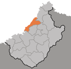 Map of Chagang showing the location of Manpo | |
 | |
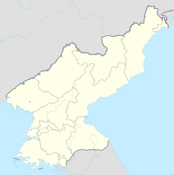 Manpo Location within North Korea | |
| Coordinates: 41°09′25″N 126°17′24″E / 41.157°N 126.290°E | |
| Country | North Korea |
| Province | Chagang Province |
| Administrative divisions | 11 tong, 15 ri |
| Government | |
| • Party Chairman of Manpo | O Myong Chol [1] |
| Population (2008) | |
| • Total | 116,760 |
| • Dialect | P'yŏngan |
| Time zone | UTC+9 (Pyongyang Time) |
Manpo (Korean pronunciation: [man.pʰo]) is a city of northwestern Chagang Province, North Korea. As of 2008, it had an estimated population of 116,760. It looks across the border to the city of Ji'an, Jilin province, China.
History
Manp'o was incorporated as a city in October 1967. Earlier, in October 1949, it had been combined into a single county consisting Manpo-myon, Kosan-myon, Oegwi-myon, Iso-myon and Sijung-myon, which were split from Kanggye-gun.[2] Manpo had first been mentioned in 1424, in the Veritable Records of the Joseon Dynasty. During the Joseon Dynasty, fortresses and camps were built in this area, for which the city is now named after.[3]
Geography
Along the shores of the Yalu River, which various tributaries flow into, and the Kŏnp'o River are the small Kosan Plain and the Kŏnha Plain.
The majority of Manpo is located at a lower height than the rest of Jagang Province, though the northeast and east do have areas of higher elevation, which gradually slopes down to the much lower areas along the banks of the Yalu River. Around 75.6% of the city is covered by forests.[4]
Climate
Manpo has a humid continental climate (Köppen climate classification: Dwa).
The yearly average temperature is 6.5 °C (43.7 °F); the January average temperature, −14.4 °C (6.1 °F); and the July average temperature, 23.6 °C (74.5 °F). The yearly average rainfall is 947.8 millimetres (37.31 in), generous due to the mountainous terrain.
| Climate data for Manpo | |||||||||||||
|---|---|---|---|---|---|---|---|---|---|---|---|---|---|
| Month | Jan | Feb | Mar | Apr | May | Jun | Jul | Aug | Sep | Oct | Nov | Dec | Year |
| Mean daily maximum °C (°F) | −6.3 (20.7) |
−1.9 (28.6) |
5.9 (42.6) |
15.8 (60.4) |
22.6 (72.7) |
26.2 (79.2) |
28.3 (82.9) |
27.8 (82.0) |
22.2 (72.0) |
15.4 (59.7) |
4.9 (40.8) |
−4.0 (24.8) |
13.1 (55.5) |
| Daily mean °C (°F) | −12.9 (8.8) |
−8.6 (16.5) |
0.2 (32.4) |
8.8 (47.8) |
15.4 (59.7) |
20.1 (68.2) |
23.4 (74.1) |
22.9 (73.2) |
16.2 (61.2) |
8.8 (47.8) |
−0.1 (31.8) |
−9.4 (15.1) |
7.1 (44.7) |
| Mean daily minimum °C (°F) | −19.5 (−3.1) |
−15.2 (4.6) |
−5.5 (22.1) |
1.9 (35.4) |
8.3 (46.9) |
14.0 (57.2) |
18.6 (65.5) |
18.0 (64.4) |
10.3 (50.5) |
2.2 (36.0) |
−5.1 (22.8) |
−14.8 (5.4) |
1.1 (34.0) |
| Average precipitation mm (inches) | 11 (0.4) |
13 (0.5) |
20 (0.8) |
51 (2.0) |
71 (2.8) |
116 (4.6) |
236 (9.3) |
220 (8.7) |
90 (3.5) |
44 (1.7) |
33 (1.3) |
16 (0.6) |
921 (36.2) |
| Source: Climate-Data.org [5] | |||||||||||||
Administrative divisions
Manp'o is divided into 11 tong and 15 ri:
|
|
Economy
Lumber processing and transportation are well developed.
Transportation
Man'po is connected to other cities in North Korea by road, and by the Unha, Manpo and Pukbunaeryuk lines of the Korean State Railway.
A new trolleybus line opened with its first phase in December 2019 from Kunmak-dong to Pyolo-dong.[6][7] The total length is around 5 km.[8]
See also
References
- ^ "당의 령도업적을 빛내이는 사업에 힘을 넣어". rodong.rep.kp (in Korean). Pyongyang: Rodong Sinmun. 10 April 2020. Archived from the original on 30 May 2020.
- ^ "북한지역정보넷". www.cybernk.net. Retrieved 2 December 2021.
- ^ "북한지역정보넷". www.cybernk.net. Retrieved 2 December 2021.
- ^ "북한지역정보넷". www.cybernk.net. Retrieved 3 December 2021.
- ^ "Climate: Manpo". Climate-Data.org. Retrieved 30 June 2018.
- ^ "목숨처럼 지켜야 할 본태". www.uriminzokkiri.com. Archived from the original on 31 January 2021. Retrieved 25 January 2021.
- ^ "당의 령도업적을 빛내이는 사업에 힘을 넣어". Rodong Sinmun.
- ^ "Manpo". transphoto.org. Retrieved 25 January 2021.
Further reading
- Dormels, Rainer. North Korea's Cities: Industrial facilities, internal structures and typification. Jimoondang, 2014. ISBN 978-89-6297-167-5
External links
- In Korean language online encyclopedias:
- North Korea Uncovered Archived 2012-01-14 at the Wayback Machine, (North Korea Google Earth) see much of Manpo's industrial and political infrastructure on Google Earth.
- City profile of Manpo Archived 2016-03-08 at the Wayback Machine

| International | |
|---|---|
| National | |
| Geographic | |
This North Korea location article is a stub. You can help Wikipedia by expanding it. |