
Panjin
盘锦市 | |
|---|---|
 | |
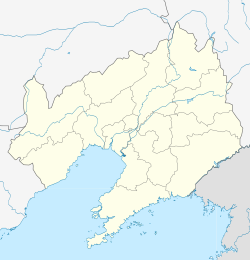
 Location of Panjin City in Liaoning | |
 Panjin Location of the city centre in Liaoning | |
| Coordinates (Panjin Library): 41°07′04″N 122°03′55″E / 41.1177°N 122.0654°E | |
| Country | People's Republic of China |
| Province | Liaoning |
| Districts and Counties | List
|
| Government | |
| • CPC Panjin | Committee Secretary |
| Area | |
| • Prefecture-level city | 3,825.2 km2 (1,476.9 sq mi) |
| • Urban | 545.2 km2 (210.5 sq mi) |
| • Metro | 3,825.2 km2 (1,476.9 sq mi) |
| Population (2020 census)[1] | |
| • Prefecture-level city | 1,389,691 |
| • Density | 360/km2 (940/sq mi) |
| • Urban | 1,166,481 |
| • Urban density | 2,100/km2 (5,500/sq mi) |
| • Metro | 1,389,691 |
| • Metro density | 360/km2 (940/sq mi) |
| GDP[2] | |
| • Prefecture-level city | CN¥ 125.7 billion US$ 20.2 billion |
| • Per capita | CN¥ 87,351 US$ 14,025 |
| Time zone | UTC+8 (China Standard) |
| Postal code | 124000 |
| Area code | 427 |
| ISO 3166 code | CN-LN-13 |
| Licence plates | 辽L |
| Administrative division code | 211300 |
| Website | panjin |
Panjin (simplified Chinese: 盘锦; traditional Chinese: 盤錦; pinyin: Pánjǐn) is a coastal prefecture-level city in central Liaoning province, People's Republic of China, situated on the northern shore of the Liaodong Bay. It borders Anshan to the east, Yingkou to the southeast, and Jinzhou to the west and north. It is the smallest city in both Liaoning and the entire Northeast China with an administrative area of 3,825 square kilometres (1,477 sq mi), and Liaoning's least populous city with a population of 1,389,691 people as of the 2020 census, all in the built-up (or metro) area made of the 2 urban districts and Dawa and Panshan counties now largely being conurbated.
YouTube Encyclopedic
-
1/5Views:4 97121 50033 9252 6491 958
-
The Red Beach | Panjin, China | Wheelee's Travels
-
Red Beach of Panjin, China 盤錦紅海灘
-
Amazing Red Sea beach in Panjin
-
Panjin Red Beach View Colour_Wonders of the world (HD1080p)
-
中国辽宁盘锦红海滩(Panjin red beach, Liaoning, China)
Transcription
Administration
Panjin has administrative jurisdiction over 3 districts and 1 county.
| Map | ||||||
|---|---|---|---|---|---|---|
| # | Name | Chinese | Hanyu Pinyin | Population (2003 est.) | Area (km2) | Density (/km2) |
| 1 | Xinglongtai District | 兴隆台区 | Xīnglóngtái Qū | 380,000 | 194 | 1,959 |
| 2 | Shuangtaizi District | 双台子区 | Shuāngtáizi Qū | 190,000 | 62 | 3,065 |
| 3 | Dawa District | 大洼区 | Dàwā Qū | 390,000 | 1,683 | 232 |
| 4 | Panshan County | 盘山县 | Pánshān Xiàn | 290,000 | 2,145 | 135 |

Panjin was established as a prefecture-level city with its current boundaries by the State Council on June 5, 1984.
Geography
Panjin is located between 40°40'−41°27' N and 121°31'−122°28' E, with its urban section mainly on the historical Liao River Delta. The Shuangtaizi River (which gives name to the city's Shuangtaizi District), formally the smaller western distributary but now the only lower section of the Liao River system, flows through the city and drains into the Liaodong Bay to its west between its Dawa District and Panshan County. The Daliao River, historically Liao River's larger eastern distributary and the main lower section but now a separate river system since 1958, runs east of Panjin, serving as the border between it and the neighboring cities of Anshan and Yingkou.
Panjin is a major crude oil production centre of Northeast China, with access to the Liaohe Oil Field, which was once the third largest oil field in China behind Daqing and Shengli Oil Fields.

Climate
Panjin has a monsoon-influenced humid continental climate (Köppen Dwa). It has an annual mean temperature of 9.2 °C (48.6 °F) and receives over 2700 hours of sunshine a year.
| Climate data for Panjin (1991–2020 normals) | |||||||||||||
|---|---|---|---|---|---|---|---|---|---|---|---|---|---|
| Month | Jan | Feb | Mar | Apr | May | Jun | Jul | Aug | Sep | Oct | Nov | Dec | Year |
| Mean daily maximum °C (°F) | −3.1 (26.4) |
0.9 (33.6) |
7.4 (45.3) |
15.9 (60.6) |
22.4 (72.3) |
26.0 (78.8) |
28.4 (83.1) |
28.3 (82.9) |
24.3 (75.7) |
16.6 (61.9) |
6.6 (43.9) |
−0.9 (30.4) |
14.4 (57.9) |
| Daily mean °C (°F) | −8.1 (17.4) |
−4.1 (24.6) |
2.5 (36.5) |
10.7 (51.3) |
17.4 (63.3) |
22.1 (71.8) |
25.1 (77.2) |
24.5 (76.1) |
19.4 (66.9) |
11.7 (53.1) |
2.2 (36.0) |
−5.5 (22.1) |
9.8 (49.7) |
| Mean daily minimum °C (°F) | −12.4 (9.7) |
−8.5 (16.7) |
−1.9 (28.6) |
5.9 (42.6) |
13.1 (55.6) |
18.8 (65.8) |
22.2 (72.0) |
21.2 (70.2) |
15.1 (59.2) |
7.2 (45.0) |
−1.8 (28.8) |
−9.5 (14.9) |
5.8 (42.4) |
| Average precipitation mm (inches) | 4.2 (0.17) |
5.8 (0.23) |
11.6 (0.46) |
30.8 (1.21) |
54.2 (2.13) |
75.5 (2.97) |
153.6 (6.05) |
165.8 (6.53) |
53.3 (2.10) |
39.5 (1.56) |
20.5 (0.81) |
6.9 (0.27) |
621.7 (24.49) |
| Average precipitation days (≥ 0.1 mm) | 2.3 | 2.3 | 3.6 | 5.1 | 7.7 | 10.3 | 9.5 | 9.4 | 6.1 | 5.4 | 4.8 | 2.6 | 69.1 |
| Average snowy days | 3.0 | 2.9 | 2.7 | 0.8 | 0 | 0 | 0 | 0 | 0 | 0.3 | 3.0 | 3.5 | 16.2 |
| Average relative humidity (%) | 58 | 56 | 55 | 56 | 61 | 72 | 81 | 80 | 72 | 66 | 62 | 61 | 65 |
| Mean monthly sunshine hours | 206.8 | 209.0 | 252.1 | 253.6 | 276.4 | 232.7 | 205.5 | 220.1 | 234.1 | 217.8 | 183.5 | 187.2 | 2,678.8 |
| Percent possible sunshine | 69 | 69 | 68 | 63 | 62 | 52 | 45 | 52 | 63 | 64 | 63 | 66 | 61 |
| Source: China Meteorological Administration[3][4] | |||||||||||||
Attractions
Major points of interest include:
- Shuangtaihekou State Natural Reserve, a marshland that serves as natural habitat to 321 species of animals. It also serves as one of the few breeding grounds for endangered birds such as the red-crowned crane and Saunders' gull. Millions of birds of as much as 172 different species stop at the area during their migration, including more than 20 endangered species such as the red-crowned crane, demoiselle crane, white stork, black stork, white-fronted goose, whooper swan, and brown goshawk. On a special note, Panjin is also called "Home of the Cranes" for the above reasons.
- reed-grass beach (Golden Beach at Bohai Sea) and the clam mound
- Red Seabeach
- Hubin Park in Panshan, featuring the Liaohe Tablets. These stone tablets bear inscriptions of Chinese calligraphy by historical and contemporary artists.


See also
- List of twin towns and sister cities in China
- Zhou Yongkang, one-time mayor of Panjin
Education
- Higher Education:
Dalian University of Technology, Panjin Campus
Liaohe Petroleum Career Technical College
Panjin Vocational and Technical College
- Secondary Education:
Panjin Senior Middle School
LYYG
References
- ^ "China: Liáoníng (Prefectures, Cities, Districts and Counties) - Population Statistics, Charts and Map".
- ^ 辽宁省统计局、国家统计局辽宁调查总队 (October 2016). 《辽宁统计年鉴-2016》. 中国统计出版社. ISBN 978-7-5037-7900-8. Archived from the original on 2017-06-05. Retrieved 2017-06-05.
- ^ 中国气象数据网 – WeatherBk Data (in Simplified Chinese). China Meteorological Administration. Retrieved 5 October 2023.
- ^ 中国气象数据网 (in Simplified Chinese). China Meteorological Administration. Retrieved 5 October 2023.
External links
| International | |
|---|---|
| National | |
| Geographic | |