
Donggang
东港市 | |
|---|---|
 Location in Dandong | |
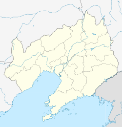 Donggang Location in Liaoning | |
| Coordinates: 39°52′N 124°09′E / 39.867°N 124.150°E | |
| Country | People's Republic of China |
| Province | Liaoning |
| Prefecture-level city | Dandong |
| Area | |
| • County-level city | 2,398.0 km2 (925.9 sq mi) |
| • Urban | 126.00 km2 (48.65 sq mi) |
| Population (2017)[1] | |
| • County-level city | 609,000 |
| • Density | 250/km2 (660/sq mi) |
| • Urban | 170,400 |
| Time zone | UTC+8 (China Standard) |
Donggang (simplified Chinese: 东港; traditional Chinese: 東港; pinyin: Dōnggǎng; lit. 'Eastern Port') is a city in the southeast of Liaoning Province in Northeast China. Situated on the coast of the Yellow Sea at the mouth of the Yalu River, it is located near the maritime border with North Korea. Administratively, it is a county-level city of Dandong, the downtown of which lies 35 kilometres (22 mi) to the northeast.
YouTube Encyclopedic
-
1/2Views:1 012574
-
Liaoning Dalian Donggang Venice city aerial China night
-
Donggang River, the waterway of meandering through the Baekdudaegan Mountain Range
Transcription
Administrative Divisions


There are three subdistricts, 14 towns, and one ethnic township under the city's administration.[2]
Subdistricts: Dadong Subdistrict (大东街道), Xincheng Subdistrict (新城街道), Xinxing Subdistrict (新兴街道)
Towns: Gushan (Kushan) (孤山镇), Qianyang (前阳镇), Changshan (长山镇), Beijingzi (北井子镇), Yiquan (椅圈镇), Huangtukan (Hwangtukan) (黄土坎镇), Majiadian (马家店镇), Pusamiao (菩萨庙镇), Longwangmiao (龙王庙镇), Xiaodianzi (小甸子镇), Chang'an (长安镇), Xinnong (新农镇), Heigou (黑沟镇), Shizijie (十字街镇)
The only township is Helong Manchu Ethnic Township (合隆满族乡)
Climate
| Climate data for Donggang (1991–2020 normals, extremes 1981–2010) | |||||||||||||
|---|---|---|---|---|---|---|---|---|---|---|---|---|---|
| Month | Jan | Feb | Mar | Apr | May | Jun | Jul | Aug | Sep | Oct | Nov | Dec | Year |
| Record high °C (°F) | 9.5 (49.1) |
14.7 (58.5) |
20.2 (68.4) |
24.4 (75.9) |
29.7 (85.5) |
32.5 (90.5) |
34.6 (94.3) |
34.1 (93.4) |
32.1 (89.8) |
28.7 (83.7) |
19.3 (66.7) |
11.6 (52.9) |
34.6 (94.3) |
| Mean daily maximum °C (°F) | −1.6 (29.1) |
1.7 (35.1) |
7.2 (45.0) |
14.1 (57.4) |
19.7 (67.5) |
23.6 (74.5) |
26.7 (80.1) |
27.9 (82.2) |
24.4 (75.9) |
17.5 (63.5) |
8.3 (46.9) |
0.1 (32.2) |
14.1 (57.5) |
| Daily mean °C (°F) | −6.7 (19.9) |
−3.3 (26.1) |
2.5 (36.5) |
9.4 (48.9) |
15.3 (59.5) |
20.0 (68.0) |
23.4 (74.1) |
24.1 (75.4) |
19.3 (66.7) |
11.8 (53.2) |
3.4 (38.1) |
−4.5 (23.9) |
9.6 (49.2) |
| Mean daily minimum °C (°F) | −10.9 (12.4) |
−7.7 (18.1) |
−1.7 (28.9) |
4.9 (40.8) |
11.3 (52.3) |
16.8 (62.2) |
20.9 (69.6) |
20.9 (69.6) |
14.7 (58.5) |
6.8 (44.2) |
−0.8 (30.6) |
−8.4 (16.9) |
5.6 (42.0) |
| Record low °C (°F) | −25.5 (−13.9) |
−23.9 (−11.0) |
−11.7 (10.9) |
−4.6 (23.7) |
2.8 (37.0) |
9.4 (48.9) |
15.4 (59.7) |
11.8 (53.2) |
3.4 (38.1) |
−4.6 (23.7) |
−13.6 (7.5) |
−23.5 (−10.3) |
−25.5 (−13.9) |
| Average precipitation mm (inches) | 5.2 (0.20) |
14.0 (0.55) |
18.9 (0.74) |
48.0 (1.89) |
83.9 (3.30) |
106.6 (4.20) |
211.3 (8.32) |
218.0 (8.58) |
81.6 (3.21) |
51.2 (2.02) |
36.8 (1.45) |
15.5 (0.61) |
891 (35.07) |
| Average precipitation days (≥ 0.1 mm) | 2.9 | 3.6 | 4.2 | 6.9 | 9.6 | 10.7 | 13.7 | 11.6 | 6.6 | 6.3 | 5.9 | 4.0 | 86 |
| Average snowy days | 4.4 | 3.8 | 2.0 | 0.4 | 0 | 0 | 0 | 0 | 0 | 0 | 2.1 | 4.9 | 17.6 |
| Average relative humidity (%) | 59 | 61 | 65 | 68 | 75 | 84 | 88 | 85 | 78 | 71 | 66 | 62 | 72 |
| Mean monthly sunshine hours | 186.7 | 183.3 | 217.5 | 217.0 | 230.2 | 185.9 | 146.1 | 186.5 | 216.5 | 203.2 | 159.9 | 167.9 | 2,300.7 |
| Percent possible sunshine | 62 | 60 | 58 | 54 | 52 | 42 | 32 | 44 | 59 | 59 | 54 | 58 | 53 |
| Source: China Meteorological Administration[3][4] | |||||||||||||
References
- ^ a b Ministry of Housing and Urban-Rural Development, ed. (2019). China Urban Construction Statistical Yearbook 2017. Beijing: China Statistics Press. p. 50. Archived from the original on 18 June 2019. Retrieved 11 January 2020.
- ^ 丹东市-行政区划网
- ^ 中国气象数据网 – WeatherBk Data (in Simplified Chinese). China Meteorological Administration. Retrieved 29 July 2023.
- ^ 中国气象数据网 (in Simplified Chinese). China Meteorological Administration. Retrieved 29 July 2023.
External links
This Liaoning location article is a stub. You can help Wikipedia by expanding it. |