
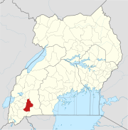
The Mbarara–Kikagati Road is in southwestern Uganda, connecting the city of Mbarara in Mbarara District and the town of Kikagati in Isingiro District, at the border between Uganda and Tanzania. The road continues into Tanzania as Highway B182.
Location
The road starts at Mbarara and then passes through Gayaza, Isingiro, and Kibwera and ends in Kikagati, a distance of approximately 65 kilometres (40 mi).[1] The coordinates of the road near Gayaza in Mbarara District are 0°41'37.0"S, 30°41'36.0"E (Longitude:-0.693611; Latitude:30.693333).[2]
Overview
The road, whose total length is 74 kilometres (46 mi), was previously made of unsealed gravel before being converted to class II bitumen surface. The conversion was done by China Communications Construction Company between 2011 and 2014.[3]
The road effectively connects the town of Mbarara to the town of Kikagati and to Murongo across the Kagera River in Tanzania.[4] In addition to the straight road, there is a 7 kilometres (4 mi) loop around Isingiro and Mabona.[5]
See also
References
- ^ GFC (9 July 2015). "Travel Distance Between Mbarara And Kikagati With Interactive Map". Globefeed.com (GFC). Retrieved 9 July 2015.
- ^ Google (9 July 2015). "Location of Mbarara–Kikagati Road at Google Maps" (Map). Google Maps. Google. Retrieved 9 July 2015.
- ^ UMWT (11 July 2015). "Upgrade of Mbarara – Kikagati – Murongo Bridge (74 Km)". Uganda Ministry of Works & Transport (UMWT). Archived from the original on 12 July 2015. Retrieved 11 July 2015.
- ^ Administrator (2 October 2014). "Mbarara-Kikagati-Murongo Bridge Road Completed". Chimpreports.com. Retrieved 8 July 2015.
- ^ UNRA (1 October 2014). "Upgrading of Mbarara-Kikagati-Murongo Bridge Road Completed". Uganda National Roads Authority (UNRA) via Facebook.com. Retrieved 11 July 2015.
External links
Capital: Mbarara | ||
| Counties and sub-counties |
|  |
| Towns and villages |
| |
| Economy |
| |
| Notable landmarks | ||
| Transport | ||
| Health | ||
| Education | ||
| Notable people | ||
Capital: Isingiro | ||
| Towns and villages |  | |
| Economy | ||
| Energy | ||
| Transport | ||
| Notable landmarks | ||
| Notable people | ||
00°52′S 30°46′E / 0.867°S 30.767°E