

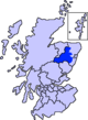
Marr (Scottish Gaelic: Màrr) is one of six committee areas in Aberdeenshire, Scotland. It has a population of 34,038 (2001 Census). Someone from Marr is called a Màrnach in Scottish Gaelic.
Etymology
The genesis of the name Marr is uncertain.[1] Mar, a Brittonic personal name, may be involved.[2][3] Further possibilities include a connection with the ethnic names Marsi and Marsigni of Italy and Bohemia,[2] or a derivation from Old Norse marr meaning "sea, marsh, fen".[1]
American academic Thomas Clancy has noted cautiously the similarity between the territory names Buchan and Marr to those of the Welsh commotes Cantref Bychan and Cantref Mawr, meaning "large-" and "small-commote", respectively.[4] Linguist Guto Rhys adjudged the proposal "appealing" but "questionable", on the basis that the form Marr conflicts with the expected development of mawr. [4]
Features
To the west, the mountain environment of the Cairngorms National Park sustains a well-developed tourist industry based on heritage and outdoor pursuits. Forestry and livestock farming are key industries, particularly in remoter areas. Part of the area has qualified for EU financial assistance. To the east, Marr has experienced population growth due to its strong commuter links with the city of Aberdeen.[citation needed]
The committee area consists of three wards of Aberdeenshire council:
- Aboyne, Upper Deeside and Donside
- Banchory and Mid-Deeside
- Huntly, Strathbogie and Howe of Alford[5]
Between them the three wards elect 10 councillors to the sixty-eight member council.[6]
Historic province

Marr is named after Mar, one of the historic provinces of Scotland, extending from north of the Don southward to the Mounth.[7] Like other such areas, it was under the rule of a mormaer in the Middle Ages.[7] In the 12th century an earl (the Earl of Mar) took his place, but no definite succession of earls appears until the 13th century, nor has any genealogical connection been established between them and the mormaers.[7]
In the eleventh century Malcolm III introduced the office of sheriff to Scotland. He and his successors Edgar, Alexander I and in particular David I established sheriffdoms throughout the country.[8] In the mid 19th century, local government reforms replaced the ancient provinces with new counties (shires), aligned to sheriffdom boundaries; hence, Marr became the southern portion of the shire of Aberdeen.[9]
References
- ^ a b Hanks, Patrick (8 May 2003). Dictionary of American Family Names: 3-Volume Set. United States: Oxford University Press. p. 521. ISBN 9780195081374. Retrieved 1 May 2020.
- ^ a b Watson, W.J.; Taylor, Simon (2011). The Celtic Place-Names of Scotland (reprint ed.). Birlinn LTD. ISBN 9781906566357.
- ^ Mac an Tàilleir, Iain. "Gaelic Place names - K-O" (PDF). Scottish Parliament. Archived from the original (PDF) on 4 November 2020. Retrieved 1 May 2020.
- ^ a b Rhys, Guto. "Approaching the Pictish language: historiography, early evidence and the question of Pritenic" (PDF). University of Glasgow. University of Glasgow.
- ^ "Area Committee Membership". Aberdeenshire Council. 18 February 2009. Archived from the original on 17 September 2009. Retrieved 2 August 2009.
- ^ "Councillors". Aberdeenshire Council. 29 April 2009. Archived from the original on 3 August 2009. Retrieved 2 August 2009.
- ^ a b c Round, John Horace (1911). . In Chisholm, Hugh (ed.). Encyclopædia Britannica. Vol. 17 (11th ed.). Cambridge University Press. p. 665.
- ^ Wallace, James (1890). The Sheriffdom of Clackmannan. A sketch of its history with a list of its sheriffs and excerpts from the records of court compiled from public documents and other authorities with preparatory notes on the office of Sheriff in Scotland, his powers and duties. Edinburgh: James Thin. pp. 7–19.
- ^ Mackie, Alexander (1911). Aberdeenshire. Cambridge County Geographies. London: Cambridge University Press.
Areas and primary settlements in Aberdeenshire (see also: Aberdeen City) | ||
|---|---|---|
| in Banff and Buchan |  | |
| in Buchan | ||
| in Formartine | ||
| in Garioch | ||
| in Kincardine and Mearns | ||
| in Marr | ||
57°13′35″N 2°46′38″W / 57.22639°N 2.77722°W