
Kaukaba
كوكبا Kawkaba | |
|---|---|
Village | |
 The bridge over Litani River by Kaukaba, by van de Velde, in 1851 | |
 Kaukaba Location within Lebanon | |
| Coordinates: 33°23′44″N 35°38′18″E / 33.39556°N 35.63833°E | |
| Grid position | 140/162 L |
| Country | |
| Governorate | Nabatieh Governorate |
| District | Hasbaya District |
| Time zone | UTC+2 (EET) |
| • Summer (DST) | UTC+3 (EEST) |
| Dialing code | +961 |

Kaukaba, Kaukabet El-Arab or Kaukaba Station is a village in the Hasbaya District in the Nabatiye Governorate in southern Lebanon.
YouTube Encyclopedic
-
1/1Views:617
-
Kampung Seumileuk
Transcription
Archaeology
By the village is a Neolithic archaeological site East of Majdel Balhis near Rashaya in the Beqaa Valley, Lebanon. It was first found by P. Billaux in 1957 who alerted Jesuit Archaeologists, Fathers Henri Fleisch and Tallon. Open air site excavations by L. and F. Skeels were also carried out in 1964.[1]
The rock shelter site lies amongst fields covered with basalt boulders from ancient lava flows. It is in a low pass from the Karaoun Dam to Rashaya. This area is close to the 4 heads of the Jordan River and is drained by feeders such as the Dan, Banias, Hasbani and Upper Jordan rivers, North of Hasbaya.[2][3]
Artefacts found on the surface included flint axes, sickles, obsidian, basalt vessels and arrowheads dated to the oldest Neolithic periods. Prominent artefacts found included a series of flint picks with heavily worn points due to extremely heavy usage. Fragments of agricultural tools such as basalt hoes have been found with very slight dating suggesting the 6th millennium or earlier. Flints were not knapped on site and the centre of the hoe production has not yet been found.[4][5][6]
Modern era
In 1838, during the Ottoman era, Eli Smith noted the population of Kaukaba as Maronite and Druze,[7] while in 1875, Victor Guérin found the population to mostly be Maronite.[8]
See also
References
- ^ Hours, Francis., Atlas des sites du proche orient (14000-5700 BP), pp 57, 198 & 490, Maison de l'Orient Mediterraneen, 1994.
- ^ Copeland, Lorraine & Wescombe, P. J., Inventory of Stone Age Sites in Lebanon (1966) Part 2: North - South - East Central Lebanon, pp 23, 37 & 39 Melanges de L'Universite Saint-Joseph, Volume 42, Universite Saint-Joseph (Beirut, Lebanon), 1966.
- ^ Moore, A.M.T. (1978). The Neolithic of the Levant. Oxford University, Unpublished Ph.D. Thesis. pp. 192–198.
- ^ J. Cauvin., Mèches en silex et travail du basalte au IVe millénaire en Béka (Liban)., pp. 118-131, Melanges de l'Universite Saint-Joseph, Volume 45, Universite Saint-Joseph (Beirut, Lebanon), 1969.
- ^ Copeland, Lorraine., Neolithic village sites in the South Bekaa, Lebanon., pp. 83-114, Melanges de l'Universite Saint-Joseph, Volume 45, Universite Saint-Joseph (Beirut, Lebanon), 1969.
- ^ Copeland, Lorraine & Wescombe, P. J., Inventory of Stone Age Sites in Lebanon (1966) Part 2: North - South - East Central Lebanon, pp 23, 1-174, Melanges de L'Universite Saint-Joseph, Volume 42, Universite Saint-Joseph (Beirut, Lebanon), 1966.
- ^ Robinson and Smith, 1841, vol 3, 2nd appendix, p. 138
- ^ Guérin, 1880, p. 298
Bibliography
- Guérin, V. (1880). Description Géographique Historique et Archéologique de la Palestine (in French). Vol. 3: Galilee, pt. 2. Paris: L'Imprimerie Nationale.
- Robinson, E.; Smith, E. (1841). Biblical Researches in Palestine, Mount Sinai and Arabia Petraea: A Journal of Travels in the year 1838. Vol. 3. Boston: Crocker & Brewster.
External links
- Kaoukaba, Localiban
Capital: Hasbaya | ||
| Towns and villages | 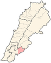 | |
| Other | ||