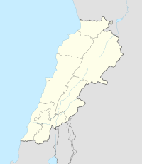
Kfarabida
Kfar Aabida كفرعبيدا | |
|---|---|
Town | |
| Country | |
| Governorate | North Governorate |
| District | Batroun District |
| Elevation | 700 ft (200 m) |
| Population (2007) | |
| • Total | 9,613 |
| Alternative name | Fadaous Sud |
|---|---|
| Location | 2 kilometres (1.2 mi) south of Batroun, Lebanon |
| Region | North Governorate |
| Coordinates | 34°13′35″N 35°39′36″E / 34.226389°N 35.66°E |
| Type | Flint factory[2] |
| Part of | Tell Fadous |
| Length | 800 meters[3] |
| History | |
| Cultures | Qaraoun |
| Site notes | |
| Archaeologists | Maurice Tallon, Dörte Rokitta-Krumnow[4] |
| Public access | Yes |
Kfar Abida, (sometimes spelled Kfar Aabida or Kfaraabida) is a village located 2 kilometres (1.2 mi) south of Batroun in the Batroun District of the North Governorate in Lebanon.[5]
History
Neolithic
Located south of the tell, is Fadous Sud, a Heavy Neolithic site of the Qaraoun culture.[6][7]

Bronze Age (Tell Fadous)
Early Bronze
On the coast, in the southwest of the town, lies an archaeological tell, Tell Fadous. The site may have been part of Byblos (12 km) to the south. Ceramic and architectural similaritiies are found from Sidon in the south to Tell Arqa in the north.
Phase III (EB II) shows a regular layout of the settlement with buildings separated by narrow streets.[8]
Phase IV (EB III) has a different layout where the buildings are spaced farther apart.[9]
References
- ^ "Mapanet postal codes in english". Mapanet. Retrieved 2023-02-23.
- ^ Genz, H. and Sader, H. 2007 Excavations at the Early Bronze Age Site of Tell Fadous-Kfarabida: Preliminary Report on the 2007 Season of Excavations. Bulletin d’Archéologie et d’Architecture Libanaises 11: 7-16., 2007.
- ^ Copeland, Lorraine (1966). Inventory of Stone Age Sites in Lebanon: North, South and East-Central Lebanon. Part two. éditeur non identifié.
- ^ Rokitta D., A lithic site southeast for Tell Fadous-Kfarabida: Preliminary observations. Baal 9 (2005) 100-101.
- ^ Robert Boulanger (1966). The Middle East, Lebanon, Syria, Jordan, Iraq, Iran, p. 178. Hachette. Retrieved 9 July 2012.
- ^ "Fadous site". fadous.net. Retrieved 2023-02-23.
- ^ "Tell Fadous | University of Tübingen". uni-tuebingen.de. Retrieved 2023-02-23.
- ^ Hermann Genz (2010) Recent Excavations at Tell Fadous-Kfarabida
- ^ Hermann Genz (2010) Recent Excavations at Tell Fadous-Kfarabida


