
Gaziosmanpaşa | |
|---|---|
District and municipality | |
 Gaziosmanpaşa Republic Square | |
 Map showing Gaziosmanpaşa District in Istanbul Province | |
 Gaziosmanpaşa Location in Turkey 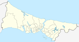 Gaziosmanpaşa Gaziosmanpaşa (Istanbul) | |
| Coordinates: 41°2′57″N 28°54′05″E / 41.04917°N 28.90139°E | |
| Country | Turkey |
| Province | Istanbul |
| Government | |
| • Mayor | Hakan Bahçetepe (CHP) |
| Area | 12 km2 (5 sq mi) |
| Population (2022)[1] | 495,998 |
| • Density | 41,000/km2 (110,000/sq mi) |
| Time zone | UTC+3 (TRT) |
| Postal code | 34275 |
| Area code | 0212 |
| Website | www |
Gaziosmanpaşa (Turkish: [ɡaːziosˈmanpaʃa]; old name: Taşlıtarla) is a developing working class municipality (belediye) and district of Istanbul, Turkey, on its European side.[2] Its area is 12 km2,[3] and its population is 495,998 (2022).[1] With a population of almost 500,000, it is one of the most populous districts. Esenler and Bayrampaşa are west, Sultangazi is north and Eyüp is south and east of the district.
YouTube Encyclopedic
-
1/5Views:1 8301 427571 00266 3531 121
-
FULL REOPENING! istanbul Gaziosmanpaşa Walking Tour June 2021 | 4k UHD 60fps
-
Gaziosmanpaşa 2021 | Istanbul 4K UHD
-
Plevne Kahramanı Gazi Osman Paşa
-
Bus Ride from Beşiktaş to Gaziosmanpaşa in Istanbul
-
KENT ORMANI KEMERBURGAZ Bahçesi Gaziosmanpaşa Alibeyköy Eyüp
Transcription
History
The district was named after Gazi Osman Pasha (1832–1900), a prominent Ottoman general who was active in the Balkans. The area was empty, rocky pasture until the 1950s when immigrants from the Balkans (especially from Bulgaria, Yugoslavia and Western Thrace) settled here. Much of their housing was illegally built, primitive tiny cottages. Gaziosmanpaşa expanded rapidly during the 1970s and 1980s due to migration from eastern Anatolia. The population is still growing with half the people under 20 years old.
Gaziosmanpaşa was formed as a district in 1963 from parts of Eyüp and Çatalca districts. In 2009 Gaziosmanpaşa district was divided into three neighborhoods: Gaziosmanpaşa, the central; Sultangazi, the northern part; and Arnavutköy, the northernmost part.
NBA's Orlando Magic star, Hedo Türkoğlu, who played in the 2009 NBA Finals, was born in the district. The NBA's Cleveland Cavaliers center Semih Erden was also born in the district.
Composition
There are 16 neighbourhoods in Gaziosmanpaşa District:[4]
- Bağlarbaşı
- Barbaros Hayrettin Paşa
- Fevzi Çakmak
- Hürriyet
- Karadeniz
- Karayolları
- Karlıtepe
- Kazım Karabekir
- Merkez
- Mevlana
- Pazariçi
- Sarıgöl
- Şemsipaşa
- Yeni Mahalle
- Yenidoğan
- Yıldıztabya
Gaziosmanpaşa today
The centre of Gaziosmanpaşa is still inhabited by the descendants of the 1950s and 1960s Balkan immigrants. Most of the original illegal houses have beenpulled down and replaced with semi-legal blocks of flats to house the children and grandchildren.
Other areas, often isolated communities far out of the city, are dominated by populations of migrants from Anatolia. These areas are an ethnic, religious and political melting pot. In particular, one area of Gaziosmanpaşa has a substantial population of migrants from Tunceli Province, a province mainly populated by people who claim both Kurdish and Zaza identities. The mixture of people plus the number of young people in the communities has at times given Gaziosmanpaşa the unfortunate reputation for being the centre of crime and of left- and right-wing violence in Istanbul.
The city council is trying to spend its way out of this situation by putting in sports facilities, theatres, shopping centres and better transport to the city. But still more and more housing is being built. As the area has grown without sufficient control or regulations the city is still struggling to put in schools and other infrastructure throughout Gaziosmanpaşa to support the population, while industrial development is taking place too.
The area itself suffers from unemployment despite the industry coming in, and the main employers are small workshops producing light fittings, electrical goods, clothing, lathe and metalwork and car repairs.
Urban renewal projects aim to revitalize the district through increasing housing prices.[5]
International relations
Sister cities:
References
- ^ a b "Address-based population registration system (ADNKS) results dated 31 December 2022, Favorite Reports" (XLS). TÜİK. Retrieved 12 July 2023.
- ^ Büyükşehir İlçe Belediyesi, Turkey Civil Administration Departments Inventory. Retrieved 12 July 2023.
- ^ "İl ve İlçe Yüz ölçümleri". General Directorate of Mapping. Retrieved 12 July 2023.
- ^ Mahalle, Turkey Civil Administration Departments Inventory. Retrieved 12 July 2023.
- ^ Istanbul’s most expensive place to rent property: The Grand Bazaar
- ^ "Kardeş Belediyeler" [Gaziosmanpaşa Twin Towns]. Gaziosmanpaşa Municipality (in Turkish). Retrieved 2017-12-19.
Sources
- "Information on Gaziosmanpaşa district" (in Turkish). Governorship of Istanbul. 2009. Archived from the original on 2011-07-16. Retrieved 2009-08-17.
External links
- District governor's official website (in Turkish)
- District municipality's official website (in Turkish)

