
Cumings, Texas | |
|---|---|
 | |
| Coordinates: 29°34′25″N 95°48′12″W / 29.57361°N 95.80333°W | |
| Country | United States |
| State | Texas |
| County | Fort Bend |
| Area | |
| • Total | 2.92 sq mi (7.57 km2) |
| • Land | 2.80 sq mi (7.24 km2) |
| • Water | 0.12 sq mi (0.32 km2) |
| Elevation | 85 ft (26 m) |
| Population (2020) | |
| • Total | 2,207 |
| • Density | 760/sq mi (290/km2) |
| Time zone | UTC-6 (Central (CST)) |
| • Summer (DST) | UTC-5 (CDT) |
| FIPS code | 48-18134[1] |
| GNIS feature ID | 1852696[2] |
Cumings is an unincorporated community and census-designated place (CDP) in Fort Bend County, Texas, United States. The population was 2,207 at the 2020 census,[3] significantly up from 981 at the 2010 census.[4]
History
The town was established in the early 1990s.[5]
Geography

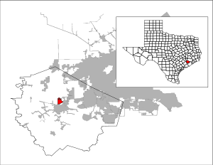
Cumings is located north of the center of Fort Bend County at 29°34′25″N 95°48′12″W / 29.57361°N 95.80333°W (29.573483, -95.803286).[6] It is bordered to the south and west by the city of Rosenberg. The southern and eastern edge of Cumings is the Brazos River.
According to the United States Census Bureau, the CDP has a total area of 2.9 square miles (7.6 km2), of which 2.8 square miles (7.2 km2) and 0.1 square miles (0.3 km2), or 4.25%, is water.[4]
Demographics
| Census | Pop. | Note | %± |
|---|---|---|---|
| 2000 | 683 | — | |
| 2010 | 981 | 43.6% | |
| 2020 | 2,207 | 125.0% | |
| US Decennial Census[6] 2020 Census[3] | |||
As of the census[1] of 2000, there were 683 people, 172 households, and 156 families residing in the CDP. The population density was 225.6 inhabitants per square mile (87.1/km2). There were 186 housing units at an average density of 61.4 per square mile (23.7/km2). The racial makeup of the CDP was 60.76% White, 0.29% Asian, 35.43% from other races, and 3.51% from two or more races. Hispanic or Latino of any race were 91.65% of the population.
There were 172 households, out of which 50.6% had children under the age of 18 living with them, 70.9% were married couples living together, 13.4% had a female householder with no husband present, and 9.3% were non-families. 8.1% of all households were made up of individuals, and 2.9% had someone living alone who was 65 years of age or older. The average household size was 3.97 and the average family size was 4.16.
In the CDP, the population was spread out, with 34.8% under the age of 18, 13.0% from 18 to 24, 29.6% from 25 to 44, 16.7% from 45 to 64, and 5.9% who were 65 years of age or older. The median age was 27 years. For every 100 females, there were 98.5 males. For every 100 females age 18 and over, there were 99.6 males.
The median income for a household in the CDP was $36,316, and the median income for a family was $36,776. Males had a median income of $25,847 versus $16,641 for females. The per capita income for the CDP was $10,399. About 24.0% of families and 20.5% of the population were below the poverty line, including 14.7% of those under age 18 and 56.8% of those age 65 or over.
Education
Cumings is within the Lamar Consolidated Independent School District.[7]
Zoned schools include:[8]
- Jackson Elementary School
- Briscoe Junior High School
- Foster High School[9]
The designated community college for LCISD is Wharton County Junior College.[10]
References
- ^ a b "U.S. Census website". United States Census Bureau. Retrieved January 31, 2008.
- ^ "US Board on Geographic Names". United States Geological Survey. October 25, 2007. Retrieved January 31, 2008.
- ^ a b "Census Bureau profile: Cumings, Texas". United States Census Bureau. May 2023. Retrieved May 14, 2024.
- ^ a b "Geographic Identifiers: 2010 Demographic Profile Data (G001): Cumings CDP, Texas". U.S. Census Bureau, American Factfinder. Retrieved September 1, 2016.[dead link]
- ^ "Cumings, Texas". Texas State Historical Association. Retrieved February 6, 2012.
- ^ a b "US Gazetteer files: 2010, 2000, and 1990". United States Census Bureau. February 12, 2011. Retrieved April 23, 2011.
- ^ "2020 CENSUS - SCHOOL DISTRICT REFERENCE MAP: Fort Bend County, TX" (PDF). U.S. Census Bureau. Retrieved September 21, 2022.
- ^ "Maps of LCISD." Lamar Consolidated Independent School District.
- ^ "High School Attendance Zones" (PDF). Lamar Consolidated Independent School District. Retrieved September 21, 2022. - Compare with the Census map.
- ^ Texas Education Code Sec. 130.211. WHARTON COUNTY JUNIOR COLLEGE DISTRICT SERVICE AREA.
External links
Municipalities and communities of Fort Bend County, Texas, United States | ||
|---|---|---|
| Cities |  | |
| Town | ||
| Villages | ||
| CDPs | ||
| Other communities | ||
| Former communities | ||
| Ghost towns |
| |
| Footnotes | ‡This populated place also has portions in an adjacent county or counties ±Former CDP annexed by Missouri City ^Former CDP annexed by Sugar Land #Still active as a community, but is no longer listed as a census-designated place | |