
Bassila | |
|---|---|
Commune | |
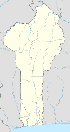
 Commune location in the Donga Department | |
 Bassila Location in Benin | |
| Coordinates: 9°01′N 1°40′E / 9.017°N 1.667°E | |
| Country | |
| Department | Donga Department |
| Area | |
| • Total | 5,661 km2 (2,186 sq mi) |
| Population (2013) | |
| • Total | 130,770 |
| • Density | 23/km2 (60/sq mi) |
| Time zone | UTC+0 (GMT 0) |
Bassila is a town, arrondissement, and commune located in the Donga Department of Benin. The commune covers an area of 120 square kilometres and as of 2013 had a population of 130,770 people.[1][2]
The RNIE 3 highway of Benin passes through the town of Bassila and the commune. The main ethnic groups in the commune are in the order of significance: Yoruba/Nagot who are the native dwellers, as well as smaller migrant communities of Anii and Tem people otherwise known as 'Kotokoli'. The Nagots historically migrated from Nigeria during a westward Yoruba expansion. The town of Bassila is largely Anii, and is the largest Anii-speaking village. Given that Bassila is located in proximity to the border with Togo, a significant proportion of the population are of Togolese origin (Anii and Kotokoli migrants).[3] Bassila is the second largest arrondissement in Benin by land area.
Mont Sokbaro, widely cited as the highest point of Benin, lies in Bassila commune, on the border with Togo.
YouTube Encyclopedic
-
1/1Views:1 750
-
ONG ADRIA, Alédjo, Commune de Bassila (Rep du BENIN)
Transcription
Towns and villages
Adeli, Afodiobo, Agougou, Akarade, Aledjo-Koura, Aletoutou, Alori, Assion, Aworo, Bakana-Kari, Bakperou, Baningli, Bassila, Bayakou, Biguina, Bodi, Bomako, Boutou, Diengou, Dogue, Gando, Gaougado, Gassagadi, Gatakpal, Goutoungadoni, Guiguizo, Igbere, Igbomakoro, Inkolonie, Iyo, Kadjimani, Kaoute, Katia, Kemeni, Kemetou Alidjo, Kemetou Penezoulou, Kikele, Koakoaliki, Kokotyi, Kominde, Kouloumizi, Kpartao, Kpendi, Lagbere, Liro, Madiatom, Manigri, Mborko, Ngioro, Ngmellang, Niala, Odokoriko, Odola, Ogougouworo, Okouta-Boussa, Penelan, Pénéssoulou, Prekete, Sakouna, Sakouna-Neugbawaperoun, Saramanga, Tchembere, Tiakpartia, Tiatiala, Touroumini, Wetietie, Yadia, Yari
Notable people
References
- ^ "Bassila". Atlas Monographique des Communes du Benin. Retrieved January 5, 2013.[permanent dead link]
- ^ "Communes of Benin". Statoids. Archived from the original on 2 January 2010. Retrieved January 5, 2013.
- ^ Segnon, AC; Achigan-Dako, EG (2014). "Comparative analysis of diversity and utilization of edible plants in arid and semi-arid areas in Benin". J Ethnobiol Ethnomed. 10: 80. doi:10.1186/1746-4269-10-80. PMC 4290139. PMID 25539993.


| International | |
|---|---|
| National | |
This Donga Department location article is a stub. You can help Wikipedia by expanding it. |