
Bandar Tenggara | |
|---|---|
 Bandar Tenggara | |
| Coordinates: 1°52′N 103°37′E / 1.867°N 103.617°E | |
| Negara | |
| Negeri | |
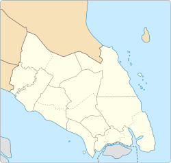
| District | Kulai |
Bandar Tenggara is a town in Kulai District, Johor, Malaysia.[1]
YouTube Encyclopedic
-
1/1Views:1 096
-
jalan ke bandar tenggara
Transcription
History
Similar to Bandar Penawar, the township was established around the year 1972 by Lembaga Kemajuan Johor Tenggara (Southeast Johor Development Authority) (KEJORA).
Geology
The town is surrounded by oil palm estate.
Geography
The town spans over an area of 20 km2.[2]
Economy
The industrial development especially in the manufacturing sector and small and medium industries here growth rapidly due to its strategic position that links between the regions centre of Kulai, Kota Tinggi and Kluang.
Education
Secondary school
- Sekolah Menengah Kebangsaan Bandar Tenggara 2
- Sekolah Menengah Kebangsaan Bandar Tenggara
- Sekolah Menengah Kebangsaan Seri Pinang
- Sekolah Menengah Agama Bandar Tenggara
Primary school
- Sekolah Kebangsaan Bandar Tenggara 1
- Sekolah Kebangsaan Felda Sungai Sibol
- Sekolah Kebangsaan Felda Pengeli Timur
- Sekolah Kebangsaan Bandar Tenggara 2
References
- ^ "Bandar Tenggara, Malaysia". Geonames. Retrieved May 19, 2021.
- ^ "Handbook" (PDF). johor.gov.my. Retrieved 1 February 2024.
| |||||||||||||||
| General topics |
|  | |||||||||||||
| Administrative divisions |
| ||||||||||||||
| City councils (Majlis Bandaraya) |
| ||||||||||||||
| Municipal councils (Majlis Perbandaran) |
| ||||||||||||||
| District councils (Majlis Daerah) |
| ||||||||||||||
1°52′N 103°37′E / 1.867°N 103.617°E
This Johor location article is a stub. You can help Wikipedia by expanding it. |