
Al-Muwaylih
المويْلح | |
|---|---|
Village | |
 1870s map 1870s map  1940s map 1940s map modern map modern map  1940s with modern overlay map 1940s with modern overlay mapA series of historical maps of the area around Al-Muwaylih (click the buttons) | |
 Al-Muwaylih Location within Mandatory Palestine | |
| Coordinates: 32°07′17″N 34°55′27″E / 32.12139°N 34.92417°E | |
| Palestine grid | 142/169 |
| Geopolitical entity | Mandatory Palestine |
| Subdistrict | Jaffa |
| Area | |
| • Total | 3,342 dunams (3.342 km2 or 1.290 sq mi) |
| Population (1945) | |
| • Total | 360[1][2] |
| Current Localities | Neve Yarak[3] |
Al-Muwaylih (Arabic: المويْلح, El Muweilih) was a Palestinian village in the Jaffa Subdistrict. It was depopulated during the 1948 Palestine War.
YouTube Encyclopedic
-
1/1Views:1 086
-
حفل تخرج طالبات مدرسة المويلح
Transcription
History
British Mandate era
In the 1931 census of Palestine, conducted by the British Mandate authorities Malalha had 37 Muslim inhabitants.[4]
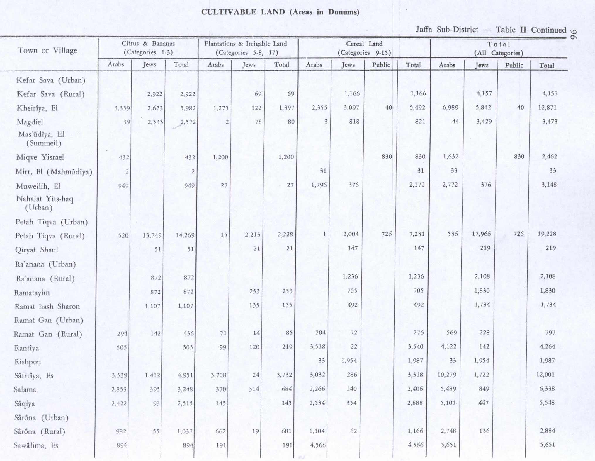
In the 1945 statistics the population numbered 360 Muslims,[1] who had a total of 3,342 dunams of land.[2] Of this, 949 dunums were planted with citrus and bananas, 27 dunums were plantations and irrigable land, 1,796 were for cereals,[5] while a total of 194 dunams were classified as non-cultivable areas.[6]
1948, aftermath
Neve Yarak is located, partly on Al-Muwaylih land, and partly on land formerly belonging to Jaljuliya.[3]
By 1992, it was described: "The site is very difficult to identify. Some of the houses still stand, deserted, amidst wild vegetation. One of them belonged to Hashim al-Jayyusi, who later became a Jordanian cabinet minister. It is a two-storey, concrete structure with rectangular doors and windows and a stairway in front that leads to the second storey. The other villas have been reduced to rubble. The land in the area is cultivated."[3]
References
- ^ a b Government of Palestine, Department of Statistics, 1945, p. 27
- ^ a b c Government of Palestine, Department of Statistics. Village Statistics, April, 1945. Quoted in Hadawi, 1970, p. 52
- ^ a b c Khalidi, 1992, p. 251
- ^ Mills, 1932, p. 17
- ^ Government of Palestine, Department of Statistics. Village Statistics, April, 1945. Quoted in Hadawi, 1970, p. 96
- ^ Government of Palestine, Department of Statistics. Village Statistics, April, 1945. Quoted in Hadawi, 1970, p. 146
Bibliography
- Government of Palestine, Department of Statistics (1945). Village Statistics, April, 1945.
- Hadawi, S. (1970). Village Statistics of 1945: A Classification of Land and Area ownership in Palestine. Palestine Liberation Organization Research Center. Archived from the original on 2018-12-08. Retrieved 2009-08-18.
- Khalidi, W. (1992). All That Remains: The Palestinian Villages Occupied and Depopulated by Israel in 1948. Washington D.C.: Institute for Palestine Studies. ISBN 0-88728-224-5.
- Mills, E., ed. (1932). Census of Palestine 1931. Population of Villages, Towns and Administrative Areas. Jerusalem: Government of Palestine.
External links
- Welcome To al-Muwaylih
- al-Muwaylih, Zochrot
- Survey of Western Palestine, Map 13: IAA, Wikimedia commons
- Al-Muwayliha from the Khalil Sakakini Cultural Center
- Al-Muweileh from Dr. Moslih Kanaaneh
