


The following chronology traces the territorial evolution of the U.S. State of Montana.
YouTube Encyclopedic
-
1/5Views:35 8374 083 2184484041 115
-
Why study Montana History (a short history of Montana)
-
The Bozeman Trail: A Rush to Montana's Gold
-
A History of Montana in 101 Objects
-
A Short History of Montana
-
Confederates in Montana Territory
Transcription
Timeline
- Historical territorial claims of the United Kingdom in the present State of Montana:
- Rupert's Land, 1670–1870
- Historical territorial claims of France in the present State of Montana:
- Louisiane, 1682–1764
- Historical territorial claims of Spain in the present State of Montana:
- Luisiana, 1764–1803
- Third Treaty of San Ildefonso of 1800
- Luisiana, 1764–1803
- Historical territorial claims of France in the present State of Montana:
- Louisiane, 1803
- Vente de la Louisiane of 1803
- Louisiane, 1803
- Historical international territory in the present State of Montana:
- Oregon Country, 1818–1846
- Provisional Government of Oregon (extralegal), 1843–1849
- Oregon Treaty of 1846
- Oregon Country, 1818–1846
- Historical political divisions of the United States in the present State of Montana:
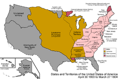
- Unorganized territory created by the Louisiana Purchase, 1803–1804
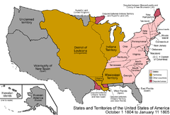
- District of Louisiana, 1804–1805
- Territory of Louisiana, 1805–1812
- Territory of Missouri, 1812–1821
- Unorganized territory previously the northwestern portion of the Missouri Territory, 1821–1854
- Unorganized territory created by the Oregon Treaty, 1846–1848
- Territory of Oregon, 1848–1859
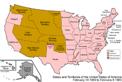
- Territory of Nebraska, 1854–1867
- Territory of Washington, 1853–1889
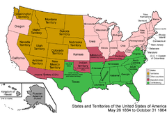
- Territory of Dakota, 1861–1889
- Territory of Idaho, 1863–1890
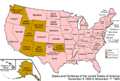
- Territory of Montana, 1864-1889[1]
- State of Montana since November 8, 1889[2]
See also
References
- ^ Thirty-eighth United States Congress (May 26, 1864). "An Act to provide a temporary Government for the Territory of Montana" (cgi-bin). Retrieved June 5, 2009.
- ^ Benjamin Harrison (November 8, 1889). "By the President of the United States of America, A Proclamation Admitting the State of Montana to the Union". Retrieved June 4, 2009.
- ^ Federal Writers' Project (1939). "Chronology". Montana: a State Guide Book. American Guide Series. NY: Viking Press.
External links
| By country | |
|---|---|
| By former country | |
| By subdivision |
|
| By region |
|
| By country, people, region or period | |
| By international organisation | |