
Tecumseh, Indiana | |
|---|---|
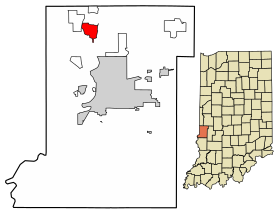 Location of Tecumseh in Vigo County, Indiana. | |
| Coordinates: 39°33′47″N 87°25′18″W / 39.56306°N 87.42167°W | |
| Country | United States |
| State | Indiana |
| County | Vigo |
| Township | Fayette |
| Area | |
| • Total | 3.55 sq mi (9.20 km2) |
| • Land | 3.48 sq mi (9.00 km2) |
| • Water | 0.08 sq mi (0.20 km2) |
| Elevation | 558 ft (170 m) |
| Population (2020) | |
| • Total | 778 |
| • Density | 223.82/sq mi (86.41/km2) |
| Time zone | UTC-5 (Eastern (EST)) |
| • Summer (DST) | UTC-4 (EDT) |
| ZIP code | 47885 |
| Area code(s) | 812, 930 |
| GNIS feature ID | 444612 |
Tecumseh is an unincorporated census-designated place in eastern Fayette Township, Vigo County, in the U.S. state of Indiana.[3] It is part of the Terre Haute metropolitan area.
YouTube Encyclopedic
-
1/1Views:2 466
-
Carving Chief Tecumseh's Monument in Vincennes Indiana.
Transcription
History
Located on the Wabash River, the community was named for Tecumseh, the Native American leader of the Shawnee who fought General William Henry Harrison at Fort Harrison, only a mile south of the town.[4] Tecumseh was once known as Durkee's Ferry, and in 1890 it was merely a post-office with five or six houses.[5] Durkee's Ferry was once one of the main crossing points on the Wabash River.[6]
A post office was established at Tecumseh in 1882, and remained in operation until it was discontinued in 1907.[7]
Geography
Tecumseh is located at 39°33′47″N 87°25′18″W / 39.56306°N 87.42167°W at an elevation of 561 feet.
Demographics
| Census | Pop. | Note | %± |
|---|---|---|---|
| 2020 | 778 | — | |
| U.S. Decennial Census[8] | |||
References
- ^ "2020 U.S. Gazetteer Files". United States Census Bureau. Retrieved March 16, 2022.
- ^ "US Board on Geographic Names". United States Geological Survey. October 25, 2007. Retrieved July 13, 2016.
- ^ "Tecumseh, Indiana". Geographic Names Information System. United States Geological Survey. Retrieved August 6, 2017.
- ^ Baker, Ronald L. (October 1995). From Needmore to Prosperity: Hoosier Place Names in Folklore and History. Indiana University Press. p. 11. ISBN 978-0-253-32866-3.
Tecumseh was named for the famous Shawnee chief...
- ^ Bradsby, H.C. (1891). History of Vigo County, Indiana, with Biographical Selections. Chicago: S. B. Nelson & Co. pp. 480.
- ^ Oakey, Charles Cochran (1908). Great Terre Haute and Vigo County. Chicago: Lewis Publishing Co. pp. 130.
- ^ "Vigo County". Jim Forte Postal History. Retrieved July 13, 2016.
- ^ "Census of Population and Housing". Census.gov. Retrieved June 4, 2016.
Municipalities and communities of Vigo County, Indiana, United States | ||
|---|---|---|
| City |  | |
| Towns | ||
| Townships | ||
| CDPs | ||
| Other communities |
| |
| Footnotes | ‡This populated place also has portions in an adjacent county or counties | |
This Vigo County, Indiana location article is a stub. You can help Wikipedia by expanding it. |