
Sandcut, Indiana | |
|---|---|
| Nickname: Meltonville | |
 Vigo County's location in Indiana | |
 Sandcut location in Vigo County, Indiana | |
| Coordinates: 39°33′53″N 87°19′25″W / 39.56472°N 87.32361°W | |
| Country | United States |
| State | Indiana |
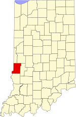
| County | Vigo |
| Township | Otter Creek |
| Elevation | 525 ft (160 m) |
| Time zone | UTC-5 (Eastern (EST)) |
| • Summer (DST) | UTC-4 (EDT) |
| ZIP code | 47805 |
| Area code(s) | 812, 930 |
| GNIS feature ID | 442993 |
Sandcut is an unincorporated community in Otter Creek Township, Vigo County, in the U.S. state of Indiana.[2] It is part of the Terre Haute metropolitan area. Little Gundy Creek flows on the southeastern side of Sandcut. Sandcut also has a volunteer fire department.
YouTube Encyclopedic
-
1/1Views:713
-
Three trains at Sandcut, California
Transcription
History
Sandcut was founded in 1927, and was so named because of its sandy soil.[3]
Geography
Sandcut is located at the intersection of Rio Grande Avenue and Rosedale Road, at 39°33′53″N 87°19′25″W / 39.56472°N 87.32361°W.
References
- ^ "US Board on Geographic Names". United States Geological Survey. October 25, 2007. Retrieved July 14, 2016.
- ^ "Sandcut, Indiana". Geographic Names Information System. United States Geological Survey. Retrieved August 6, 2017.
- ^ Baker, Ronald L. (October 1995). From Needmore to Prosperity: Hoosier Place Names in Folklore and History. Indiana University Press. p. 293. ISBN 978-0-253-32866-3.
...founded about 1927 and apparently named for sandy soil...
Municipalities and communities of Vigo County, Indiana, United States | ||
|---|---|---|
| City |  | |
| Towns | ||
| Townships | ||
| CDPs | ||
| Other communities |
| |
| Footnotes | ‡This populated place also has portions in an adjacent county or counties | |
This Vigo County, Indiana location article is a stub. You can help Wikipedia by expanding it. |