
Le Luc - Le Cannet Airport Base école Général Lejay | |||||||||||||||
|---|---|---|---|---|---|---|---|---|---|---|---|---|---|---|---|
| Summary | |||||||||||||||
| Airport type | Public / Military | ||||||||||||||
| Operator | Ministry of Defence | ||||||||||||||
| Serves | Le Luc, France | ||||||||||||||
| Location | Le Cannet-des-Maures | ||||||||||||||
| Elevation AMSL | 265 ft / 81 m | ||||||||||||||
| Coordinates | 43°23′05″N 006°23′13″E / 43.38472°N 6.38694°E | ||||||||||||||
| Map | |||||||||||||||
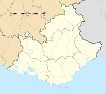 LFMC Location in Provence-Alpes-Côte d'Azur region Provence-Alpes-Côte d’Azur in France 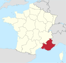 | |||||||||||||||
| Runways | |||||||||||||||
| |||||||||||||||
Le Luc-Le Cannet Airport (ICAO: LFMC) is an airport located at Le Cannet-des-Maures, 6 km (4 mi) east of Le Luc,[1] in the Var department of the Provence-Alpes-Côte d'Azur region in southern France. The airport is open to public air traffic,[1] but has no commercial airline service. It also has military use as part of Base école Général Lejay, a French Army (Armée de Terre) training facility for combat helicopters and various ground equipment.
YouTube Encyclopedic
-
1/5Views:63712 2583 330512641
-
Spotting at LFMC - NH-90, AS555, AS342 and SA330 at Le Luc/Le Cannet Des Maures, EA-ALAT
-
France Army - NH90 F-MEAA startup, close up and takeoff at Albi-Le Séquestre [LBI/LFCI]
-
France Army - Eurocopter AS-555 Fennec F-MAYJ takeoff from Albi-Le Séquestre airport [LBI/LFCI]
-
Super Puma Solo Display - Meeting Aérien Le Luc 2013
-
Défilé aérien de l'ALAT au meeting du Luc 2014
Transcription
History
Le Luc airport was built prior to World War II and was seized by Allied Forces during Operation Dragoon, the Invasion of Southern France in August 1944. After minimal repairs by the United States Army Air Forces Twelfth Air Force XII Engineer Command, it was turned over for operations use by XII Fighter Command on 22 August. It was not given an Advanced Landing Ground designation. Known units assigned to the airfield were:
- 27th Fighter Group, August 1944, A-36 Apache
- 324th Fighter Group, 25 August-2 September 1944, P-47 Thunderbolt
With the combat units moving quickly up into Eastern France, the airport was returned to French civil control on 13 September.[2]
Facilities
The airport resides at an elevation of 265 feet (81 m) above mean sea level. It has two paved runways: 13/31 measures 1,399 by 30 metres (4,590 ft × 98 ft) and 09/27 is 800 by 30 metres (2,625 ft × 98 ft).[1]
References
- ^ a b c d LFMC – LE LUC LE CANNET. AIP from French Service d'information aéronautique, effective 16 May 2024.
- ^
 This article incorporates public domain material from the Air Force Historical Research Agency
- Maurer, Maurer. Air Force Combat Units of World War II. Maxwell AFB, Alabama: Office of Air Force History, 1983. ISBN 0-89201-092-4.
- Maurer, Maurer (1969), Combat Squadrons of the Air Force, World War II, Air Force Historical Studies Office, Maxwell AFB, Alabama. ISBN 0-89201-097-5
- Johnson, David C. (1988), U.S. Army Air Forces Continental Airfields (ETO), D-Day to V-E Day; Research Division, USAF Historical Research Center, Maxwell AFB, Alabama.
External links
- Aeronautical chart and airport information for LFMC at SkyVector
- Current weather for LFMC at NOAA/NWS
- Accident history for LFMC at Aviation Safety Network